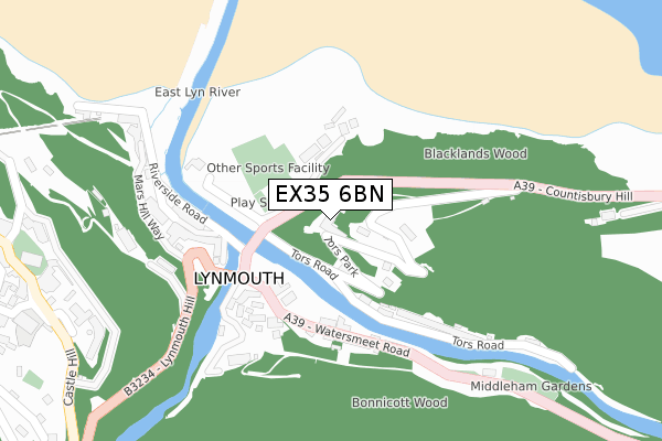
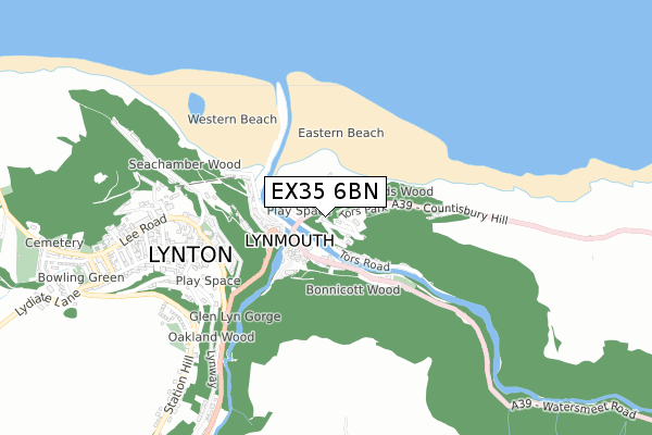
EX35 6BN is located in the Lynton & Lynmouth electoral ward, within the local authority district of North Devon and the English Parliamentary constituency of North Devon. The Sub Integrated Care Board (ICB) Location is NHS Devon ICB - 15N and the police force is Devon & Cornwall. This postcode has been in use since September 2018.


GetTheData
Source: OS Open Zoomstack (Ordnance Survey)
Licence: Open Government Licence (requires attribution)
Attribution: Contains OS data © Crown copyright and database right 2024
Source: Open Postcode Geo
Licence: Open Government Licence (requires attribution)
Attribution: Contains OS data © Crown copyright and database right 2024; Contains Royal Mail data © Royal Mail copyright and database right 2024; Source: Office for National Statistics licensed under the Open Government Licence v.3.0
| Easting | 272516 |
| Northing | 149494 |
| Latitude | 51.230352 |
| Longitude | -3.827267 |
GetTheData
Source: Open Postcode Geo
Licence: Open Government Licence
| Country | England |
| Postcode District | EX35 |
| ➜ EX35 open data dashboard ➜ See where EX35 is on a map ➜ Where is Lynmouth? | |
GetTheData
Source: Land Registry Price Paid Data
Licence: Open Government Licence
| Ward | Lynton & Lynmouth |
| Constituency | North Devon |
GetTheData
Source: ONS Postcode Database
Licence: Open Government Licence
| June 2022 | Shoplifting | On or near Parking Area | 206m |
| May 2022 | Anti-social behaviour | On or near Castle Hill | 468m |
| May 2022 | Public order | On or near Church Hill | 482m |
| ➜ Get more crime data in our Crime section | |||
GetTheData
Source: data.police.uk
Licence: Open Government Licence
| Lyndale Bridge (A39) | Lynmouth | 125m |
| Lyndale Bridge (A39) | Lynmouth | 128m |
| Castle Hill Car Park | Lynton | 444m |
| The Studio (Lee Road) | Lynton | 579m |
| Town Hall (Lee Road) | Lynton | 597m |
GetTheData
Source: NaPTAN
Licence: Open Government Licence
| Percentage of properties with Next Generation Access | 100.0% |
| Percentage of properties with Superfast Broadband | 100.0% |
| Percentage of properties with Ultrafast Broadband | 0.0% |
| Percentage of properties with Full Fibre Broadband | 0.0% |
Superfast Broadband is between 30Mbps and 300Mbps
Ultrafast Broadband is > 300Mbps
| Percentage of properties unable to receive 2Mbps | 0.0% |
| Percentage of properties unable to receive 5Mbps | 0.0% |
| Percentage of properties unable to receive 10Mbps | 0.0% |
| Percentage of properties unable to receive 30Mbps | 0.0% |
GetTheData
Source: Ofcom
Licence: Ofcom Terms of Use (requires attribution)
GetTheData
Source: ONS Postcode Database
Licence: Open Government Licence

➜ Get more ratings from the Food Standards Agency
GetTheData
Source: Food Standards Agency
Licence: FSA terms & conditions
| Last Collection | |||
|---|---|---|---|
| Location | Mon-Fri | Sat | Distance |
| Tors Road | 17:25 | 11:00 | 134m |
| Lynmouth Post Office | 17:30 | 11:00 | 194m |
| Crown Hotel | 16:20 | 11:00 | 543m |
GetTheData
Source: Dracos
Licence: Creative Commons Attribution-ShareAlike
| Facility | Distance |
|---|---|
| Holman Park Longmead, Lynton Grass Pitches | 1.2km |
| Lynton & Lynmouth Cricket Club Valley Of Rocks, Lynton Grass Pitches | 1.6km |
GetTheData
Source: Active Places
Licence: Open Government Licence
| School | Phase of Education | Distance |
|---|---|---|
| Lynton Church of England Primary School Market Street, Lynton, EX35 6AF | Primary | 530m |
GetTheData
Source: Edubase
Licence: Open Government Licence
The below table lists the International Territorial Level (ITL) codes (formerly Nomenclature of Territorial Units for Statistics (NUTS) codes) and Local Administrative Units (LAU) codes for EX35 6BN:
| ITL 1 Code | Name |
|---|---|
| TLK | South West (England) |
| ITL 2 Code | Name |
| TLK4 | Devon |
| ITL 3 Code | Name |
| TLK43 | Devon CC |
| LAU 1 Code | Name |
| E07000043 | North Devon |
GetTheData
Source: ONS Postcode Directory
Licence: Open Government Licence
The below table lists the Census Output Area (OA), Lower Layer Super Output Area (LSOA), and Middle Layer Super Output Area (MSOA) for EX35 6BN:
| Code | Name | |
|---|---|---|
| OA | E00101918 | |
| LSOA | E01020126 | North Devon 002D |
| MSOA | E02004176 | North Devon 002 |
GetTheData
Source: ONS Postcode Directory
Licence: Open Government Licence
| EX35 6NB | Tors Park | 110m |
| EX35 6EN | 112m | |
| EX35 6EP | Watersmeet Road | 156m |
| EX35 6ES | Summerhouse Path | 190m |
| EX35 6EX | Riverside Road | 215m |
| EX35 6EH | Lynmouth Street | 219m |
| EX35 6ET | Tors Road | 227m |
| EX35 6EF | Mars Hill | 243m |
| EX35 6EL | Lynmouth Street | 263m |
| EX35 6EE | Clooneavin Path | 309m |
GetTheData
Source: Open Postcode Geo; Land Registry Price Paid Data
Licence: Open Government Licence