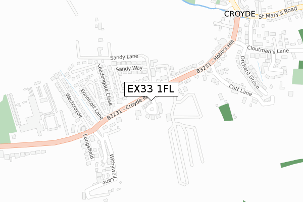
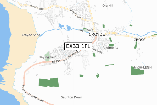
EX33 1FL maps, stats, and open data
EX33 1FL is located in the Braunton West & Georgeham electoral ward, within the local authority district of North Devon and the English Parliamentary constituency of North Devon. The Sub Integrated Care Board (ICB) Location is NHS Devon ICB - 15N and the police force is Devon & Cornwall. This postcode has been in use since August 2018.
EX33 1FL maps


Licence: Open Government Licence (requires attribution)
Attribution: Contains OS data © Crown copyright and database right 2025
Source: Open Postcode Geo
Licence: Open Government Licence (requires attribution)
Attribution: Contains OS data © Crown copyright and database right 2025; Contains Royal Mail data © Royal Mail copyright and database right 2025; Source: Office for National Statistics licensed under the Open Government Licence v.3.0
EX33 1FL geodata
| Easting | 244173 |
| Northing | 138892 |
| Latitude | 51.128050 |
| Longitude | -4.228313 |
Where is EX33 1FL?
| Country | England |
| Postcode District | EX33 |
Politics
| Ward | Braunton West & Georgeham |
|---|---|
| Constituency | North Devon |
House Prices
Sales of detached houses in EX33 1FL
2024 29 APR £684,250 |
2024 31 JAN £750,000 |
2021 9 JUL £652,000 |
10, BAY VIEW CLOSE, CROYDE, BRAUNTON, EX33 1FL 2019 12 SEP £785,000 |
9, BAY VIEW CLOSE, CROYDE, BRAUNTON, EX33 1FL 2019 12 AUG £817,000 |
7, BAY VIEW CLOSE, CROYDE, BRAUNTON, EX33 1FL 2019 29 APR £575,000 |
11, BAY VIEW CLOSE, CROYDE, BRAUNTON, EX33 1FL 2019 8 MAR £805,000 |
2018 23 NOV £465,000 |
6, BAY VIEW CLOSE, CROYDE, BRAUNTON, EX33 1FL 2018 23 NOV £581,000 |
12, BAY VIEW CLOSE, CROYDE, BRAUNTON, EX33 1FL 2018 2 NOV £497,500 |
Licence: Contains HM Land Registry data © Crown copyright and database right 2025. This data is licensed under the Open Government Licence v3.0.
Transport
Nearest bus stops to EX33 1FL
| Bay View Farm (Croyde Road) | Croyde | 51m |
| Bay View Farm (Croyde Road) | Croyde | 52m |
| Langsfield (Croyde Road) | Croyde | 238m |
| Langsfield (Croyde Road) | Croyde | 242m |
| Croyde Bridge (Hobbs Hill) | Croyde | 373m |
Broadband
Broadband access in EX33 1FL (2020 data)
| Percentage of properties with Next Generation Access | 100.0% |
| Percentage of properties with Superfast Broadband | 100.0% |
| Percentage of properties with Ultrafast Broadband | 0.0% |
| Percentage of properties with Full Fibre Broadband | 0.0% |
Superfast Broadband is between 30Mbps and 300Mbps
Ultrafast Broadband is > 300Mbps
Broadband speed in EX33 1FL (2019 data)
Download
| Median download speed | 39.5Mbps |
| Average download speed | 46.3Mbps |
| Maximum download speed | 80.00Mbps |
Upload
| Median upload speed | 9.9Mbps |
| Average upload speed | 9.5Mbps |
| Maximum upload speed | 20.00Mbps |
Broadband limitations in EX33 1FL (2020 data)
| Percentage of properties unable to receive 2Mbps | 0.0% |
| Percentage of properties unable to receive 5Mbps | 0.0% |
| Percentage of properties unable to receive 10Mbps | 0.0% |
| Percentage of properties unable to receive 30Mbps | 0.0% |
Deprivation
33.3% of English postcodes are less deprived than EX33 1FL:Food Standards Agency
Three nearest food hygiene ratings to EX33 1FL (metres)


➜ Get more ratings from the Food Standards Agency
Nearest post box to EX33 1FL
| Last Collection | |||
|---|---|---|---|
| Location | Mon-Fri | Sat | Distance |
| Croyde Bay | 16:00 | 10:15 | 848m |
| Forda | 14:45 | 11:00 | 1,455m |
| Georgeham Post Office | 15:15 | 10:30 | 2,442m |
EX33 1FL ITL and EX33 1FL LAU
The below table lists the International Territorial Level (ITL) codes (formerly Nomenclature of Territorial Units for Statistics (NUTS) codes) and Local Administrative Units (LAU) codes for EX33 1FL:
| ITL 1 Code | Name |
|---|---|
| TLK | South West (England) |
| ITL 2 Code | Name |
| TLK4 | Devon |
| ITL 3 Code | Name |
| TLK43 | Devon CC |
| LAU 1 Code | Name |
| E07000043 | North Devon |
EX33 1FL census areas
The below table lists the Census Output Area (OA), Lower Layer Super Output Area (LSOA), and Middle Layer Super Output Area (MSOA) for EX33 1FL:
| Code | Name | |
|---|---|---|
| OA | E00101827 | |
| LSOA | E01020109 | North Devon 004C |
| MSOA | E02004178 | North Devon 004 |
Nearest postcodes to EX33 1FL
| EX33 1PN | 69m | |
| EX33 1PP | Sandy Way | 95m |
| EX33 1FH | Sandy Lane | 102m |
| EX33 1PW | St Helens Close | 127m |
| EX33 1PB | Leadengate Fields | 175m |
| EX33 1PT | Leadengate Close | 187m |
| EX33 1PU | Bonnicott Lane | 208m |
| EX33 1PS | Croyde Sands Bungalows | 238m |
| EX33 1PZ | Ora Stone Park | 241m |
| EX33 1QA | West Croyde | 274m |