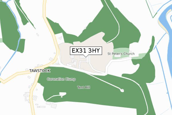
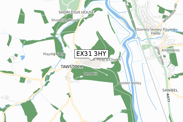
EX31 3HY is located in the Instow electoral ward, within the local authority district of North Devon and the English Parliamentary constituency of North Devon. The Sub Integrated Care Board (ICB) Location is NHS Devon ICB - 15N and the police force is Devon & Cornwall. This postcode has been in use since February 2018.


GetTheData
Source: OS Open Zoomstack (Ordnance Survey)
Licence: Open Government Licence (requires attribution)
Attribution: Contains OS data © Crown copyright and database right 2024
Source: Open Postcode Geo
Licence: Open Government Licence (requires attribution)
Attribution: Contains OS data © Crown copyright and database right 2024; Contains Royal Mail data © Royal Mail copyright and database right 2024; Source: Office for National Statistics licensed under the Open Government Licence v.3.0
| Easting | 255793 |
| Northing | 129913 |
| Latitude | 51.050406 |
| Longitude | -4.058782 |
GetTheData
Source: Open Postcode Geo
Licence: Open Government Licence
| Country | England |
| Postcode District | EX31 |
| ➜ EX31 open data dashboard ➜ See where EX31 is on a map ➜ Where is Tawstock? | |
GetTheData
Source: Land Registry Price Paid Data
Licence: Open Government Licence
| Ward | Instow |
| Constituency | North Devon |
GetTheData
Source: ONS Postcode Database
Licence: Open Government Licence
| Old Post Office | Tawstock | 311m |
| Old Post Office | Tawstock | 327m |
| The Bridge (Bishops Tawton Road) | Bishop's Tawton | 831m |
| The Bridge (Bishops Tawton Road) | Bishop's Tawton | 837m |
| Mount Pleasant (Bishops Tawton Roadxeter Road) | Bishop's Tawton | 860m |
| Barnstaple Station | 2.6km |
| Chapelton (Devon) Station | 4.5km |
GetTheData
Source: NaPTAN
Licence: Open Government Licence
| Percentage of properties with Next Generation Access | 100.0% |
| Percentage of properties with Superfast Broadband | 0.0% |
| Percentage of properties with Ultrafast Broadband | 0.0% |
| Percentage of properties with Full Fibre Broadband | 0.0% |
Superfast Broadband is between 30Mbps and 300Mbps
Ultrafast Broadband is > 300Mbps
| Percentage of properties unable to receive 2Mbps | 0.0% |
| Percentage of properties unable to receive 5Mbps | 0.0% |
| Percentage of properties unable to receive 10Mbps | 0.0% |
| Percentage of properties unable to receive 30Mbps | 100.0% |
GetTheData
Source: Ofcom
Licence: Ofcom Terms of Use (requires attribution)
GetTheData
Source: ONS Postcode Database
Licence: Open Government Licence


➜ Get more ratings from the Food Standards Agency
GetTheData
Source: Food Standards Agency
Licence: FSA terms & conditions
| Last Collection | |||
|---|---|---|---|
| Location | Mon-Fri | Sat | Distance |
| Tawstock | 15:45 | 08:45 | 378m |
| South View | 17:00 | 13:00 | 1,532m |
| Pill Lane | 18:00 | 12:30 | 1,939m |
GetTheData
Source: Dracos
Licence: Creative Commons Attribution-ShareAlike
| Facility | Distance |
|---|---|
| The Park Community School Park Lane, Barnstaple Sports Hall, Health and Fitness Gym, Artificial Grass Pitch, Grass Pitches | 2.1km |
| Tarka Leisure Centre Seven Brethren Bank, Sticklepath, Barnstaple Grass Pitches, Artificial Grass Pitch, Indoor Tennis Centre, Outdoor Tennis Courts, Swimming Pool, Health and Fitness Gym, Sports Hall, Studio | 2.4km |
| Petroc College (North Devon Campus) Old Sticklepath Hill, Sticklepath, Barnstaple Sports Hall, Health and Fitness Gym, Grass Pitches, Studio | 2.6km |
GetTheData
Source: Active Places
Licence: Open Government Licence
| School | Phase of Education | Distance |
|---|---|---|
| Holywell Church of England School Tawstock, Barnstaple, EX31 3HZ | Primary | 565m |
| Bishops Tawton Primary School School Lane, Bishops Tawton, Barnstaple, EX32 0AE | Primary | 880m |
| The Park Community School Park Lane, Barnstaple, EX32 9AX | Secondary | 2.2km |
GetTheData
Source: Edubase
Licence: Open Government Licence
The below table lists the International Territorial Level (ITL) codes (formerly Nomenclature of Territorial Units for Statistics (NUTS) codes) and Local Administrative Units (LAU) codes for EX31 3HY:
| ITL 1 Code | Name |
|---|---|
| TLK | South West (England) |
| ITL 2 Code | Name |
| TLK4 | Devon |
| ITL 3 Code | Name |
| TLK43 | Devon CC |
| LAU 1 Code | Name |
| E07000043 | North Devon |
GetTheData
Source: ONS Postcode Directory
Licence: Open Government Licence
The below table lists the Census Output Area (OA), Lower Layer Super Output Area (LSOA), and Middle Layer Super Output Area (MSOA) for EX31 3HY:
| Code | Name | |
|---|---|---|
| OA | E00101900 | |
| LSOA | E01020122 | North Devon 012E |
| MSOA | E02004186 | North Devon 012 |
GetTheData
Source: ONS Postcode Directory
Licence: Open Government Licence
| EX31 3HZ | 310m | |
| EX31 3HX | 707m | |
| EX32 0AA | The Bushens | 823m |
| EX31 3JB | Deerpark Cottages | 836m |
| EX32 0AH | Garden Terrace | 850m |
| EX32 0AL | Exeter Road | 855m |
| EX32 0AE | 855m | |
| EX32 0AD | 883m | |
| EX32 0DA | 893m | |
| EX32 0AW | Taw View Terrace | 898m |
GetTheData
Source: Open Postcode Geo; Land Registry Price Paid Data
Licence: Open Government Licence