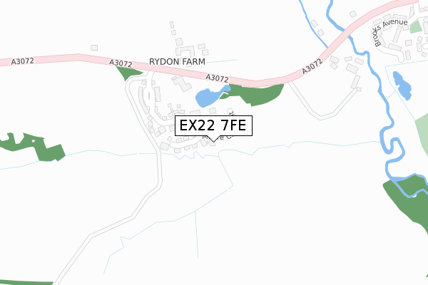
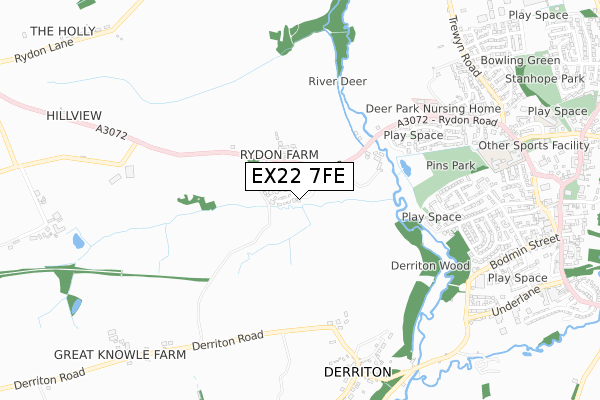
EX22 7FE is located in the Milton & Tamarside electoral ward, within the local authority district of Torridge and the English Parliamentary constituency of Torridge and West Devon. The Sub Integrated Care Board (ICB) Location is NHS Devon ICB - 15N and the police force is Devon & Cornwall. This postcode has been in use since November 2017.


GetTheData
Source: OS Open Zoomstack (Ordnance Survey)
Licence: Open Government Licence (requires attribution)
Attribution: Contains OS data © Crown copyright and database right 2024
Source: Open Postcode Geo
Licence: Open Government Licence (requires attribution)
Attribution: Contains OS data © Crown copyright and database right 2024; Contains Royal Mail data © Royal Mail copyright and database right 2024; Source: Office for National Statistics licensed under the Open Government Licence v.3.0
| Easting | 233285 |
| Northing | 103904 |
| Latitude | 50.810627 |
| Longitude | -4.367730 |
GetTheData
Source: Open Postcode Geo
Licence: Open Government Licence
| Country | England |
| Postcode District | EX22 |
| ➜ EX22 open data dashboard ➜ See where EX22 is on a map | |
GetTheData
Source: Land Registry Price Paid Data
Licence: Open Government Licence
| Ward | Milton & Tamarside |
| Constituency | Torridge And West Devon |
GetTheData
Source: ONS Postcode Database
Licence: Open Government Licence
| April 2021 | Drugs | On or near Parking Area | 270m |
| ➜ Get more crime data in our Crime section | |||
GetTheData
Source: data.police.uk
Licence: Open Government Licence
| Rydon Park (A3072) | Holsworthy | 191m |
| Rydon Park (A3072) | Holsworthy | 191m |
| Trewyn Park (Rydon Road) | Holsworthy | 679m |
| Trewen Park (Rydon Road) | Holsworthy | 683m |
| Sanders Lane (Victoria Hill) | Holsworthy | 879m |
GetTheData
Source: NaPTAN
Licence: Open Government Licence
| Percentage of properties with Next Generation Access | 100.0% |
| Percentage of properties with Superfast Broadband | 0.0% |
| Percentage of properties with Ultrafast Broadband | 0.0% |
| Percentage of properties with Full Fibre Broadband | 0.0% |
Superfast Broadband is between 30Mbps and 300Mbps
Ultrafast Broadband is > 300Mbps
| Percentage of properties unable to receive 2Mbps | 0.0% |
| Percentage of properties unable to receive 5Mbps | 0.0% |
| Percentage of properties unable to receive 10Mbps | 0.0% |
| Percentage of properties unable to receive 30Mbps | 100.0% |
GetTheData
Source: Ofcom
Licence: Ofcom Terms of Use (requires attribution)
GetTheData
Source: ONS Postcode Database
Licence: Open Government Licence


➜ Get more ratings from the Food Standards Agency
GetTheData
Source: Food Standards Agency
Licence: FSA terms & conditions
| Last Collection | |||
|---|---|---|---|
| Location | Mon-Fri | Sat | Distance |
| Stanhope Close | 17:15 | 12:30 | 1,318m |
GetTheData
Source: Dracos
Licence: Creative Commons Attribution-ShareAlike
| Facility | Distance |
|---|---|
| Holsworthy Community College Victoria Hill, Holsworthy Grass Pitches, Sports Hall, Artificial Grass Pitch | 891m |
| Holsworthy Leisure Centre Western Road, Holsworthy Sports Hall, Swimming Pool, Health and Fitness Gym | 992m |
| Stanhope Park Park Grove, Holsworthy Grass Pitches | 1.2km |
GetTheData
Source: Active Places
Licence: Open Government Licence
| School | Phase of Education | Distance |
|---|---|---|
| Holsworthy Community College Victoria Hill, Holsworthy, EX22 6JD | Secondary | 891m |
| The Copper Academy The Holsworthy Business and Training Centre, Western Road, Holsworthy, Devon, EX22 6DH | Not applicable | 996m |
| Holsworthy Church of England Primary School Sanders Lane, Holsworthy, EX22 6HD | Primary | 1km |
GetTheData
Source: Edubase
Licence: Open Government Licence
The below table lists the International Territorial Level (ITL) codes (formerly Nomenclature of Territorial Units for Statistics (NUTS) codes) and Local Administrative Units (LAU) codes for EX22 7FE:
| ITL 1 Code | Name |
|---|---|
| TLK | South West (England) |
| ITL 2 Code | Name |
| TLK4 | Devon |
| ITL 3 Code | Name |
| TLK43 | Devon CC |
| LAU 1 Code | Name |
| E07000046 | Torridge |
GetTheData
Source: ONS Postcode Directory
Licence: Open Government Licence
The below table lists the Census Output Area (OA), Lower Layer Super Output Area (LSOA), and Middle Layer Super Output Area (MSOA) for EX22 7FE:
| Code | Name | |
|---|---|---|
| OA | E00102851 | |
| LSOA | E01020302 | Torridge 008D |
| MSOA | E02004227 | Torridge 008 |
GetTheData
Source: ONS Postcode Directory
Licence: Open Government Licence
| EX22 7FD | Molesworth Way | 134m |
| EX22 7HU | 320m | |
| EX22 6FQ | Brooks Avenue | 467m |
| EX22 6FB | St Peters Road | 550m |
| EX22 6FE | Wesley Road | 557m |
| EX22 6AG | Glebelands | 618m |
| EX22 6AH | Glebe Meadow | 623m |
| EX22 6FD | St Pauls Drive | 643m |
| EX22 6BY | Westcroft Road | 649m |
| EX22 6FA | Penhale Drive | 685m |
GetTheData
Source: Open Postcode Geo; Land Registry Price Paid Data
Licence: Open Government Licence