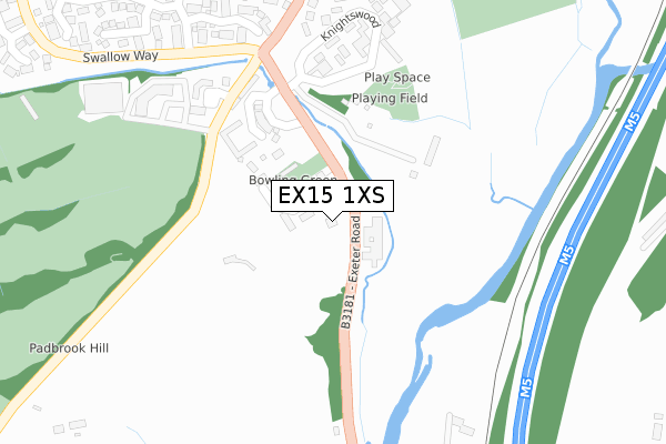
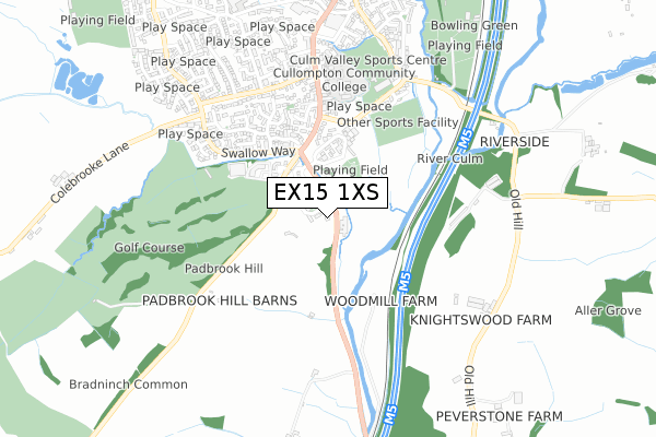
EX15 1XS is located in the Cullompton Padbrook electoral ward, within the local authority district of Mid Devon and the English Parliamentary constituency of Tiverton and Honiton. The Sub Integrated Care Board (ICB) Location is NHS Devon ICB - 15N and the police force is Devon & Cornwall. This postcode has been in use since April 2020.


GetTheData
Source: OS Open Zoomstack (Ordnance Survey)
Licence: Open Government Licence (requires attribution)
Attribution: Contains OS data © Crown copyright and database right 2024
Source: Open Postcode Geo
Licence: Open Government Licence (requires attribution)
Attribution: Contains OS data © Crown copyright and database right 2024; Contains Royal Mail data © Royal Mail copyright and database right 2024; Source: Office for National Statistics licensed under the Open Government Licence v.3.0
| Easting | 301993 |
| Northing | 106179 |
| Latitude | 50.846794 |
| Longitude | -3.393505 |
GetTheData
Source: Open Postcode Geo
Licence: Open Government Licence
| Country | England |
| Postcode District | EX15 |
| ➜ EX15 open data dashboard ➜ See where EX15 is on a map | |
GetTheData
Source: Land Registry Price Paid Data
Licence: Open Government Licence
| Ward | Cullompton Padbrook |
| Constituency | Tiverton And Honiton |
GetTheData
Source: ONS Postcode Database
Licence: Open Government Licence
| October 2022 | Violence and sexual offences | On or near Dukes Mead | 421m |
| October 2022 | Violence and sexual offences | On or near Dukes Mead | 421m |
| October 2022 | Anti-social behaviour | On or near Dukes Mead | 421m |
| ➜ Get more crime data in our Crime section | |||
GetTheData
Source: data.police.uk
Licence: Open Government Licence
| Swalcliffe House (B3181) | Cullompton | 146m |
| Heyridge Meadow (B3181) | Cullompton | 179m |
| Toad Hall (Exeter Road) | Cullompton | 330m |
| Toad Hall (Exeter Road) | Cullompton | 351m |
| Swallow Way | Cullompton | 356m |
GetTheData
Source: NaPTAN
Licence: Open Government Licence
GetTheData
Source: ONS Postcode Database
Licence: Open Government Licence


➜ Get more ratings from the Food Standards Agency
GetTheData
Source: Food Standards Agency
Licence: FSA terms & conditions
| Last Collection | |||
|---|---|---|---|
| Location | Mon-Fri | Sat | Distance |
| Motterton | 10:00 | 10:00 | 1,344m |
| Tesco | 17:45 | 12:00 | 1,406m |
| St Georges Well | 17:45 | 12:00 | 1,856m |
GetTheData
Source: Dracos
Licence: Creative Commons Attribution-ShareAlike
| Facility | Distance |
|---|---|
| Padbrook Park Hotel Cullompton Indoor Bowls, Health and Fitness Gym, Golf | 396m |
| Cullompton Community College Exeter Road, Cullompton Grass Pitches | 533m |
| Culm Valley Sports Centre Meadow Lane, Cullompton Sports Hall, Health and Fitness Gym, Artificial Grass Pitch, Studio, Squash Courts | 582m |
GetTheData
Source: Active Places
Licence: Open Government Licence
| School | Phase of Education | Distance |
|---|---|---|
| Cullompton Community College Exeter Road, Cullompton, EX15 1DX | Secondary | 533m |
| Willowbank Primary School Manitoba Gardens, Cullompton, EX15 1EZ | Primary | 934m |
| St Andrew's Primary School St Andrews Estate, Cullompton, EX15 1HU | Primary | 1.3km |
GetTheData
Source: Edubase
Licence: Open Government Licence
The below table lists the International Territorial Level (ITL) codes (formerly Nomenclature of Territorial Units for Statistics (NUTS) codes) and Local Administrative Units (LAU) codes for EX15 1XS:
| ITL 1 Code | Name |
|---|---|
| TLK | South West (England) |
| ITL 2 Code | Name |
| TLK4 | Devon |
| ITL 3 Code | Name |
| TLK43 | Devon CC |
| LAU 1 Code | Name |
| E07000042 | Mid Devon |
GetTheData
Source: ONS Postcode Directory
Licence: Open Government Licence
The below table lists the Census Output Area (OA), Lower Layer Super Output Area (LSOA), and Middle Layer Super Output Area (MSOA) for EX15 1XS:
| Code | Name | |
|---|---|---|
| OA | E00101542 | |
| LSOA | E01020056 | Mid Devon 008C |
| MSOA | E02004171 | Mid Devon 008 |
GetTheData
Source: ONS Postcode Directory
Licence: Open Government Licence
| EX15 1FD | Heyridge Meadow | 219m |
| EX15 1EU | Knightswood | 288m |
| EX15 1ET | Knightswood | 305m |
| EX15 1EX | Knightswood | 341m |
| EX15 1RX | 346m | |
| EX15 1RR | Wheatfield Close | 376m |
| EX15 1QT | Dukes Mead | 410m |
| EX15 1TB | Ploudal Road | 412m |
| EX15 1SH | Clover Drive | 417m |
| EX15 1TD | Heron Way | 422m |
GetTheData
Source: Open Postcode Geo; Land Registry Price Paid Data
Licence: Open Government Licence