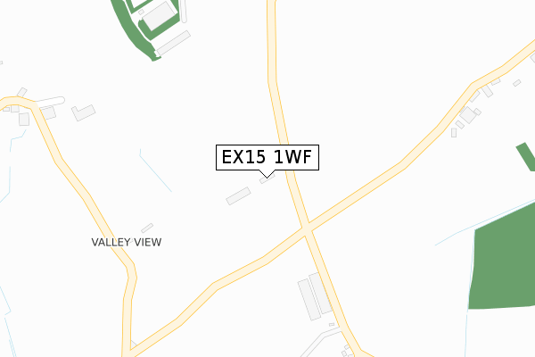
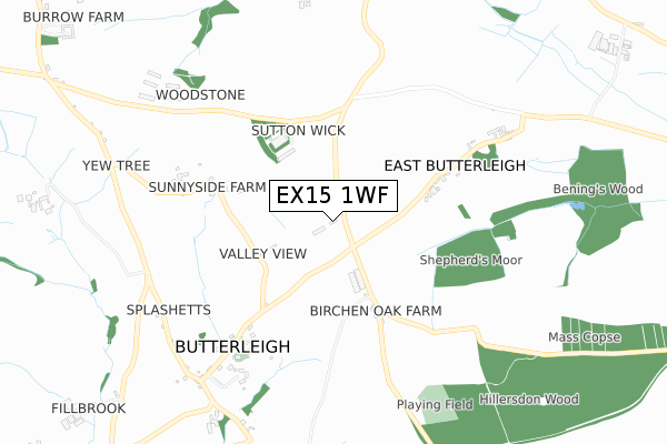
EX15 1WF is located in the Halberton electoral ward, within the local authority district of Mid Devon and the English Parliamentary constituency of Tiverton and Honiton. The Sub Integrated Care Board (ICB) Location is NHS Devon ICB - 15N and the police force is Devon & Cornwall. This postcode has been in use since February 2019.


GetTheData
Source: OS Open Zoomstack (Ordnance Survey)
Licence: Open Government Licence (requires attribution)
Attribution: Contains OS data © Crown copyright and database right 2024
Source: Open Postcode Geo
Licence: Open Government Licence (requires attribution)
Attribution: Contains OS data © Crown copyright and database right 2024; Contains Royal Mail data © Royal Mail copyright and database right 2024; Source: Office for National Statistics licensed under the Open Government Licence v.3.0
| Easting | 296977 |
| Northing | 108960 |
| Latitude | 50.870922 |
| Longitude | -3.465515 |
GetTheData
Source: Open Postcode Geo
Licence: Open Government Licence
| Country | England |
| Postcode District | EX15 |
| ➜ EX15 open data dashboard ➜ See where EX15 is on a map | |
GetTheData
Source: Land Registry Price Paid Data
Licence: Open Government Licence
| Ward | Halberton |
| Constituency | Tiverton And Honiton |
GetTheData
Source: ONS Postcode Database
Licence: Open Government Licence
GetTheData
Source: ONS Postcode Database
Licence: Open Government Licence

➜ Get more ratings from the Food Standards Agency
GetTheData
Source: Food Standards Agency
Licence: FSA terms & conditions
| Last Collection | |||
|---|---|---|---|
| Location | Mon-Fri | Sat | Distance |
| East Butterleigh | 15:00 | 08:00 | 1,459m |
| Horn Hill | 12:00 | 11:15 | 3,041m |
| Ashley | 16:30 | 11:45 | 3,129m |
GetTheData
Source: Dracos
Licence: Creative Commons Attribution-ShareAlike
| Facility | Distance |
|---|---|
| Timeout Leisure (Closed) New Parade, Anstey Crescent, Tiverton Health and Fitness Gym | 3.2km |
| Happy Meadow Recreation Ground Bickleigh Bridge, Bickleigh Grass Pitches | 3.6km |
| The Willows Health & Fitness Fore Street, Tiverton Health and Fitness Gym | 3.9km |
GetTheData
Source: Active Places
Licence: Open Government Licence
| School | Phase of Education | Distance |
|---|---|---|
| Tidcombe Primary School Marina Way, Tiverton, EX16 4BP | Primary | 3.4km |
| Wilcombe Primary School Lazenby Road, Wilcombe, Tiverton, EX16 4AL | Primary | 3.5km |
| Bickleigh on Exe Church of England Primary School Bell Meadow, Bickleigh, Tiverton, EX16 8RE | Primary | 3.5km |
GetTheData
Source: Edubase
Licence: Open Government Licence
The below table lists the International Territorial Level (ITL) codes (formerly Nomenclature of Territorial Units for Statistics (NUTS) codes) and Local Administrative Units (LAU) codes for EX15 1WF:
| ITL 1 Code | Name |
|---|---|
| TLK | South West (England) |
| ITL 2 Code | Name |
| TLK4 | Devon |
| ITL 3 Code | Name |
| TLK43 | Devon CC |
| LAU 1 Code | Name |
| E07000042 | Mid Devon |
GetTheData
Source: ONS Postcode Directory
Licence: Open Government Licence
The below table lists the Census Output Area (OA), Lower Layer Super Output Area (LSOA), and Middle Layer Super Output Area (MSOA) for EX15 1WF:
| Code | Name | |
|---|---|---|
| OA | E00101540 | |
| LSOA | E01020056 | Mid Devon 008C |
| MSOA | E02004171 | Mid Devon 008 |
GetTheData
Source: ONS Postcode Directory
Licence: Open Government Licence
| EX16 4PS | Burrow Court | 429m |
| EX16 4PW | Burrow Corner | 479m |
| EX15 1PP | 665m | |
| EX15 1PW | 793m | |
| EX15 1PN | 893m | |
| EX16 4PJ | 950m | |
| EX15 1QG | Forge Lane | 958m |
| EX15 1PL | 971m | |
| EX15 1LX | 1023m | |
| EX15 1PH | 1211m |
GetTheData
Source: Open Postcode Geo; Land Registry Price Paid Data
Licence: Open Government Licence