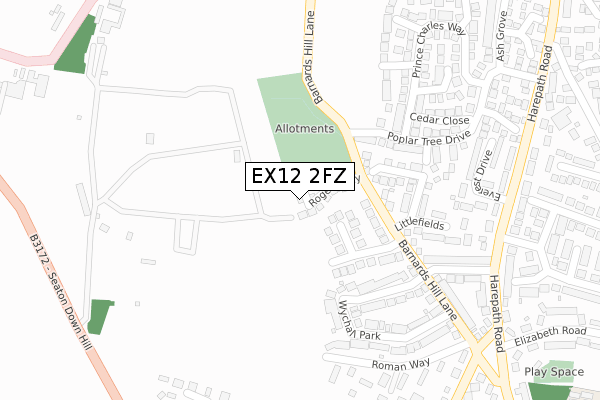
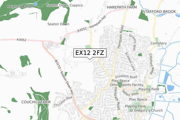
EX12 2FZ is located in the Seaton electoral ward, within the local authority district of East Devon and the English Parliamentary constituency of Tiverton and Honiton. The Sub Integrated Care Board (ICB) Location is NHS Devon ICB - 15N and the police force is Devon & Cornwall. This postcode has been in use since January 2020.


GetTheData
Source: OS Open Zoomstack (Ordnance Survey)
Licence: Open Government Licence (requires attribution)
Attribution: Contains OS data © Crown copyright and database right 2024
Source: Open Postcode Geo
Licence: Open Government Licence (requires attribution)
Attribution: Contains OS data © Crown copyright and database right 2024; Contains Royal Mail data © Royal Mail copyright and database right 2024; Source: Office for National Statistics licensed under the Open Government Licence v.3.0
| Easting | 323881 |
| Northing | 91271 |
| Latitude | 50.716052 |
| Longitude | -3.079572 |
GetTheData
Source: Open Postcode Geo
Licence: Open Government Licence
| Country | England |
| Postcode District | EX12 |
| ➜ EX12 open data dashboard ➜ See where EX12 is on a map ➜ Where is Seaton? | |
GetTheData
Source: Land Registry Price Paid Data
Licence: Open Government Licence
| Ward | Seaton |
| Constituency | Tiverton And Honiton |
GetTheData
Source: ONS Postcode Database
Licence: Open Government Licence
2022 16 MAR £500,000 |
2, POTTERS WAY, SEATON, EX12 2FZ 2020 11 JUN £425,000 |
1, POTTERS WAY, SEATON, EX12 2FZ 2020 27 FEB £414,950 |
2019 18 DEC £424,995 |
GetTheData
Source: HM Land Registry Price Paid Data
Licence: Contains HM Land Registry data © Crown copyright and database right 2024. This data is licensed under the Open Government Licence v3.0.
| August 2022 | Anti-social behaviour | On or near Harepath Road | 350m |
| June 2022 | Violence and sexual offences | On or near Littlefields | 221m |
| June 2022 | Anti-social behaviour | On or near Elmfield Road | 306m |
| ➜ Get more crime data in our Crime section | |||
GetTheData
Source: data.police.uk
Licence: Open Government Licence
| Barnards Hill Lane | Seaton | 184m |
| Maple Close (Poplar Tree Drive) | Seaton | 334m |
| Everest Drive (Harepath Road) | Seaton | 359m |
| Everest Drive (Harepath Road) | Seaton | 364m |
| Scalwell Lane (Harepath Road) | Seaton | 438m |
| Seaton Terminus (Seaton Tramway) (Underfleet) | Seaton | 1,464m |
GetTheData
Source: NaPTAN
Licence: Open Government Licence
GetTheData
Source: ONS Postcode Database
Licence: Open Government Licence


➜ Get more ratings from the Food Standards Agency
GetTheData
Source: Food Standards Agency
Licence: FSA terms & conditions
| Last Collection | |||
|---|---|---|---|
| Location | Mon-Fri | Sat | Distance |
| New Beer Road | 17:15 | 11:30 | 1,361m |
| The Square | 17:30 | 11:30 | 1,427m |
| Esplanade | 17:30 | 11:30 | 1,619m |
GetTheData
Source: Dracos
Licence: Creative Commons Attribution-ShareAlike
| Facility | Distance |
|---|---|
| Seaton Heights Hotel Leisure Centre (Closed) Harepath Hill, Seaton Health and Fitness Gym, Swimming Pool, Sports Hall, Squash Courts | 410m |
| Elizabeth Road Playing Field Scalwell Lane, Seaton Grass Pitches | 629m |
| Seaton Primary School Harepath Road, Seaton Swimming Pool, Grass Pitches | 643m |
GetTheData
Source: Active Places
Licence: Open Government Licence
| School | Phase of Education | Distance |
|---|---|---|
| Seaton Primary School Valley View, Seaton, EX12 2HF | Primary | 643m |
| Colyton Grammar School Whitwell Lane, Colyford, Colyton, EX24 6HN | Secondary | 1.4km |
| Beer Church of England Primary School Mare Lane, Beer, Seaton, EX12 3NB | Primary | 2.4km |
GetTheData
Source: Edubase
Licence: Open Government Licence
The below table lists the International Territorial Level (ITL) codes (formerly Nomenclature of Territorial Units for Statistics (NUTS) codes) and Local Administrative Units (LAU) codes for EX12 2FZ:
| ITL 1 Code | Name |
|---|---|
| TLK | South West (England) |
| ITL 2 Code | Name |
| TLK4 | Devon |
| ITL 3 Code | Name |
| TLK43 | Devon CC |
| LAU 1 Code | Name |
| E07000040 | East Devon |
GetTheData
Source: ONS Postcode Directory
Licence: Open Government Licence
The below table lists the Census Output Area (OA), Lower Layer Super Output Area (LSOA), and Middle Layer Super Output Area (MSOA) for EX12 2FZ:
| Code | Name | |
|---|---|---|
| OA | E00100979 | |
| LSOA | E01019949 | East Devon 010D |
| MSOA | E02004138 | East Devon 010 |
GetTheData
Source: ONS Postcode Directory
Licence: Open Government Licence
| EX12 2JT | Axeview Road | 122m |
| EX12 2EQ | Barnards Hill Lane | 133m |
| EX12 2TG | Barnards Hill Lane | 159m |
| EX12 2UT | Armada Close | 161m |
| EX12 2JS | Axeview Road | 176m |
| EX12 2BJ | Hawksdown View | 222m |
| EX12 2EL | Wychall Park | 237m |
| EX12 2UA | Lime Way | 248m |
| EX12 2BZ | Littlefields | 255m |
| EX12 2TW | Poplar Tree Drive | 269m |
GetTheData
Source: Open Postcode Geo; Land Registry Price Paid Data
Licence: Open Government Licence