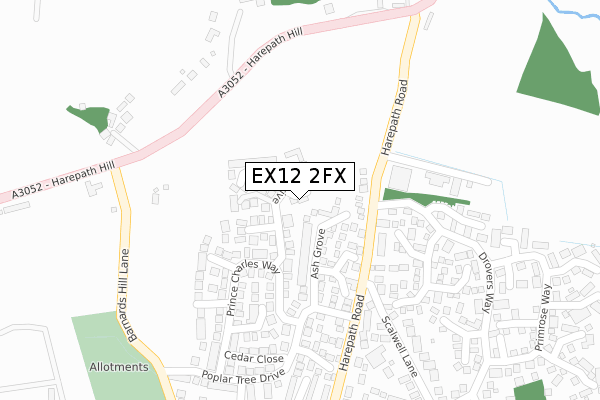
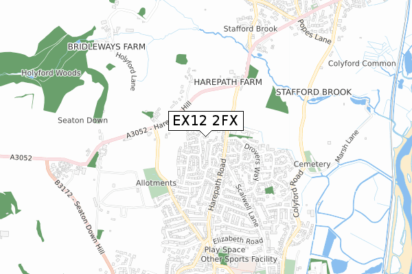
EX12 2FX is located in the Seaton electoral ward, within the local authority district of East Devon and the English Parliamentary constituency of Tiverton and Honiton. The Sub Integrated Care Board (ICB) Location is NHS Devon ICB - 15N and the police force is Devon & Cornwall. This postcode has been in use since January 2018.


GetTheData
Source: OS Open Zoomstack (Ordnance Survey)
Licence: Open Government Licence (requires attribution)
Attribution: Contains OS data © Crown copyright and database right 2024
Source: Open Postcode Geo
Licence: Open Government Licence (requires attribution)
Attribution: Contains OS data © Crown copyright and database right 2024; Contains Royal Mail data © Royal Mail copyright and database right 2024; Source: Office for National Statistics licensed under the Open Government Licence v.3.0
| Easting | 324198 |
| Northing | 91648 |
| Latitude | 50.719483 |
| Longitude | -3.075161 |
GetTheData
Source: Open Postcode Geo
Licence: Open Government Licence
| Country | England |
| Postcode District | EX12 |
| ➜ EX12 open data dashboard ➜ See where EX12 is on a map ➜ Where is Seaton? | |
GetTheData
Source: Land Registry Price Paid Data
Licence: Open Government Licence
| Ward | Seaton |
| Constituency | Tiverton And Honiton |
GetTheData
Source: ONS Postcode Database
Licence: Open Government Licence
2018 6 SEP £384,950 |
GetTheData
Source: HM Land Registry Price Paid Data
Licence: Contains HM Land Registry data © Crown copyright and database right 2024. This data is licensed under the Open Government Licence v3.0.
| August 2022 | Anti-social behaviour | On or near Harepath Road | 456m |
| July 2022 | Violence and sexual offences | On or near Primrose Way | 378m |
| June 2022 | Violence and sexual offences | On or near Primrose Way | 378m |
| ➜ Get more crime data in our Crime section | |||
GetTheData
Source: data.police.uk
Licence: Open Government Licence
| Drovers Way (Harepath Road) | Seaton | 120m |
| Drovers Way (Harepath Road) | Seaton | 125m |
| Harepath Industrial Estate (Harepath Road) | Holyford | 167m |
| Harepath Industrial Estate (Harepath Road) | Holyford | 174m |
| Scalwell Lane (Harepath Road) | Seaton | 196m |
| Colyford Station (Seaton Tramway) (Swan Hill Road) | Colyford | 1,598m |
GetTheData
Source: NaPTAN
Licence: Open Government Licence
| Percentage of properties with Next Generation Access | 100.0% |
| Percentage of properties with Superfast Broadband | 100.0% |
| Percentage of properties with Ultrafast Broadband | 100.0% |
| Percentage of properties with Full Fibre Broadband | 100.0% |
Superfast Broadband is between 30Mbps and 300Mbps
Ultrafast Broadband is > 300Mbps
| Percentage of properties unable to receive 2Mbps | 0.0% |
| Percentage of properties unable to receive 5Mbps | 0.0% |
| Percentage of properties unable to receive 10Mbps | 0.0% |
| Percentage of properties unable to receive 30Mbps | 0.0% |
GetTheData
Source: Ofcom
Licence: Ofcom Terms of Use (requires attribution)
GetTheData
Source: ONS Postcode Database
Licence: Open Government Licence


➜ Get more ratings from the Food Standards Agency
GetTheData
Source: Food Standards Agency
Licence: FSA terms & conditions
| Last Collection | |||
|---|---|---|---|
| Location | Mon-Fri | Sat | Distance |
| Shells Lane | 16:45 | 07:30 | 1,524m |
| The Square | 17:30 | 11:30 | 1,694m |
| New Beer Road | 17:15 | 11:30 | 1,788m |
GetTheData
Source: Dracos
Licence: Creative Commons Attribution-ShareAlike
| Facility | Distance |
|---|---|
| Seaton Heights Hotel Leisure Centre (Closed) Harepath Hill, Seaton Health and Fitness Gym, Swimming Pool, Sports Hall, Squash Courts | 641m |
| Elizabeth Road Playing Field Scalwell Lane, Seaton Grass Pitches | 732m |
| Seaton Primary School Harepath Road, Seaton Swimming Pool, Grass Pitches | 799m |
GetTheData
Source: Active Places
Licence: Open Government Licence
| School | Phase of Education | Distance |
|---|---|---|
| Seaton Primary School Valley View, Seaton, EX12 2HF | Primary | 799m |
| Colyton Grammar School Whitwell Lane, Colyford, Colyton, EX24 6HN | Secondary | 936m |
| Colyton Primary Academy The Butts, West Street, Colyton, EX24 6NU | Primary | 2.2km |
GetTheData
Source: Edubase
Licence: Open Government Licence
The below table lists the International Territorial Level (ITL) codes (formerly Nomenclature of Territorial Units for Statistics (NUTS) codes) and Local Administrative Units (LAU) codes for EX12 2FX:
| ITL 1 Code | Name |
|---|---|
| TLK | South West (England) |
| ITL 2 Code | Name |
| TLK4 | Devon |
| ITL 3 Code | Name |
| TLK43 | Devon CC |
| LAU 1 Code | Name |
| E07000040 | East Devon |
GetTheData
Source: ONS Postcode Directory
Licence: Open Government Licence
The below table lists the Census Output Area (OA), Lower Layer Super Output Area (LSOA), and Middle Layer Super Output Area (MSOA) for EX12 2FX:
| Code | Name | |
|---|---|---|
| OA | E00100977 | |
| LSOA | E01019949 | East Devon 010D |
| MSOA | E02004138 | East Devon 010 |
GetTheData
Source: ONS Postcode Directory
Licence: Open Government Licence
| EX12 2UH | Rowan Drive | 50m |
| EX12 2TT | Ash Grove | 78m |
| EX12 2SX | Harepath Road | 108m |
| EX12 2TS | Larch Close | 115m |
| EX12 2UQ | Oaklands Close | 164m |
| EX12 2TR | Willow Close | 164m |
| EX12 2TU | Prince Charles Way | 205m |
| EX12 2UG | Hazel Close | 210m |
| EX12 2QR | Chestnut Close | 234m |
| EX12 2TE | Barnards Hill Lane | 242m |
GetTheData
Source: Open Postcode Geo; Land Registry Price Paid Data
Licence: Open Government Licence