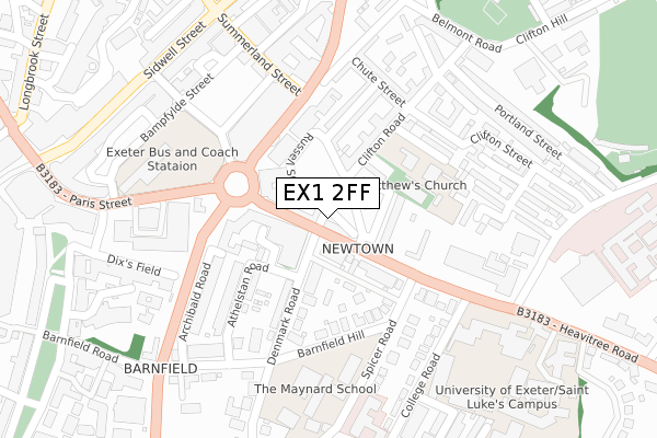
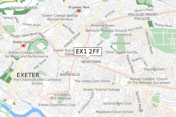
EX1 2FF is located in the Newtown and St Leonard's electoral ward, within the local authority district of Exeter and the English Parliamentary constituency of Exeter. The Sub Integrated Care Board (ICB) Location is NHS Devon ICB - 15N and the police force is Devon & Cornwall. This postcode has been in use since August 2017.


GetTheData
Source: OS Open Zoomstack (Ordnance Survey)
Licence: Open Government Licence (requires attribution)
Attribution: Contains OS data © Crown copyright and database right 2024
Source: Open Postcode Geo
Licence: Open Government Licence (requires attribution)
Attribution: Contains OS data © Crown copyright and database right 2024; Contains Royal Mail data © Royal Mail copyright and database right 2024; Source: Office for National Statistics licensed under the Open Government Licence v.3.0
| Easting | 292766 |
| Northing | 92795 |
| Latitude | 50.724839 |
| Longitude | -3.520614 |
GetTheData
Source: Open Postcode Geo
Licence: Open Government Licence
| Country | England |
| Postcode District | EX1 |
| ➜ EX1 open data dashboard ➜ See where EX1 is on a map ➜ Where is Exeter? | |
GetTheData
Source: Land Registry Price Paid Data
Licence: Open Government Licence
| Ward | Newtown And St Leonard's |
| Constituency | Exeter |
GetTheData
Source: ONS Postcode Database
Licence: Open Government Licence
| October 2022 | Other theft | On or near Chute Street | 222m |
| October 2022 | Violence and sexual offences | On or near Stover Court | 310m |
| October 2022 | Violence and sexual offences | On or near Stover Court | 310m |
| ➜ Get more crime data in our Crime section | |||
GetTheData
Source: data.police.uk
Licence: Open Government Licence
| The Pyramids (Heavitree Road) | Exeter City Centre | 60m |
| Lower Summerlands (Heavitree Road) | Exeter City Centre | 82m |
| Cheeke Street For Bus Station (Cheeke Street) | Exeter City Centre | 235m |
| College Road | St Leonard's | 251m |
| College Road | St Leonard's | 258m |
| St James Park (Devon) Station | 0.7km |
| Exeter Central Station | 0.9km |
| Polsloe Bridge Station | 1.5km |
GetTheData
Source: NaPTAN
Licence: Open Government Licence
| Percentage of properties with Next Generation Access | 66.7% |
| Percentage of properties with Superfast Broadband | 66.7% |
| Percentage of properties with Ultrafast Broadband | 66.7% |
| Percentage of properties with Full Fibre Broadband | 0.0% |
Superfast Broadband is between 30Mbps and 300Mbps
Ultrafast Broadband is > 300Mbps
| Percentage of properties unable to receive 2Mbps | 0.0% |
| Percentage of properties unable to receive 5Mbps | 0.0% |
| Percentage of properties unable to receive 10Mbps | 0.0% |
| Percentage of properties unable to receive 30Mbps | 0.0% |
GetTheData
Source: Ofcom
Licence: Ofcom Terms of Use (requires attribution)
GetTheData
Source: ONS Postcode Database
Licence: Open Government Licence


➜ Get more ratings from the Food Standards Agency
GetTheData
Source: Food Standards Agency
Licence: FSA terms & conditions
| Last Collection | |||
|---|---|---|---|
| Location | Mon-Fri | Sat | Distance |
| Eaton House | 17:45 | 13:00 | 93m |
| Clifton Road Post Office | 19:00 | 12:00 | 153m |
| Exeter Delivery Office | 19:00 | 12:30 | 201m |
GetTheData
Source: Dracos
Licence: Creative Commons Attribution-ShareAlike
| Facility | Distance |
|---|---|
| Pyramids Swimming & Leisure Centre (Closed) Heavitree Road, Exeter Swimming Pool, Health and Fitness Gym | 63m |
| Newtown Primary School (Closed) Clifton Road, Exeter Grass Pitches | 227m |
| The Maynard School Denmark Road, Exeter Sports Hall, Outdoor Tennis Courts, Health and Fitness Gym | 238m |
GetTheData
Source: Active Places
Licence: Open Government Licence
| School | Phase of Education | Distance |
|---|---|---|
| Newtown Primary School Clifton Road, Exeter, EX1 2BP | Primary | 153m |
| The Maynard School Denmark Road, Exeter, EX1 1SJ | Not applicable | 238m |
| St Sidwell's Church of England Primary School & Nursery York Road, St Sidwell's Ce Primary School and Nursery, Exeter, EX4 6PG | Primary | 520m |
GetTheData
Source: Edubase
Licence: Open Government Licence
The below table lists the International Territorial Level (ITL) codes (formerly Nomenclature of Territorial Units for Statistics (NUTS) codes) and Local Administrative Units (LAU) codes for EX1 2FF:
| ITL 1 Code | Name |
|---|---|
| TLK | South West (England) |
| ITL 2 Code | Name |
| TLK4 | Devon |
| ITL 3 Code | Name |
| TLK43 | Devon CC |
| LAU 1 Code | Name |
| E07000041 | Exeter |
GetTheData
Source: ONS Postcode Directory
Licence: Open Government Licence
The below table lists the Census Output Area (OA), Lower Layer Super Output Area (LSOA), and Middle Layer Super Output Area (MSOA) for EX1 2FF:
| Code | Name | |
|---|---|---|
| OA | E00101209 | |
| LSOA | E01019995 | Exeter 008B |
| MSOA | E02004156 | Exeter 008 |
GetTheData
Source: ONS Postcode Directory
Licence: Open Government Licence
| EX1 2LG | Heavitree Road | 16m |
| EX1 2LD | Heavitree Road | 36m |
| EX1 2LQ | Heavitree Road | 80m |
| EX1 2LY | Heavitree Road | 89m |
| EX1 2LJ | Lower Summerlands | 100m |
| EX1 1SL | Denmark Road | 128m |
| EX1 2BR | Clifton Road | 132m |
| EX1 1SX | Spicer Road | 154m |
| EX1 2EY | Belmont Mews | 176m |
| EX1 2BU | Codrington Street | 177m |
GetTheData
Source: Open Postcode Geo; Land Registry Price Paid Data
Licence: Open Government Licence