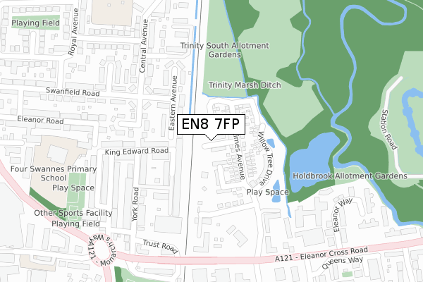
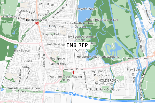
EN8 7FP is located in the Waltham Cross electoral ward, within the local authority district of Broxbourne and the English Parliamentary constituency of Broxbourne. The Sub Integrated Care Board (ICB) Location is NHS Hertfordshire and West Essex ICB - 06K and the police force is Hertfordshire. This postcode has been in use since April 2019.


GetTheData
Source: OS Open Zoomstack (Ordnance Survey)
Licence: Open Government Licence (requires attribution)
Attribution: Contains OS data © Crown copyright and database right 2025
Source: Open Postcode Geo
Licence: Open Government Licence (requires attribution)
Attribution: Contains OS data © Crown copyright and database right 2025; Contains Royal Mail data © Royal Mail copyright and database right 2025; Source: Office for National Statistics licensed under the Open Government Licence v.3.0
| Easting | 536603 |
| Northing | 200665 |
| Latitude | 51.688133 |
| Longitude | -0.025212 |
GetTheData
Source: Open Postcode Geo
Licence: Open Government Licence
| Country | England |
| Postcode District | EN8 |
➜ See where EN8 is on a map ➜ Where is Waltham Cross? | |
GetTheData
Source: Land Registry Price Paid Data
Licence: Open Government Licence
| Ward | Waltham Cross |
| Constituency | Broxbourne |
GetTheData
Source: ONS Postcode Database
Licence: Open Government Licence
| Waltham Cross Railway Station (Eleanor Cross Road) | Waltham Cross | 281m |
| Waltham Cross Railway Station (Eleanor Cross Road) | Waltham Cross | 341m |
| Waltham Cross Railway Station (Station Approach) | Waltham Cross | 362m |
| Queensway (Eleanor Cross Road) | Waltham Cross | 454m |
| Queensway (Eleanor Cross Road) | Waltham Cross | 462m |
| Waltham Cross Station | 0.4km |
| Theobalds Grove Station | 0.8km |
| Cheshunt Station | 1.6km |
GetTheData
Source: NaPTAN
Licence: Open Government Licence
| Percentage of properties with Next Generation Access | 100.0% |
| Percentage of properties with Superfast Broadband | 100.0% |
| Percentage of properties with Ultrafast Broadband | 100.0% |
| Percentage of properties with Full Fibre Broadband | 100.0% |
Superfast Broadband is between 30Mbps and 300Mbps
Ultrafast Broadband is > 300Mbps
| Median download speed | 360.0Mbps |
| Average download speed | 360.0Mbps |
| Maximum download speed | 360.00Mbps |
| Median upload speed | 360.0Mbps |
| Average upload speed | 360.0Mbps |
| Maximum upload speed | 360.00Mbps |
| Percentage of properties unable to receive 2Mbps | 0.0% |
| Percentage of properties unable to receive 5Mbps | 0.0% |
| Percentage of properties unable to receive 10Mbps | 0.0% |
| Percentage of properties unable to receive 30Mbps | 0.0% |
GetTheData
Source: Ofcom
Licence: Ofcom Terms of Use (requires attribution)
GetTheData
Source: ONS Postcode Database
Licence: Open Government Licence


➜ Get more ratings from the Food Standards Agency
GetTheData
Source: Food Standards Agency
Licence: FSA terms & conditions
| Last Collection | |||
|---|---|---|---|
| Location | Mon-Fri | Sat | Distance |
| Holdbrook | 17:30 | 11:30 | 180m |
| Crossbrook Street | 18:30 | 11:30 | 1,078m |
| Chesthunt P.o | 18:15 | 12:00 | 1,138m |
GetTheData
Source: Dracos
Licence: Creative Commons Attribution-ShareAlike
| Risk of EN8 7FP flooding from rivers and sea | Low |
| ➜ EN8 7FP flood map | |
GetTheData
Source: Open Flood Risk by Postcode
Licence: Open Government Licence
The below table lists the International Territorial Level (ITL) codes (formerly Nomenclature of Territorial Units for Statistics (NUTS) codes) and Local Administrative Units (LAU) codes for EN8 7FP:
| ITL 1 Code | Name |
|---|---|
| TLH | East |
| ITL 2 Code | Name |
| TLH2 | Bedfordshire and Hertfordshire |
| ITL 3 Code | Name |
| TLH23 | Hertfordshire CC |
| LAU 1 Code | Name |
| E07000095 | Broxbourne |
GetTheData
Source: ONS Postcode Directory
Licence: Open Government Licence
The below table lists the Census Output Area (OA), Lower Layer Super Output Area (LSOA), and Middle Layer Super Output Area (MSOA) for EN8 7FP:
| Code | Name | |
|---|---|---|
| OA | E00118561 | |
| LSOA | E01023338 | Broxbourne 013C |
| MSOA | E02004855 | Broxbourne 013 |
GetTheData
Source: ONS Postcode Directory
Licence: Open Government Licence
| EN8 7JB | Eastern Avenue | 95m |
| EN8 7JA | Railway Road | 101m |
| EN8 7HZ | King Edward Road | 143m |
| EN8 7JD | Eastern Avenue | 154m |
| EN8 7JE | Swanfield Road | 169m |
| EN8 7JG | Central Avenue | 173m |
| EN8 7HR | Foundry Gate | 176m |
| EN8 7HL | York Road | 203m |
| EN8 7HJ | York Road | 211m |
| EN8 7RL | Bryanstone Road | 218m |
GetTheData
Source: Open Postcode Geo; Land Registry Price Paid Data
Licence: Open Government Licence