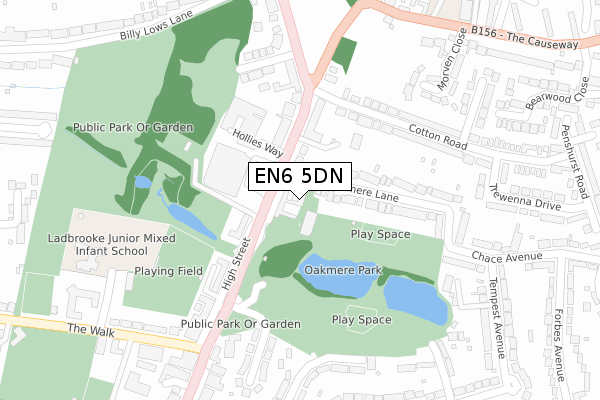
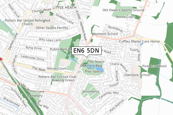
EN6 5DN is located in the Potters Bar Oakmere electoral ward, within the local authority district of Hertsmere and the English Parliamentary constituency of Hertsmere. The Sub Integrated Care Board (ICB) Location is NHS Hertfordshire and West Essex ICB - 06N and the police force is Hertfordshire. This postcode has been in use since February 2020.


GetTheData
Source: OS Open Zoomstack (Ordnance Survey)
Licence: Open Government Licence (requires attribution)
Attribution: Contains OS data © Crown copyright and database right 2024
Source: Open Postcode Geo
Licence: Open Government Licence (requires attribution)
Attribution: Contains OS data © Crown copyright and database right 2024; Contains Royal Mail data © Royal Mail copyright and database right 2024; Source: Office for National Statistics licensed under the Open Government Licence v.3.0
| Easting | 526248 |
| Northing | 201407 |
| Latitude | 51.697224 |
| Longitude | -0.174661 |
GetTheData
Source: Open Postcode Geo
Licence: Open Government Licence
| Country | England |
| Postcode District | EN6 |
| ➜ EN6 open data dashboard ➜ See where EN6 is on a map ➜ Where is Potters Bar? | |
GetTheData
Source: Land Registry Price Paid Data
Licence: Open Government Licence
| Ward | Potters Bar Oakmere |
| Constituency | Hertsmere |
GetTheData
Source: ONS Postcode Database
Licence: Open Government Licence
| January 2024 | Drugs | On or near View Road | 384m |
| January 2024 | Drugs | On or near View Road | 384m |
| January 2024 | Shoplifting | On or near Petrol Station | 421m |
| ➜ Get more crime data in our Crime section | |||
GetTheData
Source: data.police.uk
Licence: Open Government Licence
| Bus Garage (High Street) | Potters Bar | 69m |
| Bus Garage (High Street) | Potters Bar | 91m |
| Tempest Avenue (Chace Avenue) | Potters Bar | 289m |
| Quakers Lane (Hatfield Road) | Little Heath | 358m |
| Parkfield Medical Centre (The Walk) | Potters Bar | 376m |
| Potters Bar Station | 1.2km |
| Hadley Wood Station | 3.2km |
| Brookmans Park Station | 3.4km |
GetTheData
Source: NaPTAN
Licence: Open Government Licence
GetTheData
Source: ONS Postcode Database
Licence: Open Government Licence


➜ Get more ratings from the Food Standards Agency
GetTheData
Source: Food Standards Agency
Licence: FSA terms & conditions
| Last Collection | |||
|---|---|---|---|
| Location | Mon-Fri | Sat | Distance |
| High Street | 18:30 | 12:00 | 304m |
| Byng Drive | 17:45 | 12:00 | 415m |
| Mutton Lane | 649m | ||
GetTheData
Source: Dracos
Licence: Creative Commons Attribution-ShareAlike
| Facility | Distance |
|---|---|
| Potters Bar Town Fc Warkins Rise, The Walk, Potters Bar Grass Pitches | 210m |
| Potters Bar Lawn Tennis Club The Walk, Potters Bar Outdoor Tennis Courts | 450m |
| Stormont School The Causeway, Potters Bar Grass Pitches, Sports Hall | 457m |
GetTheData
Source: Active Places
Licence: Open Government Licence
| School | Phase of Education | Distance |
|---|---|---|
| Ladbrooke Junior Mixed and Infant School Watkins Rise, Potters Bar, EN6 1QB | Primary | 359m |
| Stormont School The Causeway, Potters Bar, EN6 5HA | Not applicable | 448m |
| Oakmere Primary School Chace Avenue, Potters Bar, EN6 5NP | Primary | 729m |
GetTheData
Source: Edubase
Licence: Open Government Licence
The below table lists the International Territorial Level (ITL) codes (formerly Nomenclature of Territorial Units for Statistics (NUTS) codes) and Local Administrative Units (LAU) codes for EN6 5DN:
| ITL 1 Code | Name |
|---|---|
| TLH | East |
| ITL 2 Code | Name |
| TLH2 | Bedfordshire and Hertfordshire |
| ITL 3 Code | Name |
| TLH23 | Hertfordshire CC |
| LAU 1 Code | Name |
| E07000098 | Hertsmere |
GetTheData
Source: ONS Postcode Directory
Licence: Open Government Licence
The below table lists the Census Output Area (OA), Lower Layer Super Output Area (LSOA), and Middle Layer Super Output Area (MSOA) for EN6 5DN:
| Code | Name | |
|---|---|---|
| OA | E00119725 | |
| LSOA | E01023572 | Hertsmere 003B |
| MSOA | E02004898 | Hertsmere 003 |
GetTheData
Source: ONS Postcode Directory
Licence: Open Government Licence
| EN6 5BB | High Street | 27m |
| EN6 5BY | High Street | 79m |
| EN6 5LS | Oakmere Lane | 81m |
| EN6 5BL | High Street | 114m |
| EN6 5DA | High Street | 148m |
| EN6 5AU | Parkside | 167m |
| EN6 5DB | High Street | 177m |
| EN6 5LT | Oakmere Lane | 189m |
| EN6 5BQ | The Causeway | 209m |
| EN6 5JT | Cotton Road | 209m |
GetTheData
Source: Open Postcode Geo; Land Registry Price Paid Data
Licence: Open Government Licence