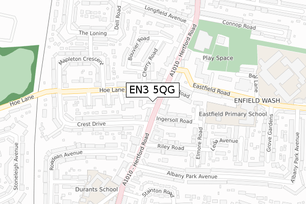
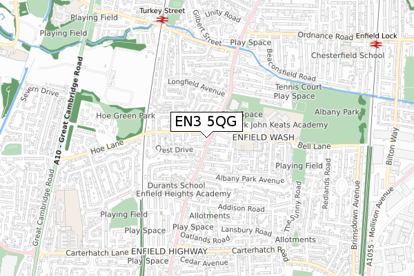
EN3 5QG is located in the Carterhatch electoral ward, within the London borough of Enfield and the English Parliamentary constituency of Enfield North. The Sub Integrated Care Board (ICB) Location is NHS North Central London ICB - 93C and the police force is Metropolitan Police. This postcode has been in use since December 2019.


GetTheData
Source: OS Open Zoomstack (Ordnance Survey)
Licence: Open Government Licence (requires attribution)
Attribution: Contains OS data © Crown copyright and database right 2024
Source: Open Postcode Geo
Licence: Open Government Licence (requires attribution)
Attribution: Contains OS data © Crown copyright and database right 2024; Contains Royal Mail data © Royal Mail copyright and database right 2024; Source: Office for National Statistics licensed under the Open Government Licence v.3.0
| Easting | 535401 |
| Northing | 198172 |
| Latitude | 51.666022 |
| Longitude | -0.043555 |
GetTheData
Source: Open Postcode Geo
Licence: Open Government Licence
| Country | England |
| Postcode District | EN3 |
| ➜ EN3 open data dashboard ➜ See where EN3 is on a map ➜ Where is London? | |
GetTheData
Source: Land Registry Price Paid Data
Licence: Open Government Licence
| Ward | Carterhatch |
| Constituency | Enfield North |
GetTheData
Source: ONS Postcode Database
Licence: Open Government Licence
| November 2023 | Criminal damage and arson | On or near Stainton Road | 362m |
| November 2023 | Criminal damage and arson | On or near Stainton Road | 362m |
| November 2023 | Violence and sexual offences | On or near Stainton Road | 362m |
| ➜ Get more crime data in our Crime section | |||
GetTheData
Source: data.police.uk
Licence: Open Government Licence
| Ingersoll Road | Enfield Wash | 34m |
| Ingersoll Road | Enfield Wash | 87m |
| Hertford Road (En3) (Eastfield Road) | Enfield Wash | 228m |
| Albany Leisure Centre (Hertford Road) | Enfield Wash | 244m |
| Hertford Road (En3) (Eastfield Road) | Enfield Wash | 264m |
| Turkey Street Station | 0.8km |
| Enfield Lock Station | 1.2km |
| Brimsdown Station | 1.5km |
GetTheData
Source: NaPTAN
Licence: Open Government Licence
GetTheData
Source: ONS Postcode Database
Licence: Open Government Licence


➜ Get more ratings from the Food Standards Agency
GetTheData
Source: Food Standards Agency
Licence: FSA terms & conditions
| Last Collection | |||
|---|---|---|---|
| Location | Mon-Fri | Sat | Distance |
| Addison Road | 17:30 | 12:00 | 502m |
| Mollison Avenue | 18:30 | 12:00 | 531m |
| Pembroke Avenue | 17:30 | 12:00 | 745m |
GetTheData
Source: Dracos
Licence: Creative Commons Attribution-ShareAlike
| Facility | Distance |
|---|---|
| Albany Leisure Centre Hertford Road, Enfield Swimming Pool, Health and Fitness Gym, Studio | 267m |
| Oasis Academy Hadley (Closed) Bell Lane, Enfield Sports Hall, Artificial Grass Pitch, Grass Pitches | 430m |
| Ark John Keats Academy Bell Lane, Enfield Artificial Grass Pitch, Health and Fitness Gym, Sports Hall, Outdoor Tennis Courts, Studio | 456m |
GetTheData
Source: Active Places
Licence: Open Government Licence
| School | Phase of Education | Distance |
|---|---|---|
| Eastfield Primary School Eastfield Road, Enfield, EN3 5UX | Primary | 311m |
| Enfield Heights Academy Pitfield Way, Enfield Highway, Enfield, EN3 5BY | Primary | 331m |
| Durants School 4 Pitfield Way, Enfield, EN3 5BY | Not applicable | 372m |
GetTheData
Source: Edubase
Licence: Open Government Licence
The below table lists the International Territorial Level (ITL) codes (formerly Nomenclature of Territorial Units for Statistics (NUTS) codes) and Local Administrative Units (LAU) codes for EN3 5QG:
| ITL 1 Code | Name |
|---|---|
| TLI | London |
| ITL 2 Code | Name |
| TLI5 | Outer London - East and North East |
| ITL 3 Code | Name |
| TLI54 | Enfield |
| LAU 1 Code | Name |
| E09000010 | Enfield |
GetTheData
Source: ONS Postcode Directory
Licence: Open Government Licence
The below table lists the Census Output Area (OA), Lower Layer Super Output Area (LSOA), and Middle Layer Super Output Area (MSOA) for EN3 5QG:
| Code | Name | |
|---|---|---|
| OA | E00007680 | |
| LSOA | E01001549 | Enfield 006D |
| MSOA | E02000282 | Enfield 006 |
GetTheData
Source: ONS Postcode Directory
Licence: Open Government Licence
| EN3 5QH | Hertford Road | 55m |
| EN3 5SJ | Hoe Lane | 61m |
| EN3 5SD | Hoe Lane | 61m |
| EN3 5UT | Hertford Road | 86m |
| EN3 5SE | Cherry Road | 95m |
| EN3 5PF | Ingersoll Road | 96m |
| EN3 5UU | East Road | 97m |
| EN3 5PU | Ingersoll Road | 102m |
| EN3 5PT | Hertford Road | 103m |
| EN3 5SP | Hoe Lane | 110m |
GetTheData
Source: Open Postcode Geo; Land Registry Price Paid Data
Licence: Open Government Licence