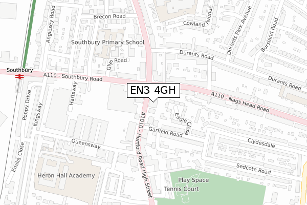
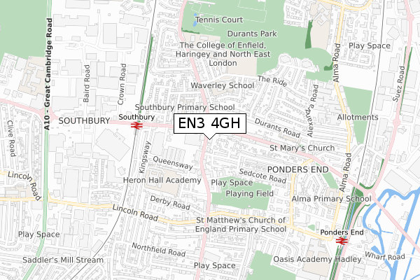
EN3 4GH is located in the Ponders End electoral ward, within the London borough of Enfield and the English Parliamentary constituency of Edmonton. The Sub Integrated Care Board (ICB) Location is NHS North Central London ICB - 93C and the police force is Metropolitan Police. This postcode has been in use since April 2020.


GetTheData
Source: OS Open Zoomstack (Ordnance Survey)
Licence: Open Government Licence (requires attribution)
Attribution: Contains OS data © Crown copyright and database right 2024
Source: Open Postcode Geo
Licence: Open Government Licence (requires attribution)
Attribution: Contains OS data © Crown copyright and database right 2024; Contains Royal Mail data © Royal Mail copyright and database right 2024; Source: Office for National Statistics licensed under the Open Government Licence v.3.0
| Easting | 535747 |
| Northing | 195391 |
| Latitude | 51.640948 |
| Longitude | -0.039634 |
GetTheData
Source: Open Postcode Geo
Licence: Open Government Licence
| Country | England |
| Postcode District | EN3 |
| ➜ EN3 open data dashboard ➜ See where EN3 is on a map ➜ Where is London? | |
GetTheData
Source: Land Registry Price Paid Data
Licence: Open Government Licence
| Ward | Ponders End |
| Constituency | Edmonton |
GetTheData
Source: ONS Postcode Database
Licence: Open Government Licence
| June 2022 | Anti-social behaviour | On or near Gardiner Close | 43m |
| June 2022 | Violence and sexual offences | On or near Gardiner Close | 43m |
| June 2022 | Anti-social behaviour | On or near Nelson Road | 122m |
| ➜ Get more crime data in our Crime section | |||
GetTheData
Source: data.police.uk
Licence: Open Government Licence
| Oasis Academy Hadley | Ponders End | 233m |
| Ponders End | Ponders End | 263m |
| Falcon Road (South Street) | Ponders End | 282m |
| Ponders End (Alma Road) | Ponders End | 325m |
| St Matthew's Church South St (South Street) | Ponders End | 391m |
| Ponders End Station | 0.3km |
| Southbury Station | 1.2km |
| Brimsdown Station | 1.7km |
GetTheData
Source: NaPTAN
Licence: Open Government Licence
GetTheData
Source: ONS Postcode Database
Licence: Open Government Licence


➜ Get more ratings from the Food Standards Agency
GetTheData
Source: Food Standards Agency
Licence: FSA terms & conditions
| Last Collection | |||
|---|---|---|---|
| Location | Mon-Fri | Sat | Distance |
| Scotland Green Road | 17:30 | 12:00 | 613m |
| Northfield Road | 17:30 | 12:00 | 814m |
| Southbury Road | 17:30 | 12:00 | 966m |
GetTheData
Source: Dracos
Licence: Creative Commons Attribution-ShareAlike
| Facility | Distance |
|---|---|
| Oasis Academy Hadley South Street, Enfield Health and Fitness Gym, Studio, Sports Hall, Artificial Grass Pitch | 171m |
| Salisbury School (Nightingale Road Campus) (Closed) Nightingale Road, Edmonton, London Sports Hall | 587m |
| Ponders End Recreation Ground High Street, Enfield Grass Pitches, Outdoor Tennis Courts | 646m |
GetTheData
Source: Active Places
Licence: Open Government Licence
| School | Phase of Education | Distance |
|---|---|---|
| Oasis Academy Hadley 143 South Street, Enfield, EN3 4PX | All-through | 218m |
| St Matthew's CofE Primary School St Matthew's C of E Primary School, South Street, Enfield, EN3 4LA | Primary | 404m |
| Alma Primary School Alma Road, Ponders End, Enfield, EN3 4UQ | Primary | 472m |
GetTheData
Source: Edubase
Licence: Open Government Licence
The below table lists the International Territorial Level (ITL) codes (formerly Nomenclature of Territorial Units for Statistics (NUTS) codes) and Local Administrative Units (LAU) codes for EN3 4GH:
| ITL 1 Code | Name |
|---|---|
| TLI | London |
| ITL 2 Code | Name |
| TLI5 | Outer London - East and North East |
| ITL 3 Code | Name |
| TLI54 | Enfield |
| LAU 1 Code | Name |
| E09000010 | Enfield |
GetTheData
Source: ONS Postcode Directory
Licence: Open Government Licence
The below table lists the Census Output Area (OA), Lower Layer Super Output Area (LSOA), and Middle Layer Super Output Area (MSOA) for EN3 4GH:
| Code | Name | |
|---|---|---|
| OA | E00171181 | |
| LSOA | E01001502 | Enfield 018D |
| MSOA | E02000294 | Enfield 018 |
GetTheData
Source: ONS Postcode Directory
Licence: Open Government Licence
| EN3 4LT | Falcon Crescent | 95m |
| EN3 4LU | Nelson Road | 118m |
| EN3 4LS | Falcon Road | 148m |
| EN3 4LE | Redburn Industrial Estate | 152m |
| EN3 4LZ | Sutherland Road | 175m |
| EN3 4LY | Falcon Road | 199m |
| EN3 4LX | Falcon Road | 200m |
| EN3 4LJ | Naylor Grove | 215m |
| EN3 4PY | South Street | 258m |
| EN3 4NU | Church Road | 262m |
GetTheData
Source: Open Postcode Geo; Land Registry Price Paid Data
Licence: Open Government Licence