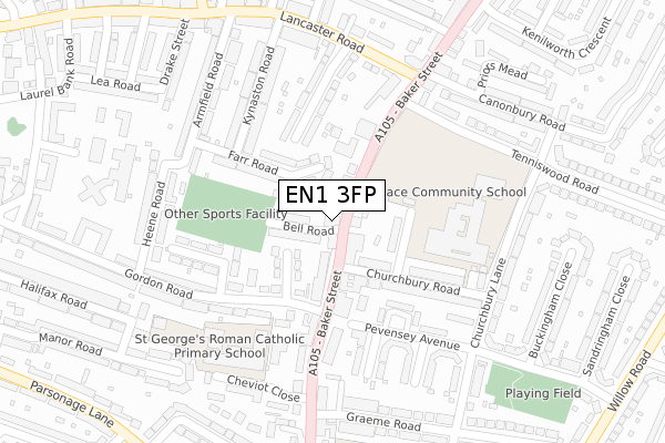
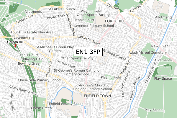
EN1 3FP is located in the Town electoral ward, within the London borough of Enfield and the English Parliamentary constituency of Enfield North. The Sub Integrated Care Board (ICB) Location is NHS North Central London ICB - 93C and the police force is Metropolitan Police. This postcode has been in use since November 2017.


GetTheData
Source: OS Open Zoomstack (Ordnance Survey)
Licence: Open Government Licence (requires attribution)
Attribution: Contains OS data © Crown copyright and database right 2024
Source: Open Postcode Geo
Licence: Open Government Licence (requires attribution)
Attribution: Contains OS data © Crown copyright and database right 2024; Contains Royal Mail data © Royal Mail copyright and database right 2024; Source: Office for National Statistics licensed under the Open Government Licence v.3.0
| Easting | 532944 |
| Northing | 197558 |
| Latitude | 51.661091 |
| Longitude | -0.079294 |
GetTheData
Source: Open Postcode Geo
Licence: Open Government Licence
| Country | England |
| Postcode District | EN1 |
| ➜ EN1 open data dashboard ➜ See where EN1 is on a map ➜ Where is London? | |
GetTheData
Source: Land Registry Price Paid Data
Licence: Open Government Licence
| Ward | Town |
| Constituency | Enfield North |
GetTheData
Source: ONS Postcode Database
Licence: Open Government Licence
| January 2024 | Anti-social behaviour | On or near Pevensey Avenue | 198m |
| November 2023 | Other crime | On or near Pevensey Avenue | 198m |
| November 2023 | Public order | On or near Gordon Road | 286m |
| ➜ Get more crime data in our Crime section | |||
GetTheData
Source: data.police.uk
Licence: Open Government Licence
| Bell Road (En1) (Baker Street) | Clay Hill | 29m |
| Bell Road (En1) (Baker Street) | Clay Hill | 61m |
| Gordon Road (En1) | Clay Hill | 181m |
| Baker Street | Forty Hill | 246m |
| Baker Street (Lancaster Road) | Forty Hill | 260m |
| Enfield Town Station | 1km |
| Gordon Hill Station | 1.1km |
| Enfield Chase Station | 1.2km |
GetTheData
Source: NaPTAN
Licence: Open Government Licence
GetTheData
Source: ONS Postcode Database
Licence: Open Government Licence


➜ Get more ratings from the Food Standards Agency
GetTheData
Source: Food Standards Agency
Licence: FSA terms & conditions
| Last Collection | |||
|---|---|---|---|
| Location | Mon-Fri | Sat | Distance |
| Baker Street P.o. | 17:30 | 12:00 | 114m |
| Gordon Hill | 17:30 | 12:00 | 128m |
| Baker Street | 17:30 | 12:00 | 228m |
GetTheData
Source: Dracos
Licence: Creative Commons Attribution-ShareAlike
| Facility | Distance |
|---|---|
| St George's Primary School (Playing Field) College Road, Enfield Grass Pitches | 162m |
| Chace Community School Churchbury Lane, Enfield Sports Hall, Health and Fitness Gym, Grass Pitches, Studio | 194m |
| St George's Catholic Primary School Gordon Road, Gordon Road, Enfield Sports Hall | 253m |
GetTheData
Source: Active Places
Licence: Open Government Licence
| School | Phase of Education | Distance |
|---|---|---|
| Chace Community School Churchbury Lane, Enfield, EN1 3HQ | Secondary | 194m |
| St George's Catholic Primary School Gordon Road, Enfield, EN2 0QA | Primary | 239m |
| St Andrew's CofE Primary School 116 Churchbury Lane, Enfield, EN1 3UL | Primary | 385m |
GetTheData
Source: Edubase
Licence: Open Government Licence
The below table lists the International Territorial Level (ITL) codes (formerly Nomenclature of Territorial Units for Statistics (NUTS) codes) and Local Administrative Units (LAU) codes for EN1 3FP:
| ITL 1 Code | Name |
|---|---|
| TLI | London |
| ITL 2 Code | Name |
| TLI5 | Outer London - East and North East |
| ITL 3 Code | Name |
| TLI54 | Enfield |
| LAU 1 Code | Name |
| E09000010 | Enfield |
GetTheData
Source: ONS Postcode Directory
Licence: Open Government Licence
The below table lists the Census Output Area (OA), Lower Layer Super Output Area (LSOA), and Middle Layer Super Output Area (MSOA) for EN1 3FP:
| Code | Name | |
|---|---|---|
| OA | E00007639 | |
| LSOA | E01001542 | Enfield 008E |
| MSOA | E02000284 | Enfield 008 |
GetTheData
Source: ONS Postcode Directory
Licence: Open Government Licence
| EN1 3LA | Baker Street | 38m |
| EN1 3JZ | Bell Road | 64m |
| EN1 3JY | Baker Street | 82m |
| EN2 0DG | The Drive | 96m |
| EN1 3HS | Ivinghoe Close | 97m |
| EN1 3JT | Baker Street | 102m |
| EN2 0QD | Weston Road | 105m |
| EN2 0DE | Farr Road | 105m |
| EN1 3HR | Churchbury Road | 115m |
| EN1 3LD | Baker Street | 121m |
GetTheData
Source: Open Postcode Geo; Land Registry Price Paid Data
Licence: Open Government Licence