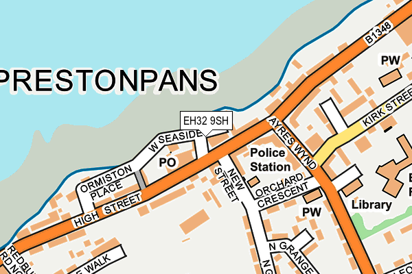
EH32 9SH is located in the Preston, Seton and Gosford electoral ward, within the council area of East Lothian and the Scottish Parliamentary constituency of East Lothian. The Community Health Partnership is East Lothian Community Health Partnership and the police force is Scotland. This postcode has been in use since May 1994.


GetTheData
Source: OS OpenMap – Local (Ordnance Survey)
Source: OS VectorMap District (Ordnance Survey)
Licence: Open Government Licence (requires attribution)
| Easting | 338551 |
| Northing | 674471 |
| Latitude | 55.959308 |
| Longitude | -2.985800 |
GetTheData
Source: Open Postcode Geo
Licence: Open Government Licence
| Country | Scotland |
| Postcode District | EH32 |
| ➜ EH32 open data dashboard ➜ See where EH32 is on a map ➜ Where is Prestonpans? | |
GetTheData
Source: Land Registry Price Paid Data
Licence: Open Government Licence
| Ward | Preston, Seton And Gosford |
| Constituency | East Lothian |
GetTheData
Source: ONS Postcode Database
Licence: Open Government Licence
| Ayres Wynd (High Street) | Prestonpans | 77m |
| Cemetery (High Street) | Prestonpans | 118m |
| Ayres Wynd (High Street) | Prestonpans | 126m |
| Post Office (Ayres Wynd) | Prestonpans | 128m |
| Cemetery (High Street) | Prestonpans | 172m |
| Prestonpans Station | 1km |
| Wallyford Station | 2.8km |
GetTheData
Source: NaPTAN
Licence: Open Government Licence
Estimated total energy consumption in EH32 9SH by fuel type, 2015.
| Consumption (kWh) | 17,104 |
|---|---|
| Meter count | 9 |
| Mean (kWh/meter) | 1,900 |
| Median (kWh/meter) | 1,455 |
GetTheData
Source: Postcode level gas estimates: 2015 (experimental)
Source: Postcode level electricity estimates: 2015 (experimental)
Licence: Open Government Licence
GetTheData
Source: ONS Postcode Database
Licence: Open Government Licence


➜ Get more ratings from the Food Standards Agency
GetTheData
Source: Food Standards Agency
Licence: FSA terms & conditions
| Last Collection | |||
|---|---|---|---|
| Location | Mon-Fri | Sat | Distance |
| 180 High Street | 17:30 | 12:15 | 74m |
| Ayers Wynd | 17:30 | 12:30 | 168m |
| North Grange | 16:00 | 10:45 | 285m |
GetTheData
Source: Dracos
Licence: Creative Commons Attribution-ShareAlike
The below table lists the International Territorial Level (ITL) codes (formerly Nomenclature of Territorial Units for Statistics (NUTS) codes) and Local Administrative Units (LAU) codes for EH32 9SH:
| ITL 1 Code | Name |
|---|---|
| TLM | Scotland |
| ITL 2 Code | Name |
| TLM7 | Eastern Scotland |
| ITL 3 Code | Name |
| TLM73 | East Lothian and Midlothian |
| LAU 1 Code | Name |
| S30000005 | East Lothian |
GetTheData
Source: ONS Postcode Directory
Licence: Open Government Licence
The below table lists the Census Output Area (OA), Lower Layer Super Output Area (LSOA), and Middle Layer Super Output Area (MSOA) for EH32 9SH:
| Code | Name | |
|---|---|---|
| OA | S00102095 | |
| LSOA | S01008203 | IZ07 - 07 |
| MSOA | S02001540 | IZ07 |
GetTheData
Source: ONS Postcode Directory
Licence: Open Government Licence