Property/Postcode Data Search:
EC3R 6AN maps, stats, and open data
EC3R 6AN is located in the Billingsgate electoral ward, within the London borough of City of London and the English Parliamentary constituency of Cities of London and Westminster. The Sub Integrated Care Board (ICB) Location is NHS North East London ICB - A3A8R and the police force is City of London. This postcode has been in use since January 2019.
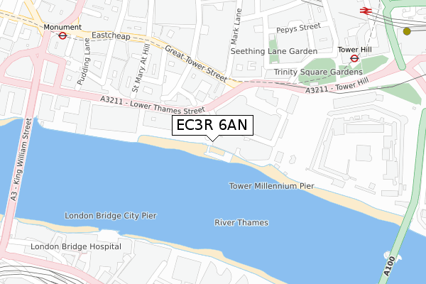
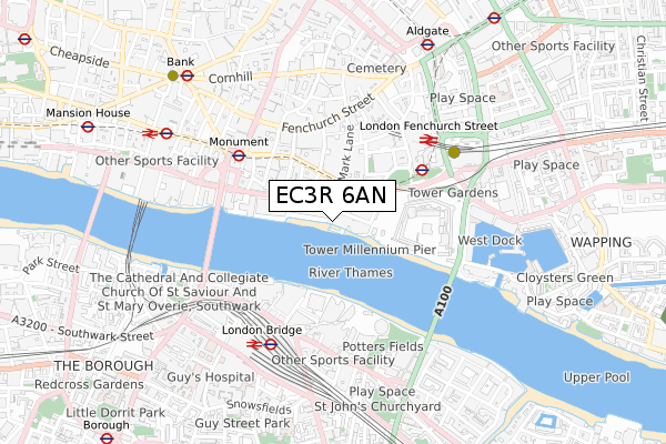
EC3R 6AN maps


Source: OS Open Zoomstack (Ordnance Survey)
Licence: Open Government Licence (requires attribution)
Attribution: Contains OS data © Crown copyright and database right 2025
Source: Open Postcode Geo
Licence: Open Government Licence (requires attribution)
Attribution: Contains OS data © Crown copyright and database right 2025; Contains Royal Mail data © Royal Mail copyright and database right 2025; Source: Office for National Statistics licensed under the Open Government Licence v.3.0
Licence: Open Government Licence (requires attribution)
Attribution: Contains OS data © Crown copyright and database right 2025
Source: Open Postcode Geo
Licence: Open Government Licence (requires attribution)
Attribution: Contains OS data © Crown copyright and database right 2025; Contains Royal Mail data © Royal Mail copyright and database right 2025; Source: Office for National Statistics licensed under the Open Government Licence v.3.0
EC3R 6AN geodata
| Easting | 533313 |
| Northing | 180555 |
| Latitude | 51.508209 |
| Longitude | -0.080413 |
Where is EC3R 6AN?
| Country | England |
| Postcode District | EC3R |
Politics
| Ward | Billingsgate |
|---|---|
| Constituency | Cities Of London And Westminster |
Transport
Nearest bus stops to EC3R 6AN
| Great Tower Street | City Of London | 197m |
| Great Tower Street | City Of London | 202m |
| The Tower Of London (Tower Hill) | Tower Hill | 326m |
| Fenchurch Street Station (Fenchurch Street) | City Of London | 366m |
| The Tower Of London (Tower Hill) | Tower Hill | 381m |
Nearest underground/metro/tram to EC3R 6AN
| Tower Hill Underground Station | Tower Hill | 334m |
| Tower Gateway Dlr Station (Minories) | Tower Gateway | 473m |
| Monument Underground Station | Monument | 473m |
| London Bridge Underground Station | London Bridge | 648m |
| Aldgate Underground Station | Aldgate | 748m |
Nearest railway stations to EC3R 6AN
| London Fenchurch Street Station | 0.4km |
| London Bridge Station | 0.5km |
| London Cannon Street Station | 0.8km |
Deprivation
36.7% of English postcodes are less deprived than EC3R 6AN:Food Standards Agency
Three nearest food hygiene ratings to EC3R 6AN (metres)
Pret A Manger

3 Three Quays Walk
45m
Coppa Club

Three Quays Apartments
50m
Cheval

Three Quays Apartments
50m
➜ Get more ratings from the Food Standards Agency
Nearest post box to EC3R 6AN
| Last Collection | |||
|---|---|---|---|
| Location | Mon-Fri | Sat | Distance |
| Tower Gate (Tower Hill) (R) | 18:30 | 12:00 | 110m |
| Tower Gate (Tower Hill) | 18:30 | 12:00 | 110m |
| Mark Lane (Gt Tower St) | 18:30 | 12:00 | 179m |
Environment
| Risk of EC3R 6AN flooding from rivers and sea | Very Low |
EC3R 6AN ITL and EC3R 6AN LAU
The below table lists the International Territorial Level (ITL) codes (formerly Nomenclature of Territorial Units for Statistics (NUTS) codes) and Local Administrative Units (LAU) codes for EC3R 6AN:
| ITL 1 Code | Name |
|---|---|
| TLI | London |
| ITL 2 Code | Name |
| TLI3 | Inner London - West |
| ITL 3 Code | Name |
| TLI31 | Camden and City of London |
| LAU 1 Code | Name |
| E09000001 | City of London |
EC3R 6AN census areas
The below table lists the Census Output Area (OA), Lower Layer Super Output Area (LSOA), and Middle Layer Super Output Area (MSOA) for EC3R 6AN:
| Code | Name | |
|---|---|---|
| OA | E00000035 | |
| LSOA | E01032739 | City of London 001F |
| MSOA | E02000001 | City of London 001 |
Nearest postcodes to EC3R 6AN
| EC3R 5AQ | Great Tower Street | 168m |
| EC3R 5AS | Byward Street | 176m |
| EC3R 7QQ | Mark Lane | 184m |
| EC3N 4AA | Trinity Square | 212m |
| EC3N 4AL | Trinity Square | 229m |
| EC3R 6DL | Lower Thames Street | 260m |
| EC3R 7BB | Minster Court | 275m |
| EC3R 8DU | St Mary At Hill | 291m |
| EC3R 8BU | Monument Street | 293m |
| EC3R 8EE | St Mary At Hill | 296m |