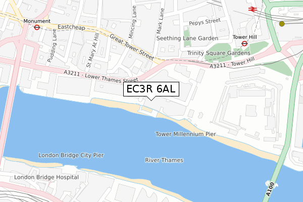
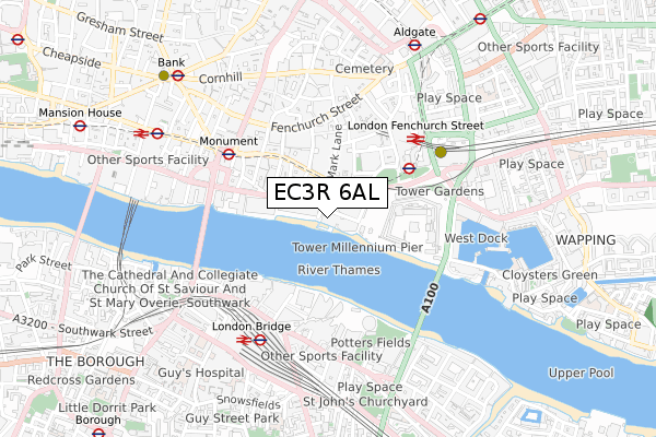
EC3R 6AL is located in the Billingsgate electoral ward, within the London borough of City of London and the English Parliamentary constituency of Cities of London and Westminster. The Sub Integrated Care Board (ICB) Location is NHS North East London ICB - A3A8R and the police force is City of London. This postcode has been in use since July 2018.


GetTheData
Source: OS Open Zoomstack (Ordnance Survey)
Licence: Open Government Licence (requires attribution)
Attribution: Contains OS data © Crown copyright and database right 2025
Source: Open Postcode Geo
Licence: Open Government Licence (requires attribution)
Attribution: Contains OS data © Crown copyright and database right 2025; Contains Royal Mail data © Royal Mail copyright and database right 2025; Source: Office for National Statistics licensed under the Open Government Licence v.3.0
| Easting | 533288 |
| Northing | 180580 |
| Latitude | 51.508439 |
| Longitude | -0.080764 |
GetTheData
Source: Open Postcode Geo
Licence: Open Government Licence
| Country | England |
| Postcode District | EC3R |
➜ See where EC3R is on a map ➜ Where is City of London? | |
GetTheData
Source: Land Registry Price Paid Data
Licence: Open Government Licence
| Ward | Billingsgate |
| Constituency | Cities Of London And Westminster |
GetTheData
Source: ONS Postcode Database
Licence: Open Government Licence
| Great Tower Street | City Of London | 167m |
| Great Tower Street | City Of London | 170m |
| The Tower Of London (Tower Hill) | Tower Hill | 336m |
| Fenchurch Street Station (Fenchurch Street) | City Of London | 337m |
| Rood Lane (Fenchurch Street) | City Of London | 362m |
| Tower Hill Underground Station | Tower Hill | 340m |
| Monument Underground Station | Monument | 439m |
| Tower Gateway Dlr Station (Minories) | Tower Gateway | 480m |
| London Bridge Underground Station | London Bridge | 637m |
| Aldgate Underground Station | Aldgate | 737m |
| London Fenchurch Street Station | 0.4km |
| London Bridge Station | 0.5km |
| London Cannon Street Station | 0.7km |
GetTheData
Source: NaPTAN
Licence: Open Government Licence
| Percentage of properties with Next Generation Access | 100.0% |
| Percentage of properties with Superfast Broadband | 100.0% |
| Percentage of properties with Ultrafast Broadband | 100.0% |
| Percentage of properties with Full Fibre Broadband | 100.0% |
Superfast Broadband is between 30Mbps and 300Mbps
Ultrafast Broadband is > 300Mbps
| Percentage of properties unable to receive 2Mbps | 0.0% |
| Percentage of properties unable to receive 5Mbps | 0.0% |
| Percentage of properties unable to receive 10Mbps | 0.0% |
| Percentage of properties unable to receive 30Mbps | 0.0% |
GetTheData
Source: Ofcom
Licence: Ofcom Terms of Use (requires attribution)
GetTheData
Source: ONS Postcode Database
Licence: Open Government Licence


➜ Get more ratings from the Food Standards Agency
GetTheData
Source: Food Standards Agency
Licence: FSA terms & conditions
| Last Collection | |||
|---|---|---|---|
| Location | Mon-Fri | Sat | Distance |
| Tower Gate (Tower Hill) (R) | 18:30 | 12:00 | 135m |
| Tower Gate (Tower Hill) | 18:30 | 12:00 | 135m |
| Mark Lane (Gt Tower St) | 18:30 | 12:00 | 153m |
GetTheData
Source: Dracos
Licence: Creative Commons Attribution-ShareAlike
| Risk of EC3R 6AL flooding from rivers and sea | Very Low |
| ➜ EC3R 6AL flood map | |
GetTheData
Source: Open Flood Risk by Postcode
Licence: Open Government Licence
The below table lists the International Territorial Level (ITL) codes (formerly Nomenclature of Territorial Units for Statistics (NUTS) codes) and Local Administrative Units (LAU) codes for EC3R 6AL:
| ITL 1 Code | Name |
|---|---|
| TLI | London |
| ITL 2 Code | Name |
| TLI3 | Inner London - West |
| ITL 3 Code | Name |
| TLI31 | Camden and City of London |
| LAU 1 Code | Name |
| E09000001 | City of London |
GetTheData
Source: ONS Postcode Directory
Licence: Open Government Licence
The below table lists the Census Output Area (OA), Lower Layer Super Output Area (LSOA), and Middle Layer Super Output Area (MSOA) for EC3R 6AL:
| Code | Name | |
|---|---|---|
| OA | E00000035 | |
| LSOA | E01032739 | City of London 001F |
| MSOA | E02000001 | City of London 001 |
GetTheData
Source: ONS Postcode Directory
Licence: Open Government Licence
| EC3R 5AQ | Great Tower Street | 138m |
| EC3R 5AS | Byward Street | 158m |
| EC3R 7QQ | Mark Lane | 161m |
| EC3N 4AA | Trinity Square | 209m |
| EC3R 6DL | Lower Thames Street | 226m |
| EC3N 4AL | Trinity Square | 226m |
| EC3R 7BB | Minster Court | 248m |
| EC3R 8DU | St Mary At Hill | 256m |
| EC3R 8BU | Monument Street | 260m |
| EC3R 8EE | St Mary At Hill | 261m |
GetTheData
Source: Open Postcode Geo; Land Registry Price Paid Data
Licence: Open Government Licence