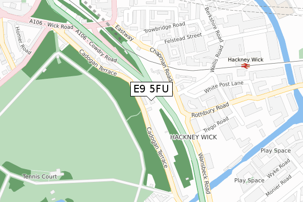
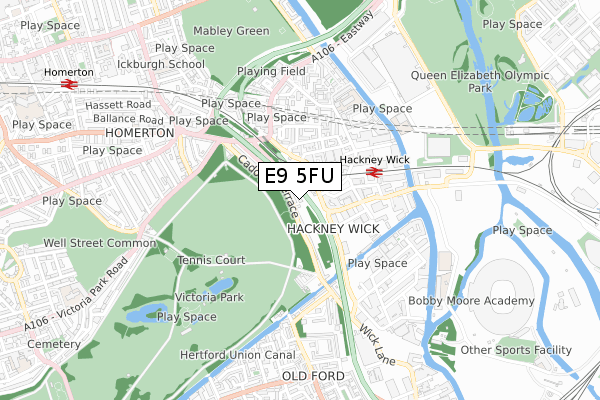
E9 5FU is located in the Hackney Wick electoral ward, within the London borough of Hackney and the English Parliamentary constituency of Hackney South and Shoreditch. The Sub Integrated Care Board (ICB) Location is NHS North East London ICB - A3A8R and the police force is Metropolitan Police. This postcode has been in use since August 2018.


GetTheData
Source: OS Open Zoomstack (Ordnance Survey)
Licence: Open Government Licence (requires attribution)
Attribution: Contains OS data © Crown copyright and database right 2024
Source: Open Postcode Geo
Licence: Open Government Licence (requires attribution)
Attribution: Contains OS data © Crown copyright and database right 2024; Contains Royal Mail data © Royal Mail copyright and database right 2024; Source: Office for National Statistics licensed under the Open Government Licence v.3.0
| Easting | 536812 |
| Northing | 184465 |
| Latitude | 51.542509 |
| Longitude | -0.028508 |
GetTheData
Source: Open Postcode Geo
Licence: Open Government Licence
| Country | England |
| Postcode District | E9 |
| ➜ E9 open data dashboard ➜ See where E9 is on a map ➜ Where is Hackney? | |
GetTheData
Source: Land Registry Price Paid Data
Licence: Open Government Licence
| Ward | Hackney Wick |
| Constituency | Hackney South And Shoreditch |
GetTheData
Source: ONS Postcode Database
Licence: Open Government Licence
| December 2023 | Violence and sexual offences | On or near Trowbridge Road | 249m |
| December 2023 | Violence and sexual offences | On or near Trowbridge Road | 249m |
| September 2023 | Anti-social behaviour | On or near Trowbridge Road | 249m |
| ➜ Get more crime data in our Crime section | |||
GetTheData
Source: data.police.uk
Licence: Open Government Licence
| Hackney Wick Station | Hackney Wick | 94m |
| Hackney Wick Station | Hackney Wick | 97m |
| Rothbury Road | Old Ford | 157m |
| Rothbury Road | Old Ford | 179m |
| Hackney Wick Station (Hepscott Road) | Hackney Wick | 213m |
| Stratford International Dlr Station | Stratford | 1,346m |
| Pudding Mill Lane Dlr Station (Pudding Mill Lane) | Pudding Mill Lane | 1,425m |
| Hackney Wick Station | 0.3km |
| Homerton Station | 1.1km |
| Stratford International Station | 1.4km |
GetTheData
Source: NaPTAN
Licence: Open Government Licence
| Percentage of properties with Next Generation Access | 100.0% |
| Percentage of properties with Superfast Broadband | 100.0% |
| Percentage of properties with Ultrafast Broadband | 0.0% |
| Percentage of properties with Full Fibre Broadband | 0.0% |
Superfast Broadband is between 30Mbps and 300Mbps
Ultrafast Broadband is > 300Mbps
| Percentage of properties unable to receive 2Mbps | 0.0% |
| Percentage of properties unable to receive 5Mbps | 0.0% |
| Percentage of properties unable to receive 10Mbps | 0.0% |
| Percentage of properties unable to receive 30Mbps | 0.0% |
GetTheData
Source: Ofcom
Licence: Ofcom Terms of Use (requires attribution)
GetTheData
Source: ONS Postcode Database
Licence: Open Government Licence


➜ Get more ratings from the Food Standards Agency
GetTheData
Source: Food Standards Agency
Licence: FSA terms & conditions
| Last Collection | |||
|---|---|---|---|
| Location | Mon-Fri | Sat | Distance |
| Cadogan Terrace | 17:00 | 11:30 | 48m |
| Eastway | 17:00 | 11:30 | 317m |
| Jodrell Road | 17:30 | 11:30 | 467m |
GetTheData
Source: Dracos
Licence: Creative Commons Attribution-ShareAlike
| Facility | Distance |
|---|---|
| Victoria Park (Hackney) St Marks Gate, London Grass Pitches, Athletics | 392m |
| Victoria Park Tennis Courts (Hackney) St Marks Gate, Victoria Park, London Outdoor Tennis Courts | 445m |
| Young Hackney Eastway Eastway, London Outdoor Tennis Courts | 532m |
GetTheData
Source: Active Places
Licence: Open Government Licence
| School | Phase of Education | Distance |
|---|---|---|
| Gainsborough Primary School Berkshire Road, London, E9 5ND | Primary | 405m |
| Mossbourne Riverside Academy East Bay Lane, London, E15 2GW | Primary | 527m |
| St. Dominic's Catholic Primary School Ballance Road, London, E9 5SR | Primary | 735m |
GetTheData
Source: Edubase
Licence: Open Government Licence
The below table lists the International Territorial Level (ITL) codes (formerly Nomenclature of Territorial Units for Statistics (NUTS) codes) and Local Administrative Units (LAU) codes for E9 5FU:
| ITL 1 Code | Name |
|---|---|
| TLI | London |
| ITL 2 Code | Name |
| TLI4 | Inner London - East |
| ITL 3 Code | Name |
| TLI41 | Hackney and Newham |
| LAU 1 Code | Name |
| E09000012 | Hackney |
GetTheData
Source: ONS Postcode Directory
Licence: Open Government Licence
The below table lists the Census Output Area (OA), Lower Layer Super Output Area (LSOA), and Middle Layer Super Output Area (MSOA) for E9 5FU:
| Code | Name | |
|---|---|---|
| OA | E00176314 | |
| LSOA | E01001849 | Hackney 018D |
| MSOA | E02000362 | Hackney 018 |
GetTheData
Source: ONS Postcode Directory
Licence: Open Government Licence
| E9 5EQ | Cadogan Terrace | 35m |
| E9 5DW | Chapman Road | 119m |
| E9 5EJ | Cadogan Terrace | 140m |
| E9 5DS | Felstead Street | 175m |
| E9 5DT | Felstead Street | 175m |
| E9 5HP | Cadogan Terrace | 191m |
| E9 5HR | Cadogan Terrace | 205m |
| E9 5EL | Cadogan Terrace | 238m |
| E9 5GY | Gainsborough Street | 246m |
| E9 5LJ | Trowbridge Road | 250m |
GetTheData
Source: Open Postcode Geo; Land Registry Price Paid Data
Licence: Open Government Licence