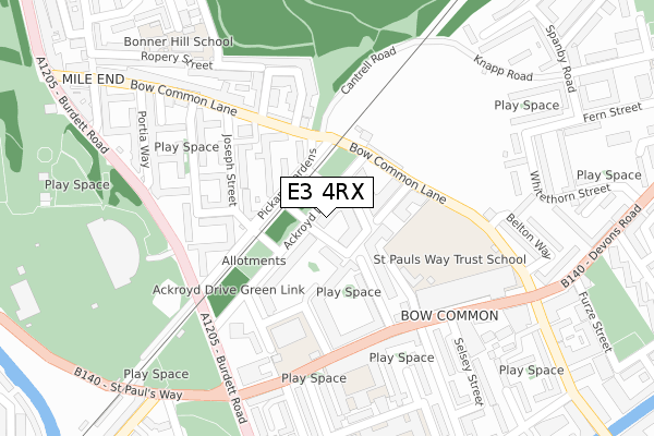
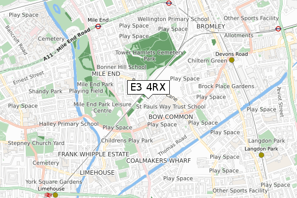
E3 4RX is located in the Mile End electoral ward, within the London borough of Tower Hamlets and the English Parliamentary constituency of Poplar and Limehouse. The Sub Integrated Care Board (ICB) Location is NHS North East London ICB - A3A8R and the police force is Metropolitan Police. This postcode has been in use since December 2017.


GetTheData
Source: OS Open Zoomstack (Ordnance Survey)
Licence: Open Government Licence (requires attribution)
Attribution: Contains OS data © Crown copyright and database right 2024
Source: Open Postcode Geo
Licence: Open Government Licence (requires attribution)
Attribution: Contains OS data © Crown copyright and database right 2024; Contains Royal Mail data © Royal Mail copyright and database right 2024; Source: Office for National Statistics licensed under the Open Government Licence v.3.0
| Easting | 536942 |
| Northing | 181928 |
| Latitude | 51.519680 |
| Longitude | -0.027620 |
GetTheData
Source: Open Postcode Geo
Licence: Open Government Licence
| Country | England |
| Postcode District | E3 |
| ➜ E3 open data dashboard ➜ See where E3 is on a map ➜ Where is London? | |
GetTheData
Source: Land Registry Price Paid Data
Licence: Open Government Licence
| Ward | Mile End |
| Constituency | Poplar And Limehouse |
GetTheData
Source: ONS Postcode Database
Licence: Open Government Licence
| January 2024 | Anti-social behaviour | On or near Ropery Street | 313m |
| December 2023 | Anti-social behaviour | On or near Ropery Street | 313m |
| December 2023 | Theft from the person | On or near Ropery Street | 313m |
| ➜ Get more crime data in our Crime section | |||
GetTheData
Source: data.police.uk
Licence: Open Government Licence
| Ackroyd Drive (Bow Common Lane) | Bow Common | 121m |
| Ackroyd Drive (Bow Common Lane) | Bow Common | 130m |
| Mile End Park Leisure Centre (Burdett Road) | Bow Common | 216m |
| Burdett Road St Pauls Church (St Paul's Way) | Bow Common | 236m |
| Burgess Street (St Paul's Way) | Bow Common | 239m |
| Mile End Underground Station | Mile End | 734m |
| Devons Road Dlr Station (Devons Road) | Devons Road | 771m |
| Bow Road Underground Station | Bow | 826m |
| Bow Church Dlr Station (Bow Road) | Bow | 1,022m |
| Langdon Park Dlr Station (Hay Currie Street) | Poplar | 1,063m |
| Limehouse Station | 1.2km |
| Whitechapel Station | 2.2km |
| Shadwell Station | 2.2km |
GetTheData
Source: NaPTAN
Licence: Open Government Licence
➜ Broadband speed and availability dashboard for E3 4RX
| Percentage of properties with Next Generation Access | 100.0% |
| Percentage of properties with Superfast Broadband | 100.0% |
| Percentage of properties with Ultrafast Broadband | 100.0% |
| Percentage of properties with Full Fibre Broadband | 100.0% |
Superfast Broadband is between 30Mbps and 300Mbps
Ultrafast Broadband is > 300Mbps
Ofcom does not currently provide download speed data for E3 4RX. This is because there are less than four broadband connections in this postcode.
Ofcom does not currently provide upload speed data for E3 4RX. This is because there are less than four broadband connections in this postcode.
| Percentage of properties unable to receive 2Mbps | 0.0% |
| Percentage of properties unable to receive 5Mbps | 0.0% |
| Percentage of properties unable to receive 10Mbps | 0.0% |
| Percentage of properties unable to receive 30Mbps | 0.0% |
➜ Broadband speed and availability dashboard for E3 4RX
GetTheData
Source: Ofcom
Licence: Ofcom Terms of Use (requires attribution)
GetTheData
Source: ONS Postcode Database
Licence: Open Government Licence


➜ Get more ratings from the Food Standards Agency
GetTheData
Source: Food Standards Agency
Licence: FSA terms & conditions
| Last Collection | |||
|---|---|---|---|
| Location | Mon-Fri | Sat | Distance |
| Burdett Road | 17:30 | 11:30 | 261m |
| Belton Way | 17:30 | 11:30 | 321m |
| Thomas Road | 17:30 | 11:30 | 459m |
GetTheData
Source: Dracos
Licence: Creative Commons Attribution-ShareAlike
| Facility | Distance |
|---|---|
| St Pauls Way Community School (Closed) Shelmerdine Close, London Health and Fitness Gym, Sports Hall, Artificial Grass Pitch, Swimming Pool, Studio | 187m |
| St Pauls Way Trust School St Pauls Way, London Health and Fitness Gym, Artificial Grass Pitch, Sports Hall, Studio, Outdoor Tennis Courts | 242m |
| Mile End Park Leisure Centre And Stadium Burdett Road, London Athletics, Artificial Grass Pitch, Grass Pitches, Health and Fitness Gym, Sports Hall, Swimming Pool, Studio, Outdoor Tennis Courts | 303m |
GetTheData
Source: Active Places
Licence: Open Government Licence
| School | Phase of Education | Distance |
|---|---|---|
| St Paul with St Luke CofE Primary School Leopold Street, Bow, London, E3 4LA | Primary | 194m |
| St Paul's Way Trust School 125 St Paul's Way, London, E3 4FT | All-through | 236m |
| Stebon Primary School Burdett Estate, Wallwood Street, Poplar, London, E14 7AD | Primary | 343m |
GetTheData
Source: Edubase
Licence: Open Government Licence
The below table lists the International Territorial Level (ITL) codes (formerly Nomenclature of Territorial Units for Statistics (NUTS) codes) and Local Administrative Units (LAU) codes for E3 4RX:
| ITL 1 Code | Name |
|---|---|
| TLI | London |
| ITL 2 Code | Name |
| TLI4 | Inner London - East |
| ITL 3 Code | Name |
| TLI42 | Tower Hamlets |
| LAU 1 Code | Name |
| E09000030 | Tower Hamlets |
GetTheData
Source: ONS Postcode Directory
Licence: Open Government Licence
The below table lists the Census Output Area (OA), Lower Layer Super Output Area (LSOA), and Middle Layer Super Output Area (MSOA) for E3 4RX:
| Code | Name | |
|---|---|---|
| OA | E00021487 | |
| LSOA | E01004271 | Tower Hamlets 014C |
| MSOA | E02000877 | Tower Hamlets 014 |
GetTheData
Source: ONS Postcode Directory
Licence: Open Government Licence
| E3 4AW | Ackroyd Drive | 55m |
| E3 4BG | Weatherley Close | 62m |
| E3 4BQ | Weatherley Close | 87m |
| E3 4AS | Ackroyd Drive | 100m |
| E3 4HS | Bow Common Lane | 102m |
| E3 4HR | Bow Common Lane | 103m |
| E3 4HT | Bow Common Lane | 113m |
| E3 4QZ | William Whiffin Square | 114m |
| E3 4RD | William Whiffin Square | 134m |
| E3 4HY | Joseph Street | 139m |
GetTheData
Source: Open Postcode Geo; Land Registry Price Paid Data
Licence: Open Government Licence