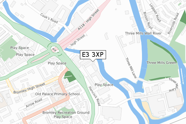
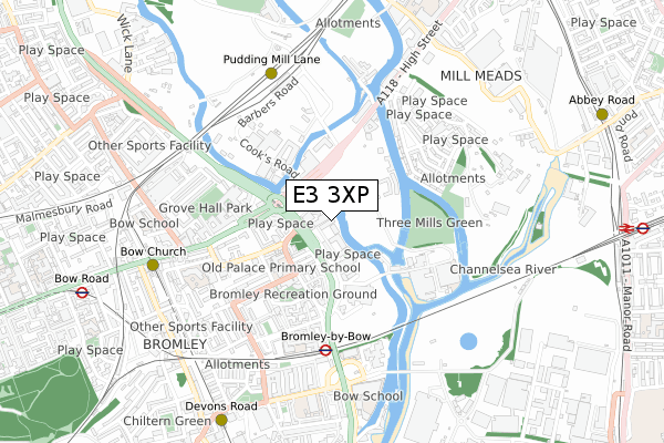
E3 3XP is located in the Bromley North electoral ward, within the London borough of Tower Hamlets and the English Parliamentary constituency of Poplar and Limehouse. The Sub Integrated Care Board (ICB) Location is NHS North East London ICB - A3A8R and the police force is Metropolitan Police. This postcode has been in use since October 2019.


GetTheData
Source: OS Open Zoomstack (Ordnance Survey)
Licence: Open Government Licence (requires attribution)
Attribution: Contains OS data © Crown copyright and database right 2024
Source: Open Postcode Geo
Licence: Open Government Licence (requires attribution)
Attribution: Contains OS data © Crown copyright and database right 2024; Contains Royal Mail data © Royal Mail copyright and database right 2024; Source: Office for National Statistics licensed under the Open Government Licence v.3.0
| Easting | 538059 |
| Northing | 183002 |
| Latitude | 51.529059 |
| Longitude | -0.011110 |
GetTheData
Source: Open Postcode Geo
Licence: Open Government Licence
| Country | England |
| Postcode District | E3 |
| ➜ E3 open data dashboard ➜ See where E3 is on a map ➜ Where is London? | |
GetTheData
Source: Land Registry Price Paid Data
Licence: Open Government Licence
| Ward | Bromley North |
| Constituency | Poplar And Limehouse |
GetTheData
Source: ONS Postcode Database
Licence: Open Government Licence
| December 2023 | Criminal damage and arson | On or near Powis Road | 370m |
| November 2023 | Criminal damage and arson | On or near Powis Road | 370m |
| October 2023 | Burglary | On or near Powis Road | 370m |
| ➜ Get more crime data in our Crime section | |||
GetTheData
Source: data.police.uk
Licence: Open Government Licence
| Hancock Road | Bromley | 120m |
| Bow Interchange (Bromley High Street) | Bromley | 150m |
| Bow Flyover (Stratford High Street) | Bow | 154m |
| Hancock Road | Bromley | 183m |
| St Leonards Street (Bromley High Street) | Bromley | 237m |
| Bromley-by-bow Underground Station | Bromley | 470m |
| Pudding Mill Lane Dlr Station (Pudding Mill Lane) | Pudding Mill Lane | 594m |
| Bow Church Dlr Station (Bow Road) | Bow | 693m |
| Devons Road Dlr Station (Devons Road) | Devons Road | 841m |
| Bow Road Underground Station | Bow | 999m |
| West Ham Station | 1.2km |
| Stratford (London) Station | 1.5km |
| Stratford International Station | 1.8km |
GetTheData
Source: NaPTAN
Licence: Open Government Licence
GetTheData
Source: ONS Postcode Database
Licence: Open Government Licence


➜ Get more ratings from the Food Standards Agency
GetTheData
Source: Food Standards Agency
Licence: FSA terms & conditions
| Last Collection | |||
|---|---|---|---|
| Location | Mon-Fri | Sat | Distance |
| Franklin Street | 17:30 | 11:30 | 231m |
| 2/4 Stroudley Walk E3 | 18:30 | 12:00 | 472m |
| O/S Bow Mspo | 18:30 | 12:00 | 472m |
GetTheData
Source: Dracos
Licence: Creative Commons Attribution-ShareAlike
| Facility | Distance |
|---|---|
| Ian Mikardo High School William Guy Gardens, London Sports Hall, Outdoor Tennis Courts | 504m |
| Bow School Twelvetrees Crescent, London Sports Hall, Studio, Outdoor Tennis Courts | 641m |
| Bow School Of Maths And Computing (Closed) Paton Close, Fairfield Road, London Health and Fitness Gym, Sports Hall | 692m |
GetTheData
Source: Active Places
Licence: Open Government Licence
| School | Phase of Education | Distance |
|---|---|---|
| Old Palace Primary School St Leonard's Street, Bow, London, E3 3BT | Primary | 263m |
| School 360 5 Sugar House Lane, London, E15 2QS | Primary | 339m |
| Harris Science Academy East London Three Mill Lane, London, E3 3DU | Secondary | 344m |
GetTheData
Source: Edubase
Licence: Open Government Licence
The below table lists the International Territorial Level (ITL) codes (formerly Nomenclature of Territorial Units for Statistics (NUTS) codes) and Local Administrative Units (LAU) codes for E3 3XP:
| ITL 1 Code | Name |
|---|---|
| TLI | London |
| ITL 2 Code | Name |
| TLI4 | Inner London - East |
| ITL 3 Code | Name |
| TLI42 | Tower Hamlets |
| LAU 1 Code | Name |
| E09000030 | Tower Hamlets |
GetTheData
Source: ONS Postcode Directory
Licence: Open Government Licence
The below table lists the Census Output Area (OA), Lower Layer Super Output Area (LSOA), and Middle Layer Super Output Area (MSOA) for E3 3XP:
| Code | Name | |
|---|---|---|
| OA | E00167084 | |
| LSOA | E01004238 | Tower Hamlets 008D |
| MSOA | E02000871 | Tower Hamlets 008 |
GetTheData
Source: ONS Postcode Directory
Licence: Open Government Licence
| E15 2QQ | High Street | 146m |
| E3 3BB | Bromley High Street | 168m |
| E3 3BU | Priory Street | 171m |
| E3 3DG | Franklin Street | 185m |
| E3 3BA | Bromley High Street | 198m |
| E3 3DA | Hancock Road | 205m |
| E3 3BD | Bromley High Street | 207m |
| E15 2PP | High Street | 209m |
| E3 3AF | Three Mill Lane | 216m |
| E3 3DH | Taft Way | 217m |
GetTheData
Source: Open Postcode Geo; Land Registry Price Paid Data
Licence: Open Government Licence