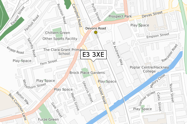
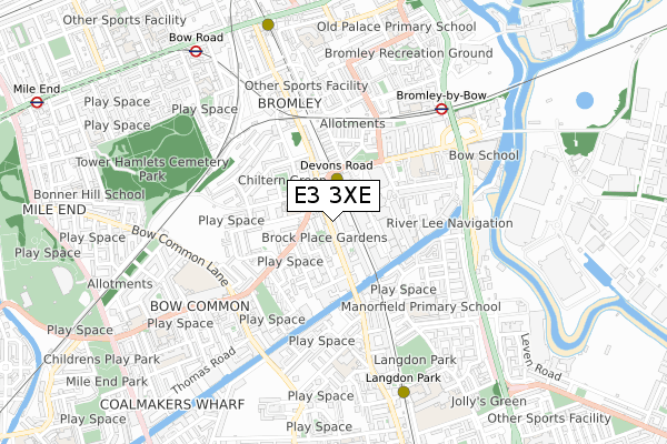
E3 3XE is located in the Bromley South electoral ward, within the London borough of Tower Hamlets and the English Parliamentary constituency of Poplar and Limehouse. The Sub Integrated Care Board (ICB) Location is NHS North East London ICB - A3A8R and the police force is Metropolitan Police. This postcode has been in use since November 2017.


GetTheData
Source: OS Open Zoomstack (Ordnance Survey)
Licence: Open Government Licence (requires attribution)
Attribution: Contains OS data © Crown copyright and database right 2024
Source: Open Postcode Geo
Licence: Open Government Licence (requires attribution)
Attribution: Contains OS data © Crown copyright and database right 2024; Contains Royal Mail data © Royal Mail copyright and database right 2024; Source: Office for National Statistics licensed under the Open Government Licence v.3.0
| Easting | 537631 |
| Northing | 182094 |
| Latitude | 51.521004 |
| Longitude | -0.017631 |
GetTheData
Source: Open Postcode Geo
Licence: Open Government Licence
| Country | England |
| Postcode District | E3 |
| ➜ E3 open data dashboard ➜ See where E3 is on a map ➜ Where is London? | |
GetTheData
Source: Land Registry Price Paid Data
Licence: Open Government Licence
| Ward | Bromley South |
| Constituency | Poplar And Limehouse |
GetTheData
Source: ONS Postcode Database
Licence: Open Government Licence
| January 2024 | Anti-social behaviour | On or near Hawgood Street | 414m |
| January 2024 | Anti-social behaviour | On or near Hawgood Street | 414m |
| January 2024 | Anti-social behaviour | On or near Hawgood Street | 414m |
| ➜ Get more crime data in our Crime section | |||
GetTheData
Source: data.police.uk
Licence: Open Government Licence
| Cranwell Close (Violet Road) | Bromley | 26m |
| Cranwell Close (Violet Road) | Bromley | 46m |
| Devons Road Station (Campbell Road) | Devons Road | 209m |
| Watts Grove (Devons Road) | Bow Common | 221m |
| Watts Grove (Devons Road) | Bow Common | 233m |
| Devons Road Dlr Station (Devons Road) | Devons Road | 185m |
| Bromley-by-bow Underground Station | Bromley | 602m |
| Langdon Park Dlr Station (Hay Currie Street) | Poplar | 693m |
| Bow Church Dlr Station (Bow Road) | Bow | 796m |
| Bow Road Underground Station | Bow | 839m |
| Limehouse Station | 1.8km |
| West Ham Station | 1.8km |
| Stratford (London) Station | 2.5km |
GetTheData
Source: NaPTAN
Licence: Open Government Licence
| Percentage of properties with Next Generation Access | 100.0% |
| Percentage of properties with Superfast Broadband | 100.0% |
| Percentage of properties with Ultrafast Broadband | 96.4% |
| Percentage of properties with Full Fibre Broadband | 96.4% |
Superfast Broadband is between 30Mbps and 300Mbps
Ultrafast Broadband is > 300Mbps
| Percentage of properties unable to receive 2Mbps | 0.0% |
| Percentage of properties unable to receive 5Mbps | 0.0% |
| Percentage of properties unable to receive 10Mbps | 0.0% |
| Percentage of properties unable to receive 30Mbps | 0.0% |
GetTheData
Source: Ofcom
Licence: Ofcom Terms of Use (requires attribution)
GetTheData
Source: ONS Postcode Database
Licence: Open Government Licence


➜ Get more ratings from the Food Standards Agency
GetTheData
Source: Food Standards Agency
Licence: FSA terms & conditions
| Last Collection | |||
|---|---|---|---|
| Location | Mon-Fri | Sat | Distance |
| Violet Road | 17:30 | 11:30 | 23m |
| 159 Devons Road E3 | 18:30 | 12:00 | 197m |
| St Andrews Hospital | 17:30 | 11:30 | 364m |
GetTheData
Source: Dracos
Licence: Creative Commons Attribution-ShareAlike
| Facility | Distance |
|---|---|
| Linc Centre Fern Street, London Sports Hall | 206m |
| Energie Fitness (Bow) Violet Road, London Health and Fitness Gym | 231m |
| Marner Primary School Devas Street, London Sports Hall, Artificial Grass Pitch | 401m |
GetTheData
Source: Active Places
Licence: Open Government Licence
| School | Phase of Education | Distance |
|---|---|---|
| The Clara Grant Primary School Knapp Road, Bow, London, E3 4BU | Primary | 167m |
| Marner Primary School Devas Street, Bow, London, E3 3LL | Primary | 425m |
| Manorfield Primary School Wyvis Street, Poplar, London, E14 6QD | Primary | 431m |
GetTheData
Source: Edubase
Licence: Open Government Licence
The below table lists the International Territorial Level (ITL) codes (formerly Nomenclature of Territorial Units for Statistics (NUTS) codes) and Local Administrative Units (LAU) codes for E3 3XE:
| ITL 1 Code | Name |
|---|---|
| TLI | London |
| ITL 2 Code | Name |
| TLI4 | Inner London - East |
| ITL 3 Code | Name |
| TLI42 | Tower Hamlets |
| LAU 1 Code | Name |
| E09000030 | Tower Hamlets |
GetTheData
Source: ONS Postcode Directory
Licence: Open Government Licence
The below table lists the Census Output Area (OA), Lower Layer Super Output Area (LSOA), and Middle Layer Super Output Area (MSOA) for E3 3XE:
| Code | Name | |
|---|---|---|
| OA | E00167211 | |
| LSOA | E01004242 | Tower Hamlets 012C |
| MSOA | E02000875 | Tower Hamlets 012 |
GetTheData
Source: ONS Postcode Directory
Licence: Open Government Licence
| E3 3TQ | Barry Blandford Way | 31m |
| E3 3TU | Barry Blandford Way | 34m |
| E3 3TW | Barry Blandford Way | 34m |
| E3 3QH | Violet Road | 39m |
| E3 3TS | Barry Blandford Way | 42m |
| E3 3QG | Violet Road | 48m |
| E3 3TR | Barry Blandford Way | 57m |
| E3 3QU | Brock Place | 65m |
| E3 3QQ | Violet Road | 81m |
| E3 3RA | Maddams Street | 124m |
GetTheData
Source: Open Postcode Geo; Land Registry Price Paid Data
Licence: Open Government Licence