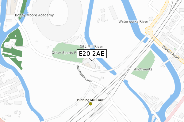
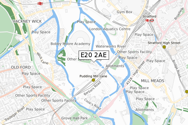
E20 2AE is located in the Stratford Olympic Park electoral ward, within the London borough of Newham and the English Parliamentary constituency of West Ham. The Sub Integrated Care Board (ICB) Location is NHS North East London ICB - A3A8R and the police force is Metropolitan Police. This postcode has been in use since January 2019.


GetTheData
Source: OS Open Zoomstack (Ordnance Survey)
Licence: Open Government Licence (requires attribution)
Attribution: Contains OS data © Crown copyright and database right 2025
Source: Open Postcode Geo
Licence: Open Government Licence (requires attribution)
Attribution: Contains OS data © Crown copyright and database right 2025; Contains Royal Mail data © Royal Mail copyright and database right 2025; Source: Office for National Statistics licensed under the Open Government Licence v.3.0
| Easting | 537841 |
| Northing | 183795 |
| Latitude | 51.536238 |
| Longitude | -0.013941 |
GetTheData
Source: Open Postcode Geo
Licence: Open Government Licence
| Country | England |
| Postcode District | E20 |
➜ Where is London? | |
GetTheData
Source: Land Registry Price Paid Data
Licence: Open Government Licence
| Ward | Stratford Olympic Park |
| Constituency | West Ham |
GetTheData
Source: ONS Postcode Database
Licence: Open Government Licence
| Warton Road | Stratford | 417m |
| Warton Road | Stratford | 485m |
| London Aquatics Centre | Stratford | 505m |
| London Aquatics Centre | Stratford | 518m |
| Abbey Lane (Stratford High Street) | Stratford | 539m |
| Pudding Mill Lane Dlr Station (Pudding Mill Lane) | Pudding Mill Lane | 231m |
| Stratford High Street Dlr Station | Stratford | 920m |
| Stratford Underground Station | Stratford | 957m |
| Stratford Dlr Station (Station Street) | Stratford | 962m |
| Stratford International Dlr Station | Stratford | 1,048m |
| Stratford (London) Station | 1km |
| Stratford International Station | 1km |
| Hackney Wick Station | 1.1km |
GetTheData
Source: NaPTAN
Licence: Open Government Licence
GetTheData
Source: ONS Postcode Database
Licence: Open Government Licence


➜ Get more ratings from the Food Standards Agency
GetTheData
Source: Food Standards Agency
Licence: FSA terms & conditions
| Last Collection | |||
|---|---|---|---|
| Location | Mon-Fri | Sat | Distance |
| Abbey Lane | 18:30 | 11:30 | 548m |
| Wick Lane | 17:30 | 11:30 | 566m |
| James Riley Point | 18:30 | 11:30 | 575m |
GetTheData
Source: Dracos
Licence: Creative Commons Attribution-ShareAlike
| Risk of E20 2AE flooding from rivers and sea | Low |
| ➜ E20 2AE flood map | |
GetTheData
Source: Open Flood Risk by Postcode
Licence: Open Government Licence
The below table lists the International Territorial Level (ITL) codes (formerly Nomenclature of Territorial Units for Statistics (NUTS) codes) and Local Administrative Units (LAU) codes for E20 2AE:
| ITL 1 Code | Name |
|---|---|
| TLI | London |
| ITL 2 Code | Name |
| TLI4 | Inner London - East |
| ITL 3 Code | Name |
| TLI41 | Hackney and Newham |
| LAU 1 Code | Name |
| E09000025 | Newham |
GetTheData
Source: ONS Postcode Directory
Licence: Open Government Licence
The below table lists the Census Output Area (OA), Lower Layer Super Output Area (LSOA), and Middle Layer Super Output Area (MSOA) for E20 2AE:
| Code | Name | |
|---|---|---|
| OA | E00175067 | |
| LSOA | E01033578 | Newham 013E |
| MSOA | E02000726 | Newham 013 |
GetTheData
Source: ONS Postcode Directory
Licence: Open Government Licence
| E15 2PZ | Otter Close | 378m |
| E15 2PT | Otter Close | 397m |
| E15 2JD | Warton Road | 400m |
| E15 2LE | Warton Road | 400m |
| E15 2JS | Warton Road | 425m |
| E3 2TT | Autumn Street | 428m |
| E15 2PX | Otter Close | 433m |
| E15 2LG | Biggerstaff Road | 442m |
| E15 2PY | Blaker Road | 457m |
| E3 2NW | Dace Road | 469m |
GetTheData
Source: Open Postcode Geo; Land Registry Price Paid Data
Licence: Open Government Licence