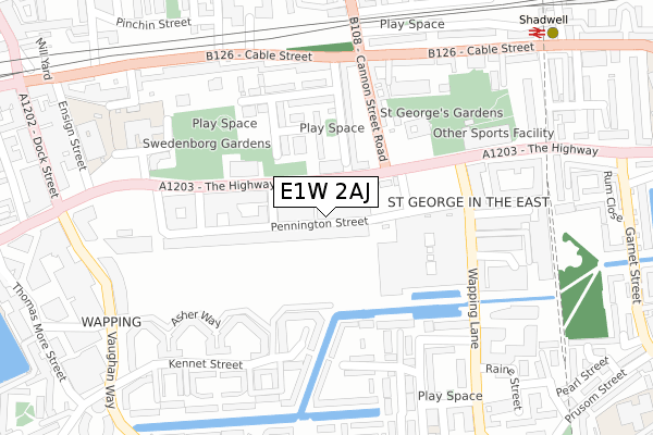
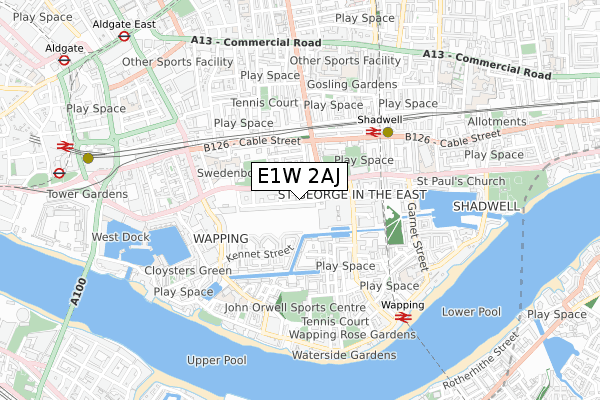
E1W 2AJ is located in the St Katharine's & Wapping electoral ward, within the London borough of Tower Hamlets and the English Parliamentary constituency of Poplar and Limehouse. The Sub Integrated Care Board (ICB) Location is NHS North East London ICB - A3A8R and the police force is Metropolitan Police. This postcode has been in use since February 2019.


GetTheData
Source: OS Open Zoomstack (Ordnance Survey)
Licence: Open Government Licence (requires attribution)
Attribution: Contains OS data © Crown copyright and database right 2024
Source: Open Postcode Geo
Licence: Open Government Licence (requires attribution)
Attribution: Contains OS data © Crown copyright and database right 2024; Contains Royal Mail data © Royal Mail copyright and database right 2024; Source: Office for National Statistics licensed under the Open Government Licence v.3.0
| Easting | 534601 |
| Northing | 180659 |
| Latitude | 51.508838 |
| Longitude | -0.061825 |
GetTheData
Source: Open Postcode Geo
Licence: Open Government Licence
| Country | England |
| Postcode District | E1W |
| ➜ E1W open data dashboard ➜ See where E1W is on a map ➜ Where is London? | |
GetTheData
Source: Land Registry Price Paid Data
Licence: Open Government Licence
| Ward | St Katharine's & Wapping |
| Constituency | Poplar And Limehouse |
GetTheData
Source: ONS Postcode Database
Licence: Open Government Licence
| January 2024 | Bicycle theft | On or near Parking Area | 292m |
| January 2024 | Violence and sexual offences | On or near Parking Area | 292m |
| January 2024 | Anti-social behaviour | On or near Raine Street | 391m |
| ➜ Get more crime data in our Crime section | |||
GetTheData
Source: data.police.uk
Licence: Open Government Licence
| Tobacco Dock | Shadwell | 154m |
| Tobacco Dock (The Highway) | Shadwell | 189m |
| Wellclose Street | Wapping | 198m |
| Tobacco Dock (Wapping Lane) | Shadwell | 215m |
| Tobacco Dock (Wapping Lane) | Shadwell | 221m |
| Shadwell Dlr Station (Martha Street) | Shadwell | 481m |
| Tower Gateway Dlr Station (Minories) | Tower Gateway | 922m |
| Aldgate East Underground Station | Aldgate East | 1,005m |
| Tower Hill Underground Station | Tower Hill | 1,028m |
| Aldgate Underground Station | Aldgate | 1,133m |
| Shadwell Station | 0.4km |
| Wapping Station | 0.6km |
| Rotherhithe Station | 1.1km |
GetTheData
Source: NaPTAN
Licence: Open Government Licence
| Percentage of properties with Next Generation Access | 100.0% |
| Percentage of properties with Superfast Broadband | 100.0% |
| Percentage of properties with Ultrafast Broadband | 100.0% |
| Percentage of properties with Full Fibre Broadband | 100.0% |
Superfast Broadband is between 30Mbps and 300Mbps
Ultrafast Broadband is > 300Mbps
| Percentage of properties unable to receive 2Mbps | 0.0% |
| Percentage of properties unable to receive 5Mbps | 0.0% |
| Percentage of properties unable to receive 10Mbps | 0.0% |
| Percentage of properties unable to receive 30Mbps | 0.0% |
GetTheData
Source: Ofcom
Licence: Ofcom Terms of Use (requires attribution)
GetTheData
Source: ONS Postcode Database
Licence: Open Government Licence


➜ Get more ratings from the Food Standards Agency
GetTheData
Source: Food Standards Agency
Licence: FSA terms & conditions
| Last Collection | |||
|---|---|---|---|
| Location | Mon-Fri | Sat | Distance |
| The Highway | 18:30 | 11:30 | 115m |
| Cannon Street Road | 18:30 | 11:30 | 386m |
| Cannon Street Road | 18:30 | 11:30 | 386m |
GetTheData
Source: Dracos
Licence: Creative Commons Attribution-ShareAlike
| Facility | Distance |
|---|---|
| Ensign Wellclose Square, London Sports Hall | 276m |
| St George's Leisure Centre (Closed) The Highway, London Swimming Pool, Health and Fitness Gym, Studio | 280m |
| Fitness First (Thomas More Square - Wapping) Thomas More Square, London Swimming Pool, Health and Fitness Gym, Studio | 392m |
GetTheData
Source: Active Places
Licence: Open Government Licence
| School | Phase of Education | Distance |
|---|---|---|
| St Paul's Whitechapel Church of England Primary School Wellclose Square, Stepney, London, E1 8HY | Primary | 310m |
| Hermitage Primary School Vaughan Way, London, E1W 2PT | Primary | 482m |
| Jamiatul Ummah School 56 Bigland Street, Shadwell, London, E1 2ND | Not applicable | 484m |
GetTheData
Source: Edubase
Licence: Open Government Licence
The below table lists the International Territorial Level (ITL) codes (formerly Nomenclature of Territorial Units for Statistics (NUTS) codes) and Local Administrative Units (LAU) codes for E1W 2AJ:
| ITL 1 Code | Name |
|---|---|
| TLI | London |
| ITL 2 Code | Name |
| TLI4 | Inner London - East |
| ITL 3 Code | Name |
| TLI42 | Tower Hamlets |
| LAU 1 Code | Name |
| E09000030 | Tower Hamlets |
GetTheData
Source: ONS Postcode Directory
Licence: Open Government Licence
The below table lists the Census Output Area (OA), Lower Layer Super Output Area (LSOA), and Middle Layer Super Output Area (MSOA) for E1W 2AJ:
| Code | Name | |
|---|---|---|
| OA | E00021625 | |
| LSOA | E01004294 | Tower Hamlets 026B |
| MSOA | E02000889 | Tower Hamlets 026 |
GetTheData
Source: ONS Postcode Directory
Licence: Open Government Licence
| E1W 2BX | The Highway | 36m |
| E1W 2BB | Pennington Street | 65m |
| E1 0EZ | Crowder Street | 80m |
| E1W 2BA | Artichoke Hill | 99m |
| E1W 2SD | The Highway | 115m |
| E1 8HN | Betts Street | 124m |
| E1 0BJ | Crowder Street | 154m |
| E1W 2JF | Asher Way | 159m |
| E1W 2BE | The Highway | 184m |
| E1W 2JX | Mace Close | 188m |
GetTheData
Source: Open Postcode Geo; Land Registry Price Paid Data
Licence: Open Government Licence