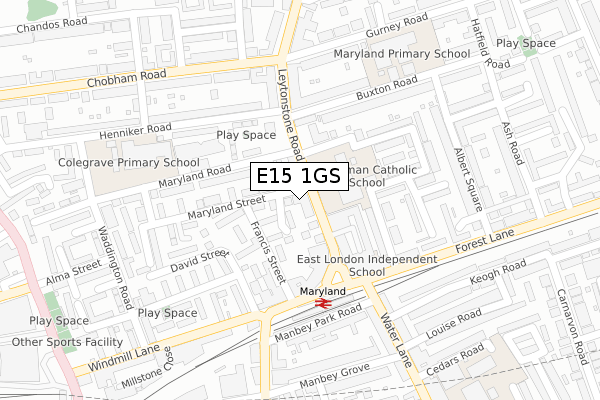
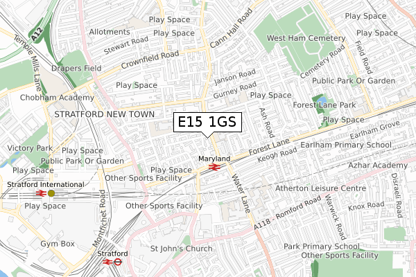
E15 1GS is located in the Maryland electoral ward, within the London borough of Newham and the English Parliamentary constituency of West Ham. The Sub Integrated Care Board (ICB) Location is NHS North East London ICB - A3A8R and the police force is Metropolitan Police. This postcode has been in use since September 2018.


GetTheData
Source: OS Open Zoomstack (Ordnance Survey)
Licence: Open Government Licence (requires attribution)
Attribution: Contains OS data © Crown copyright and database right 2024
Source: Open Postcode Geo
Licence: Open Government Licence (requires attribution)
Attribution: Contains OS data © Crown copyright and database right 2024; Contains Royal Mail data © Royal Mail copyright and database right 2024; Source: Office for National Statistics licensed under the Open Government Licence v.3.0
| Easting | 539152 |
| Northing | 185103 |
| Latitude | 51.547671 |
| Longitude | 0.005466 |
GetTheData
Source: Open Postcode Geo
Licence: Open Government Licence
| Country | England |
| Postcode District | E15 |
| ➜ E15 open data dashboard ➜ See where E15 is on a map ➜ Where is London? | |
GetTheData
Source: Land Registry Price Paid Data
Licence: Open Government Licence
| Ward | Maryland |
| Constituency | West Ham |
GetTheData
Source: ONS Postcode Database
Licence: Open Government Licence
| January 2024 | Violence and sexual offences | On or near Manbey Road | 342m |
| January 2024 | Violence and sexual offences | On or near Keogh Road | 349m |
| January 2024 | Anti-social behaviour | On or near Gawsworth Close | 403m |
| ➜ Get more crime data in our Crime section | |||
GetTheData
Source: data.police.uk
Licence: Open Government Licence
| Maryland (Leytonstone Road) | Stratford | 66m |
| Maryland (Leytonstone Road) | Stratford | 96m |
| Chobham Road (Leytonstone Road) | Stratford New Town | 168m |
| Maryland (Water Lane) | Stratford | 225m |
| Maryland Station Manbey Grove (The Grove) | Stratford | 245m |
| Stratford Dlr Station (Station Street) | Stratford | 894m |
| Stratford Underground Station | Stratford | 898m |
| Stratford International Dlr Station | Stratford | 1,079m |
| Stratford High Street Dlr Station | Stratford | 1,147m |
| Leyton Underground Station | Leyton | 1,250m |
| Maryland Station | 0.2km |
| Stratford (London) Station | 0.9km |
| Stratford International Station | 1km |
GetTheData
Source: NaPTAN
Licence: Open Government Licence
➜ Broadband speed and availability dashboard for E15 1GS
| Percentage of properties with Next Generation Access | 100.0% |
| Percentage of properties with Superfast Broadband | 100.0% |
| Percentage of properties with Ultrafast Broadband | 0.0% |
| Percentage of properties with Full Fibre Broadband | 0.0% |
Superfast Broadband is between 30Mbps and 300Mbps
Ultrafast Broadband is > 300Mbps
| Median download speed | 70.5Mbps |
| Average download speed | 56.5Mbps |
| Maximum download speed | 80.00Mbps |
| Median upload speed | 19.8Mbps |
| Average upload speed | 14.4Mbps |
| Maximum upload speed | 20.00Mbps |
| Percentage of properties unable to receive 2Mbps | 0.0% |
| Percentage of properties unable to receive 5Mbps | 0.0% |
| Percentage of properties unable to receive 10Mbps | 0.0% |
| Percentage of properties unable to receive 30Mbps | 0.0% |
➜ Broadband speed and availability dashboard for E15 1GS
GetTheData
Source: Ofcom
Licence: Ofcom Terms of Use (requires attribution)
GetTheData
Source: ONS Postcode Database
Licence: Open Government Licence


➜ Get more ratings from the Food Standards Agency
GetTheData
Source: Food Standards Agency
Licence: FSA terms & conditions
| Last Collection | |||
|---|---|---|---|
| Location | Mon-Fri | Sat | Distance |
| Maryland Street | 17:30 | 11:30 | 26m |
| 85 Leytonstone Road | 17:30 | 11:30 | 26m |
| Water Lane | 17:30 | 11:30 | 253m |
GetTheData
Source: Dracos
Licence: Creative Commons Attribution-ShareAlike
| Facility | Distance |
|---|---|
| Sarah Bonnell School Deanery Road, London Sports Hall, Outdoor Tennis Courts | 474m |
| Anytime Fitness (London Stratford East) Leyton Road, Leyton Road, London Health and Fitness Gym | 610m |
| Puregym (London Stratford) The Mall, The Stratford Centre, London Health and Fitness Gym | 691m |
GetTheData
Source: Active Places
Licence: Open Government Licence
| School | Phase of Education | Distance |
|---|---|---|
| St Francis' Catholic Primary School Maryland Park, Stratford, Main Entrance in Bow Street, London, E15 1HD | Primary | 84m |
| Hafs Academy Unit 3, 26 Maryland Road, Stratford, London, E15 1JW | Not applicable | 175m |
| Colegrave Primary School Henniker Road, London, E15 1JY | Primary | 275m |
GetTheData
Source: Edubase
Licence: Open Government Licence
The below table lists the International Territorial Level (ITL) codes (formerly Nomenclature of Territorial Units for Statistics (NUTS) codes) and Local Administrative Units (LAU) codes for E15 1GS:
| ITL 1 Code | Name |
|---|---|
| TLI | London |
| ITL 2 Code | Name |
| TLI4 | Inner London - East |
| ITL 3 Code | Name |
| TLI41 | Hackney and Newham |
| LAU 1 Code | Name |
| E09000025 | Newham |
GetTheData
Source: ONS Postcode Directory
Licence: Open Government Licence
The below table lists the Census Output Area (OA), Lower Layer Super Output Area (LSOA), and Middle Layer Super Output Area (MSOA) for E15 1GS:
| Code | Name | |
|---|---|---|
| OA | E00018224 | |
| LSOA | E01003616 | Newham 012A |
| MSOA | E02000725 | Newham 012 |
GetTheData
Source: ONS Postcode Directory
Licence: Open Government Licence
| E15 1BY | Maryland Street | 35m |
| E15 1JR | Carolina Close | 44m |
| E15 1SD | Luxembourg Mews | 74m |
| E15 1JA | Leytonstone Road | 88m |
| E15 1JG | Francis Street | 90m |
| E15 1JD | Maryland Street | 95m |
| E15 1SE | Leytonstone Road | 98m |
| E15 1LG | Leytonstone Road | 127m |
| E15 1LQ | Leytonstone Road | 127m |
| E15 1SQ | Leytonstone Road | 131m |
GetTheData
Source: Open Postcode Geo; Land Registry Price Paid Data
Licence: Open Government Licence