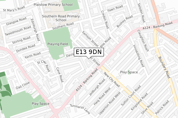
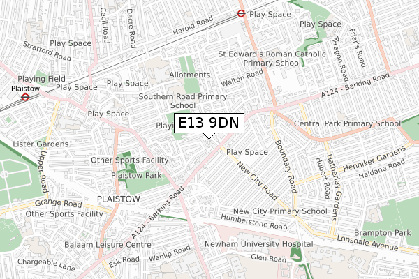
E13 9DN is located in the Plaistow North electoral ward, within the London borough of Newham and the English Parliamentary constituency of West Ham. The Sub Integrated Care Board (ICB) Location is NHS North East London ICB - A3A8R and the police force is Metropolitan Police. This postcode has been in use since October 2017.


GetTheData
Source: OS Open Zoomstack (Ordnance Survey)
Licence: Open Government Licence (requires attribution)
Attribution: Contains OS data © Crown copyright and database right 2024
Source: Open Postcode Geo
Licence: Open Government Licence (requires attribution)
Attribution: Contains OS data © Crown copyright and database right 2024; Contains Royal Mail data © Royal Mail copyright and database right 2024; Source: Office for National Statistics licensed under the Open Government Licence v.3.0
| Easting | 541061 |
| Northing | 183041 |
| Latitude | 51.528668 |
| Longitude | 0.032153 |
GetTheData
Source: Open Postcode Geo
Licence: Open Government Licence
| Country | England |
| Postcode District | E13 |
| ➜ E13 open data dashboard ➜ See where E13 is on a map ➜ Where is London? | |
GetTheData
Source: Land Registry Price Paid Data
Licence: Open Government Licence
| Ward | Plaistow North |
| Constituency | West Ham |
GetTheData
Source: ONS Postcode Database
Licence: Open Government Licence
| January 2024 | Violence and sexual offences | On or near Samson Street | 104m |
| January 2024 | Burglary | On or near Southern Road | 220m |
| January 2024 | Robbery | On or near Southern Road | 220m |
| ➜ Get more crime data in our Crime section | |||
GetTheData
Source: data.police.uk
Licence: Open Government Licence
| New City Road Barking Road (Barking Road) | Plaistow | 84m |
| New City Road Barking Road (Barking Road) | Plaistow | 114m |
| Samson Street (Barking Road) | Plaistow | 129m |
| Plaistow Prince Regent Lane (Barking Road) | Plaistow | 292m |
| Barking Road (Greengate Street) | Plaistow | 338m |
| Upton Park Underground Station | Upton Park | 774m |
| Plaistow Underground Station | Plaistow | 1,061m |
| East Ham Underground Station | East Ham | 1,748m |
| West Ham Station | 1.9km |
| Forest Gate Station | 2.4km |
| Woodgrange Park Station | 2.4km |
GetTheData
Source: NaPTAN
Licence: Open Government Licence
➜ Broadband speed and availability dashboard for E13 9DN
| Percentage of properties with Next Generation Access | 100.0% |
| Percentage of properties with Superfast Broadband | 100.0% |
| Percentage of properties with Ultrafast Broadband | 100.0% |
| Percentage of properties with Full Fibre Broadband | 0.0% |
Superfast Broadband is between 30Mbps and 300Mbps
Ultrafast Broadband is > 300Mbps
| Median download speed | 55.0Mbps |
| Average download speed | 55.5Mbps |
| Maximum download speed | 78.12Mbps |
| Median upload speed | 10.0Mbps |
| Average upload speed | 12.2Mbps |
| Maximum upload speed | 19.53Mbps |
| Percentage of properties unable to receive 2Mbps | 0.0% |
| Percentage of properties unable to receive 5Mbps | 0.0% |
| Percentage of properties unable to receive 10Mbps | 0.0% |
| Percentage of properties unable to receive 30Mbps | 0.0% |
➜ Broadband speed and availability dashboard for E13 9DN
GetTheData
Source: Ofcom
Licence: Ofcom Terms of Use (requires attribution)
GetTheData
Source: ONS Postcode Database
Licence: Open Government Licence


➜ Get more ratings from the Food Standards Agency
GetTheData
Source: Food Standards Agency
Licence: FSA terms & conditions
| Last Collection | |||
|---|---|---|---|
| Location | Mon-Fri | Sat | Distance |
| Barking Road | 17:30 | 11:30 | 181m |
| Edinburgh Road | 17:30 | 11:30 | 367m |
| Tunmarsh Lane | 17:30 | 11:30 | 417m |
GetTheData
Source: Dracos
Licence: Creative Commons Attribution-ShareAlike
| Facility | Distance |
|---|---|
| Barking Road Community Centre Barking Road, London Sports Hall | 52m |
| Lister Community School (Southern Road Playing Fields) Southern Road, Plaistow, London Grass Pitches, Artificial Grass Pitch | 209m |
| Lister Community School St. Mary's Road, London Sports Hall, Studio, Health and Fitness Gym, Outdoor Tennis Courts | 478m |
GetTheData
Source: Active Places
Licence: Open Government Licence
| School | Phase of Education | Distance |
|---|---|---|
| Southern Road Primary School Southern Road, Plaistow, London, E13 9JH | Primary | 286m |
| The Service for Deaf and Partially Hearing Children New Tunmarsh Centre, Tunmarsh Lane, London, E13 9NB | Not applicable | 345m |
| Tunmarsh School The Tunmarsh Centre, Tunmarsh Lane, Plaistow, London, E13 9NB | Not applicable | 345m |
GetTheData
Source: Edubase
Licence: Open Government Licence
The below table lists the International Territorial Level (ITL) codes (formerly Nomenclature of Territorial Units for Statistics (NUTS) codes) and Local Administrative Units (LAU) codes for E13 9DN:
| ITL 1 Code | Name |
|---|---|
| TLI | London |
| ITL 2 Code | Name |
| TLI4 | Inner London - East |
| ITL 3 Code | Name |
| TLI41 | Hackney and Newham |
| LAU 1 Code | Name |
| E09000025 | Newham |
GetTheData
Source: ONS Postcode Directory
Licence: Open Government Licence
The below table lists the Census Output Area (OA), Lower Layer Super Output Area (LSOA), and Middle Layer Super Output Area (MSOA) for E13 9DN:
| Code | Name | |
|---|---|---|
| OA | E00018173 | |
| LSOA | E01003606 | Newham 022D |
| MSOA | E02000735 | Newham 022 |
GetTheData
Source: ONS Postcode Directory
Licence: Open Government Licence
| E13 9EF | Pragel Street | 53m |
| E13 9EB | Hollybush Street | 86m |
| E13 9EE | Davis Street | 94m |
| E13 9EJ | Samson Street | 96m |
| E13 9EQ | Parsons Road | 97m |
| E13 9ED | Hollybush Street | 123m |
| E13 9EX | Barking Road | 126m |
| E13 9EA | Hollybush Street | 130m |
| E13 9EL | Nile Road | 132m |
| E13 9JZ | Barking Road | 135m |
GetTheData
Source: Open Postcode Geo; Land Registry Price Paid Data
Licence: Open Government Licence