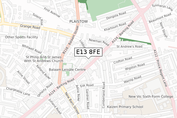
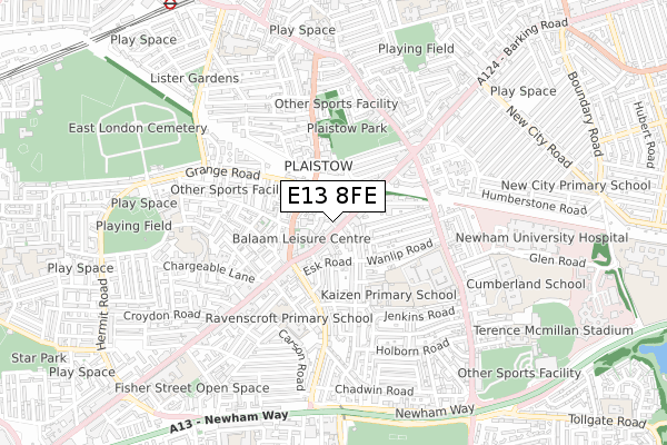
E13 8FE is located in the Plaistow West & Canning Town East electoral ward, within the London borough of Newham and the English Parliamentary constituency of West Ham. The Sub Integrated Care Board (ICB) Location is NHS North East London ICB - A3A8R and the police force is Metropolitan Police. This postcode has been in use since December 2017.


GetTheData
Source: OS Open Zoomstack (Ordnance Survey)
Licence: Open Government Licence (requires attribution)
Attribution: Contains OS data © Crown copyright and database right 2024
Source: Open Postcode Geo
Licence: Open Government Licence (requires attribution)
Attribution: Contains OS data © Crown copyright and database right 2024; Contains Royal Mail data © Royal Mail copyright and database right 2024; Source: Office for National Statistics licensed under the Open Government Licence v.3.0
| Easting | 540574 |
| Northing | 182473 |
| Latitude | 51.523685 |
| Longitude | 0.024910 |
GetTheData
Source: Open Postcode Geo
Licence: Open Government Licence
| Country | England |
| Postcode District | E13 |
| ➜ E13 open data dashboard ➜ See where E13 is on a map ➜ Where is London? | |
GetTheData
Source: Land Registry Price Paid Data
Licence: Open Government Licence
| Ward | Plaistow West & Canning Town East |
| Constituency | West Ham |
GetTheData
Source: ONS Postcode Database
Licence: Open Government Licence
| January 2024 | Anti-social behaviour | On or near Wigston Road | 266m |
| January 2024 | Violence and sexual offences | On or near Wigston Road | 266m |
| January 2024 | Theft from the person | On or near Lincoln Road | 388m |
| ➜ Get more crime data in our Crime section | |||
GetTheData
Source: data.police.uk
Licence: Open Government Licence
| Plaistow Police Station (Barking Road) | Plaistow | 29m |
| Plaistow Police Station (Barking Road) | Plaistow | 120m |
| Liddon Road (Balaam Street) | Plaistow | 143m |
| Balaam Street (Barking Road) | Plaistow | 163m |
| Barking Road Plaistow (Balaam Street) | Plaistow | 191m |
| Plaistow Underground Station | Plaistow | 996m |
| West Ham Underground Station | West Ham | 1,462m |
| Star Lane Dlr Station | Canning Town | 1,474m |
| Upton Park Underground Station | Upton Park | 1,483m |
| West Ham Dlr Station | West Ham | 1,491m |
| West Ham Station | 1.5km |
| Stratford (London) Station | 2.8km |
| Maryland Station | 2.8km |
GetTheData
Source: NaPTAN
Licence: Open Government Licence
➜ Broadband speed and availability dashboard for E13 8FE
| Percentage of properties with Next Generation Access | 100.0% |
| Percentage of properties with Superfast Broadband | 100.0% |
| Percentage of properties with Ultrafast Broadband | 0.0% |
| Percentage of properties with Full Fibre Broadband | 0.0% |
Superfast Broadband is between 30Mbps and 300Mbps
Ultrafast Broadband is > 300Mbps
| Median download speed | 80.0Mbps |
| Average download speed | 66.1Mbps |
| Maximum download speed | 80.00Mbps |
| Median upload speed | 20.0Mbps |
| Average upload speed | 15.9Mbps |
| Maximum upload speed | 20.00Mbps |
| Percentage of properties unable to receive 2Mbps | 0.0% |
| Percentage of properties unable to receive 5Mbps | 0.0% |
| Percentage of properties unable to receive 10Mbps | 0.0% |
| Percentage of properties unable to receive 30Mbps | 0.0% |
➜ Broadband speed and availability dashboard for E13 8FE
GetTheData
Source: Ofcom
Licence: Ofcom Terms of Use (requires attribution)
GetTheData
Source: ONS Postcode Database
Licence: Open Government Licence

➜ Get more ratings from the Food Standards Agency
GetTheData
Source: Food Standards Agency
Licence: FSA terms & conditions
| Last Collection | |||
|---|---|---|---|
| Location | Mon-Fri | Sat | Distance |
| Liddon Road | 17:30 | 11:30 | 69m |
| O/S Plaistow Mspo | 18:30 | 12:00 | 293m |
| 360 Barking Road E13 | 18:30 | 12:00 | 300m |
GetTheData
Source: Dracos
Licence: Creative Commons Attribution-ShareAlike
| Facility | Distance |
|---|---|
| Balaam Leisure Centre (Closed) Balaam Street, London Swimming Pool, Health and Fitness Gym, Studio | 128m |
| Newham Sixth Form College Prince Regent Lane, London Health and Fitness Gym, Sports Hall, Studio, Outdoor Tennis Courts | 390m |
| Ravenscroft Primary School Carson Road, London Outdoor Tennis Courts | 402m |
GetTheData
Source: Active Places
Licence: Open Government Licence
| School | Phase of Education | Distance |
|---|---|---|
| Kaizen Primary School Elkington Road, London, E13 8LF | Primary | 312m |
| Newham Sixth Form College Prince Regent Lane, Plaistow, London, E13 8SG | 16 plus | 399m |
| Ravenscroft Primary School Carson Road, London, E16 4BD | Primary | 412m |
GetTheData
Source: Edubase
Licence: Open Government Licence
The below table lists the International Territorial Level (ITL) codes (formerly Nomenclature of Territorial Units for Statistics (NUTS) codes) and Local Administrative Units (LAU) codes for E13 8FE:
| ITL 1 Code | Name |
|---|---|
| TLI | London |
| ITL 2 Code | Name |
| TLI4 | Inner London - East |
| ITL 3 Code | Name |
| TLI41 | Hackney and Newham |
| LAU 1 Code | Name |
| E09000025 | Newham |
GetTheData
Source: ONS Postcode Directory
Licence: Open Government Licence
The below table lists the Census Output Area (OA), Lower Layer Super Output Area (LSOA), and Middle Layer Super Output Area (MSOA) for E13 8FE:
| Code | Name | |
|---|---|---|
| OA | E00017689 | |
| LSOA | E01003499 | Newham 030A |
| MSOA | E02000743 | Newham 030 |
GetTheData
Source: ONS Postcode Directory
Licence: Open Government Licence
| E13 8AL | Barking Road | 17m |
| E13 8AN | Liddon Road | 79m |
| E13 8QB | Barking Road | 100m |
| E13 8HJ | Barking Road | 102m |
| E13 8QA | Newman Road | 125m |
| E13 8AQ | Balaam Street | 135m |
| E13 8LJ | Esk Road | 143m |
| E13 8EA | Balaam Street | 160m |
| E13 8EB | Balaam Street | 184m |
| E13 8QT | Crofton Road | 184m |
GetTheData
Source: Open Postcode Geo; Land Registry Price Paid Data
Licence: Open Government Licence