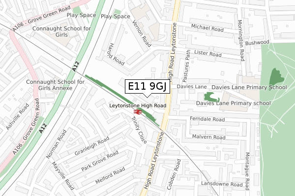
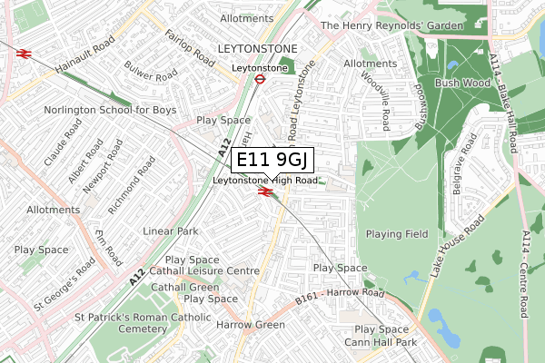
E11 9GJ is located in the Leytonstone electoral ward, within the London borough of Waltham Forest and the English Parliamentary constituency of Leyton and Wanstead. The Sub Integrated Care Board (ICB) Location is NHS North East London ICB - A3A8R and the police force is Metropolitan Police. This postcode has been in use since November 2018.


GetTheData
Source: OS Open Zoomstack (Ordnance Survey)
Licence: Open Government Licence (requires attribution)
Attribution: Contains OS data © Crown copyright and database right 2024
Source: Open Postcode Geo
Licence: Open Government Licence (requires attribution)
Attribution: Contains OS data © Crown copyright and database right 2024; Contains Royal Mail data © Royal Mail copyright and database right 2024; Source: Office for National Statistics licensed under the Open Government Licence v.3.0
| Easting | 539336 |
| Northing | 186929 |
| Latitude | 51.564033 |
| Longitude | 0.008840 |
GetTheData
Source: Open Postcode Geo
Licence: Open Government Licence
| Country | England |
| Postcode District | E11 |
| ➜ E11 open data dashboard ➜ See where E11 is on a map ➜ Where is London? | |
GetTheData
Source: Land Registry Price Paid Data
Licence: Open Government Licence
| Ward | Leytonstone |
| Constituency | Leyton And Wanstead |
GetTheData
Source: ONS Postcode Database
Licence: Open Government Licence
| January 2024 | Criminal damage and arson | On or near Caradon Close | 77m |
| January 2024 | Violence and sexual offences | On or near Short Road | 256m |
| January 2024 | Anti-social behaviour | On or near Lynn Road | 417m |
| ➜ Get more crime data in our Crime section | |||
GetTheData
Source: data.police.uk
Licence: Open Government Licence
| Leytonstone High Road Station (Leytonstone High Road) | Leytonstone | 82m |
| Leytonstone High Road Station (Leytonstone High Road) | Leytonstone | 145m |
| Vernon Rdleytonstone High Rd (Leytonstone High Road) | Leytonstone | 156m |
| Michael Road (Leytonstone High Road) | Leytonstone | 253m |
| Leytonstone Stn Grove Green Rd | Leytonstone | 392m |
| Leytonstone Underground Station | Leytonstone | 479m |
| Leyton Underground Station | Leyton | 1,294m |
| Wanstead Underground Station | Wanstead | 1,870m |
| Leytonstone High Road Station | 0.1km |
| Leyton Midland Road Station | 1.3km |
| Wanstead Park Station | 1.8km |
GetTheData
Source: NaPTAN
Licence: Open Government Licence
GetTheData
Source: ONS Postcode Database
Licence: Open Government Licence


➜ Get more ratings from the Food Standards Agency
GetTheData
Source: Food Standards Agency
Licence: FSA terms & conditions
| Last Collection | |||
|---|---|---|---|
| Location | Mon-Fri | Sat | Distance |
| Joseph Ray Road | 18:30 | 11:30 | 70m |
| Lister Road | 17:30 | 11:30 | 135m |
| High Road Leytonstone | 17:30 | 11:30 | 352m |
GetTheData
Source: Dracos
Licence: Creative Commons Attribution-ShareAlike
| Facility | Distance |
|---|---|
| Connaught School For Girls Dyers Hall Road, London Sports Hall | 386m |
| Puregym (London Leytonstone) High Road Leytonstone, High Road Leytonstone, Leytonstone Health and Fitness Gym | 408m |
| Mayville Primary School Lincoln Street, London Artificial Grass Pitch | 485m |
GetTheData
Source: Active Places
Licence: Open Government Licence
| School | Phase of Education | Distance |
|---|---|---|
| Davies Lane Primary School Davies Lane, Leytonstone, London, E11 3DR | Primary | 218m |
| George Tomlinson Primary School Harrington Road, Leytonstone, London, E11 4QN | Primary | 251m |
| Connaught School for Girls Dyers Hall Road, Leytonstone, London, E11 4AE | Secondary | 386m |
GetTheData
Source: Edubase
Licence: Open Government Licence
The below table lists the International Territorial Level (ITL) codes (formerly Nomenclature of Territorial Units for Statistics (NUTS) codes) and Local Administrative Units (LAU) codes for E11 9GJ:
| ITL 1 Code | Name |
|---|---|
| TLI | London |
| ITL 2 Code | Name |
| TLI5 | Outer London - East and North East |
| ITL 3 Code | Name |
| TLI53 | Redbridge and Waltham Forest |
| LAU 1 Code | Name |
| E09000031 | Waltham Forest |
GetTheData
Source: ONS Postcode Directory
Licence: Open Government Licence
The below table lists the Census Output Area (OA), Lower Layer Super Output Area (LSOA), and Middle Layer Super Output Area (MSOA) for E11 9GJ:
| Code | Name | |
|---|---|---|
| OA | E00022320 | |
| LSOA | E01004440 | Waltham Forest 024D |
| MSOA | E02000918 | Waltham Forest 024 |
GetTheData
Source: ONS Postcode Directory
Licence: Open Government Licence
| E11 4TF | Brockway Close | 29m |
| E11 4TE | Brockway Close | 53m |
| E11 4TD | Brockway Close | 58m |
| E11 4RD | High Road Leytonstone | 58m |
| E11 4RB | High Road Leytonstone | 60m |
| E11 4TG | Brockway Close | 72m |
| E11 4TB | Caradon Close | 84m |
| E11 4TQ | Brockway Close | 86m |
| E11 3DH | High Road Leytonstone | 97m |
| E11 4QZ | High Road | 109m |
GetTheData
Source: Open Postcode Geo; Land Registry Price Paid Data
Licence: Open Government Licence