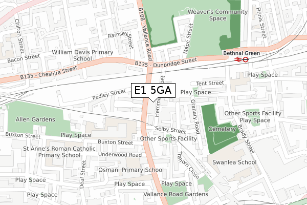
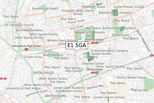
E1 5GA is located in the Spitalfields & Banglatown electoral ward, within the London borough of Tower Hamlets and the English Parliamentary constituency of Bethnal Green and Bow. The Sub Integrated Care Board (ICB) Location is NHS North East London ICB - A3A8R and the police force is Metropolitan Police. This postcode has been in use since August 2019.


GetTheData
Source: OS Open Zoomstack (Ordnance Survey)
Licence: Open Government Licence (requires attribution)
Attribution: Contains OS data © Crown copyright and database right 2024
Source: Open Postcode Geo
Licence: Open Government Licence (requires attribution)
Attribution: Contains OS data © Crown copyright and database right 2024; Contains Royal Mail data © Royal Mail copyright and database right 2024; Source: Office for National Statistics licensed under the Open Government Licence v.3.0
| Easting | 534418 |
| Northing | 182201 |
| Latitude | 51.522739 |
| Longitude | -0.063873 |
GetTheData
Source: Open Postcode Geo
Licence: Open Government Licence
| Country | England |
| Postcode District | E1 |
| ➜ E1 open data dashboard ➜ See where E1 is on a map ➜ Where is Bethnal Green? | |
GetTheData
Source: Land Registry Price Paid Data
Licence: Open Government Licence
| Ward | Spitalfields & Banglatown |
| Constituency | Bethnal Green And Bow |
GetTheData
Source: ONS Postcode Database
Licence: Open Government Licence
| January 2024 | Anti-social behaviour | On or near Surma Close | 94m |
| January 2024 | Anti-social behaviour | On or near Surma Close | 94m |
| January 2024 | Drugs | On or near Surma Close | 94m |
| ➜ Get more crime data in our Crime section | |||
GetTheData
Source: data.police.uk
Licence: Open Government Licence
| Fakruddin Street (Vallance Road) | Bethnal Green | 28m |
| Fakruddin Street (Vallance Road) | Bethnal Green | 42m |
| Underwood Road (Vallance Road) | Whitechapel | 170m |
| Weavers Fields (Vallance Road) | Bethnal Green | 237m |
| Weavers Fields (Vallance Road) | Bethnal Green | 251m |
| Whitechapel Underground Station | Whitechapel | 450m |
| Bethnal Green Underground Station | Bethnal Green | 767m |
| Aldgate East Underground Station | Aldgate East | 1,040m |
| Stepney Green Underground Station | Stepney Green | 1,205m |
| Aldgate Underground Station | Aldgate | 1,250m |
| Bethnal Green Station | 0.3km |
| Whitechapel Station | 0.5km |
| Shoreditch High Street Station | 0.8km |
GetTheData
Source: NaPTAN
Licence: Open Government Licence
GetTheData
Source: ONS Postcode Database
Licence: Open Government Licence


➜ Get more ratings from the Food Standards Agency
GetTheData
Source: Food Standards Agency
Licence: FSA terms & conditions
| Last Collection | |||
|---|---|---|---|
| Location | Mon-Fri | Sat | Distance |
| Dunbridge Street | 18:30 | 11:30 | 112m |
| Three Colts Lane | 18:30 | 11:30 | 355m |
| Pollard Row | 18:30 | 11:30 | 437m |
GetTheData
Source: Dracos
Licence: Creative Commons Attribution-ShareAlike
| Facility | Distance |
|---|---|
| Weavers Field Dunbridge Street, London Grass Pitches | 317m |
| Swanlea School Brady Street, London Sports Hall, Health and Fitness Gym, Artificial Grass Pitch | 346m |
| Whitechapel Sports Centre Durward Street, London Sports Hall, Health and Fitness Gym, Studio, Artificial Grass Pitch | 348m |
GetTheData
Source: Active Places
Licence: Open Government Licence
| School | Phase of Education | Distance |
|---|---|---|
| Thomas Buxton Primary School Buxton Street, Bethnal Green, Thomas Buxton Primary School, London, E1 5AR | Primary | 129m |
| Osmani Primary School Vallance Road, Whitechapel, London, E1 5AD | Primary | 197m |
| William Davis Primary School Wood Close, Cheshire Street, London, E2 6ET | Primary | 280m |
GetTheData
Source: Edubase
Licence: Open Government Licence
The below table lists the International Territorial Level (ITL) codes (formerly Nomenclature of Territorial Units for Statistics (NUTS) codes) and Local Administrative Units (LAU) codes for E1 5GA:
| ITL 1 Code | Name |
|---|---|
| TLI | London |
| ITL 2 Code | Name |
| TLI4 | Inner London - East |
| ITL 3 Code | Name |
| TLI42 | Tower Hamlets |
| LAU 1 Code | Name |
| E09000030 | Tower Hamlets |
GetTheData
Source: ONS Postcode Directory
Licence: Open Government Licence
The below table lists the Census Output Area (OA), Lower Layer Super Output Area (LSOA), and Middle Layer Super Output Area (MSOA) for E1 5GA:
| Code | Name | |
|---|---|---|
| OA | E00167171 | |
| LSOA | E01004205 | Tower Hamlets 013A |
| MSOA | E02000876 | Tower Hamlets 013 |
GetTheData
Source: ONS Postcode Directory
Licence: Open Government Licence
| E1 5BL | Hemming Street | 46m |
| E1 5DD | Surma Close | 76m |
| E1 5BX | Selby Street | 126m |
| E1 5BJ | Vallance Road | 140m |
| E1 5BH | Vallance Road | 144m |
| E1 5BS | Vallance Road | 145m |
| E2 6JA | Dunbridge Street | 146m |
| E2 6JH | Menotti Street | 156m |
| E2 6HR | Vallance Road | 158m |
| E1 5EL | Trahorn Close | 166m |
GetTheData
Source: Open Postcode Geo; Land Registry Price Paid Data
Licence: Open Government Licence