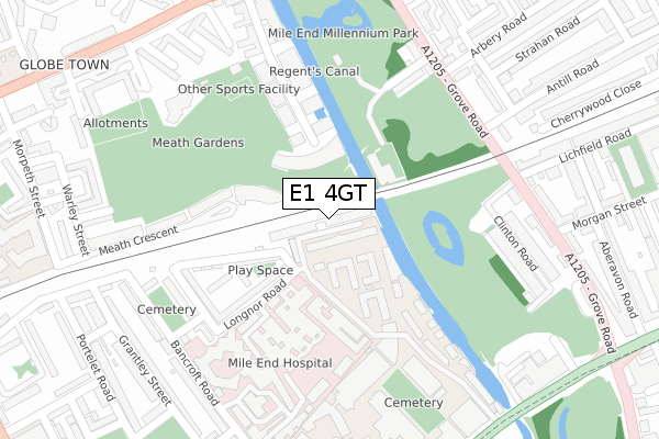
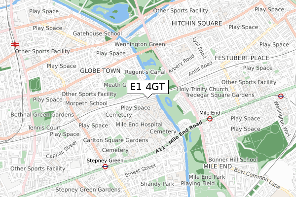
E1 4GT is located in the Bethnal Green electoral ward, within the London borough of Tower Hamlets and the English Parliamentary constituency of Bethnal Green and Bow. The Sub Integrated Care Board (ICB) Location is NHS North East London ICB - A3A8R and the police force is Metropolitan Police. This postcode has been in use since March 2019.


GetTheData
Source: OS Open Zoomstack (Ordnance Survey)
Licence: Open Government Licence (requires attribution)
Attribution: Contains OS data © Crown copyright and database right 2024
Source: Open Postcode Geo
Licence: Open Government Licence (requires attribution)
Attribution: Contains OS data © Crown copyright and database right 2024; Contains Royal Mail data © Royal Mail copyright and database right 2024; Source: Office for National Statistics licensed under the Open Government Licence v.3.0
| Easting | 535995 |
| Northing | 182715 |
| Latitude | 51.526980 |
| Longitude | -0.040957 |
GetTheData
Source: Open Postcode Geo
Licence: Open Government Licence
| Country | England |
| Postcode District | E1 |
| ➜ E1 open data dashboard ➜ See where E1 is on a map ➜ Where is London? | |
GetTheData
Source: Land Registry Price Paid Data
Licence: Open Government Licence
| Ward | Bethnal Green |
| Constituency | Bethnal Green And Bow |
GetTheData
Source: ONS Postcode Database
Licence: Open Government Licence
| January 2024 | Criminal damage and arson | On or near Theatre/Concert Hall | 448m |
| December 2023 | Drugs | On or near Theatre/Concert Hall | 448m |
| December 2023 | Violence and sexual offences | On or near Theatre/Concert Hall | 448m |
| ➜ Get more crime data in our Crime section | |||
GetTheData
Source: data.police.uk
Licence: Open Government Licence
| Arbery Road (Grove Road) | Globe Town | 279m |
| Arbery Road (Grove Road) | Globe Town | 281m |
| Lichfield Road (Grove Road) | Mile End | 309m |
| Lichfield Road (Grove Road) | Mile End | 317m |
| St Barnabas Church (E3) | Globe Town | 379m |
| Mile End Underground Station | Mile End | 550m |
| Stepney Green Underground Station | Stepney Green | 690m |
| Bethnal Green Underground Station | Bethnal Green | 1,008m |
| Bow Road Underground Station | Bow | 1,100m |
| Bow Church Dlr Station (Bow Road) | Bow | 1,395m |
| Cambridge Heath (London) Station | 1.3km |
| Bethnal Green Station | 1.3km |
| Whitechapel Station | 1.5km |
GetTheData
Source: NaPTAN
Licence: Open Government Licence
| Percentage of properties with Next Generation Access | 0.0% |
| Percentage of properties with Superfast Broadband | 0.0% |
| Percentage of properties with Ultrafast Broadband | 0.0% |
| Percentage of properties with Full Fibre Broadband | 0.0% |
Superfast Broadband is between 30Mbps and 300Mbps
Ultrafast Broadband is > 300Mbps
| Percentage of properties unable to receive 2Mbps | 0.0% |
| Percentage of properties unable to receive 5Mbps | 0.0% |
| Percentage of properties unable to receive 10Mbps | 0.0% |
| Percentage of properties unable to receive 30Mbps | 0.0% |
GetTheData
Source: Ofcom
Licence: Ofcom Terms of Use (requires attribution)
GetTheData
Source: ONS Postcode Database
Licence: Open Government Licence


➜ Get more ratings from the Food Standards Agency
GetTheData
Source: Food Standards Agency
Licence: FSA terms & conditions
| Last Collection | |||
|---|---|---|---|
| Location | Mon-Fri | Sat | Distance |
| Grove Road | 17:30 | 11:30 | 280m |
| Bancroft Road E1 | 18:30 | 11:30 | 341m |
| Bancroft Road | 18:30 | 11:30 | 341m |
GetTheData
Source: Dracos
Licence: Creative Commons Attribution-ShareAlike
| Facility | Distance |
|---|---|
| Meath Gardens Palmers Road, London Grass Pitches | 197m |
| Q Motion Health & Fitness Godward Square, London Health and Fitness Gym, Sports Hall, Squash Courts, Studio | 447m |
| Morpeth School Portman Place, London Health and Fitness Gym, Sports Hall | 521m |
GetTheData
Source: Active Places
Licence: Open Government Licence
| School | Phase of Education | Distance |
|---|---|---|
| Rachel Keeling Nursery School Bullards Place, Morpeth Street, Bethnal Green, London, E2 0PS | Nursery | 431m |
| Queen Mary University of London Mile End Road, London, E1 4NS | Not applicable | 448m |
| Morpeth School Portman Place, Bethnal Green, London, E2 0PX | Secondary | 470m |
GetTheData
Source: Edubase
Licence: Open Government Licence
The below table lists the International Territorial Level (ITL) codes (formerly Nomenclature of Territorial Units for Statistics (NUTS) codes) and Local Administrative Units (LAU) codes for E1 4GT:
| ITL 1 Code | Name |
|---|---|
| TLI | London |
| ITL 2 Code | Name |
| TLI4 | Inner London - East |
| ITL 3 Code | Name |
| TLI42 | Tower Hamlets |
| LAU 1 Code | Name |
| E09000030 | Tower Hamlets |
GetTheData
Source: ONS Postcode Directory
Licence: Open Government Licence
The below table lists the Census Output Area (OA), Lower Layer Super Output Area (LSOA), and Middle Layer Super Output Area (MSOA) for E1 4GT:
| Code | Name | |
|---|---|---|
| OA | E00021466 | |
| LSOA | E01004262 | Tower Hamlets 010B |
| MSOA | E02000873 | Tower Hamlets 010 |
GetTheData
Source: ONS Postcode Directory
Licence: Open Government Licence
| E2 0TB | Palmers Road | 96m |
| E2 0TD | Palmers Road | 96m |
| E2 0QA | Meath Crescent | 98m |
| E2 0QQ | Meath Crescent | 98m |
| E2 0FF | Palmers Road | 131m |
| E2 0FG | Cadmium Square | 144m |
| E1 4DB | Longnor Road | 156m |
| E1 4DA | Longnor Road | 164m |
| E2 0QL | Meath Crescent | 169m |
| E2 0FS | Palmers Road | 181m |
GetTheData
Source: Open Postcode Geo; Land Registry Price Paid Data
Licence: Open Government Licence