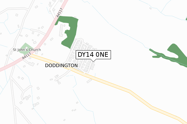
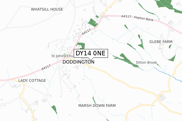
DY14 0NE is located in the Cleobury Mortimer electoral ward, within the unitary authority of Shropshire and the English Parliamentary constituency of Ludlow. The Sub Integrated Care Board (ICB) Location is NHS Shropshire, Telford and Wrekin ICB - M2L0M and the police force is West Mercia. This postcode has been in use since March 2019.


GetTheData
Source: OS Open Zoomstack (Ordnance Survey)
Licence: Open Government Licence (requires attribution)
Attribution: Contains OS data © Crown copyright and database right 2024
Source: Open Postcode Geo
Licence: Open Government Licence (requires attribution)
Attribution: Contains OS data © Crown copyright and database right 2024; Contains Royal Mail data © Royal Mail copyright and database right 2024; Source: Office for National Statistics licensed under the Open Government Licence v.3.0
| Easting | 361911 |
| Northing | 276099 |
| Latitude | 52.381605 |
| Longitude | -2.561003 |
GetTheData
Source: Open Postcode Geo
Licence: Open Government Licence
| Country | England |
| Postcode District | DY14 |
| ➜ DY14 open data dashboard ➜ See where DY14 is on a map | |
GetTheData
Source: Land Registry Price Paid Data
Licence: Open Government Licence
| Ward | Cleobury Mortimer |
| Constituency | Ludlow |
GetTheData
Source: ONS Postcode Database
Licence: Open Government Licence
| Church (A4117) | Doddington | 412m |
| Church (A4117) | Doddington | 416m |
| Foxwood Cottages (A4117) | Foxwood | 580m |
| Foxwood Cottages (A4117) | Foxwood | 589m |
| Chapel (A4117) | Cornbrook | 662m |
GetTheData
Source: NaPTAN
Licence: Open Government Licence
| Percentage of properties with Next Generation Access | 100.0% |
| Percentage of properties with Superfast Broadband | 100.0% |
| Percentage of properties with Ultrafast Broadband | 0.0% |
| Percentage of properties with Full Fibre Broadband | 0.0% |
Superfast Broadband is between 30Mbps and 300Mbps
Ultrafast Broadband is > 300Mbps
| Percentage of properties unable to receive 2Mbps | 0.0% |
| Percentage of properties unable to receive 5Mbps | 0.0% |
| Percentage of properties unable to receive 10Mbps | 0.0% |
| Percentage of properties unable to receive 30Mbps | 0.0% |
GetTheData
Source: Ofcom
Licence: Ofcom Terms of Use (requires attribution)
GetTheData
Source: ONS Postcode Database
Licence: Open Government Licence


➜ Get more ratings from the Food Standards Agency
GetTheData
Source: Food Standards Agency
Licence: FSA terms & conditions
| Last Collection | |||
|---|---|---|---|
| Location | Mon-Fri | Sat | Distance |
| Clee Hill Post Office | 16:30 | 11:30 | 2,699m |
| Royal Oak | 11:30 | 11:30 | 3,776m |
| Oreton Post Office | 15:50 | 10:30 | 5,389m |
GetTheData
Source: Dracos
Licence: Creative Commons Attribution-ShareAlike
| Facility | Distance |
|---|---|
| Clee Hill Recreation Field High Street, Clee Hill, Ludlow Grass Pitches | 2.7km |
| Clee Hill Community Academy Tenbury Road, Clee Hill, Ludlow Grass Pitches | 2.8km |
| Clee Hill Rugby Club (Tenbury Road) Tenbury Road, Clee Hill, Ludlow Grass Pitches | 3km |
GetTheData
Source: Active Places
Licence: Open Government Licence
| School | Phase of Education | Distance |
|---|---|---|
| Clee Hill Community Academy Tenbury Road, Clee Hill, Ludlow, SY8 3NE | Primary | 2.8km |
| Farlow CofE Primary School Farlow, Cleobury Mortimer, Kidderminster, DY14 0RQ | Primary | 5km |
GetTheData
Source: Edubase
Licence: Open Government Licence
The below table lists the International Territorial Level (ITL) codes (formerly Nomenclature of Territorial Units for Statistics (NUTS) codes) and Local Administrative Units (LAU) codes for DY14 0NE:
| ITL 1 Code | Name |
|---|---|
| TLG | West Midlands (England) |
| ITL 2 Code | Name |
| TLG2 | Shropshire and Staffordshire |
| ITL 3 Code | Name |
| TLG22 | Shropshire |
| LAU 1 Code | Name |
| E06000051 | Shropshire |
GetTheData
Source: ONS Postcode Directory
Licence: Open Government Licence
The below table lists the Census Output Area (OA), Lower Layer Super Output Area (LSOA), and Middle Layer Super Output Area (MSOA) for DY14 0NE:
| Code | Name | |
|---|---|---|
| OA | E00147692 | |
| LSOA | E01029000 | Shropshire 039D |
| MSOA | E02006046 | Shropshire 039 |
GetTheData
Source: ONS Postcode Directory
Licence: Open Government Licence
| DY14 0NL | 219m | |
| DY14 0NP | 312m | |
| DY14 0NS | 411m | |
| DY14 0NR | 429m | |
| DY14 0NT | 455m | |
| DY14 0NU | Hopton Bank | 570m |
| DY14 0HQ | 651m | |
| DY14 0HG | Hopton Bank | 670m |
| DY14 0NY | New Road | 695m |
| DY14 0PA | Hopton Bank | 785m |
GetTheData
Source: Open Postcode Geo; Land Registry Price Paid Data
Licence: Open Government Licence