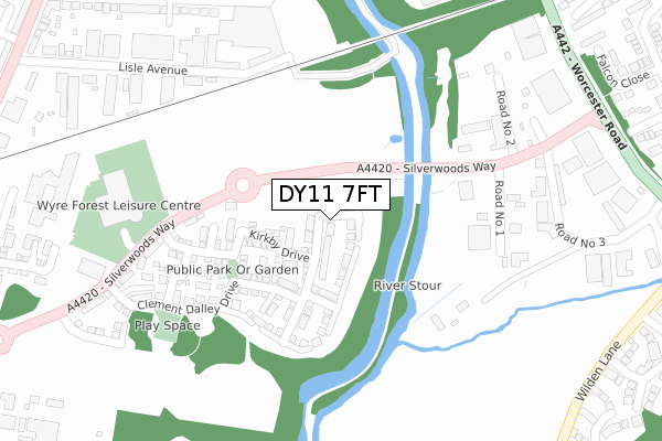
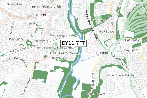
DY11 7FT is located in the Foley Park & Hoobrook electoral ward, within the local authority district of Wyre Forest and the English Parliamentary constituency of Wyre Forest. The Sub Integrated Care Board (ICB) Location is NHS Herefordshire and Worcestershire ICB - 18C and the police force is West Mercia. This postcode has been in use since April 2020.


GetTheData
Source: OS Open Zoomstack (Ordnance Survey)
Licence: Open Government Licence (requires attribution)
Attribution: Contains OS data © Crown copyright and database right 2024
Source: Open Postcode Geo
Licence: Open Government Licence (requires attribution)
Attribution: Contains OS data © Crown copyright and database right 2024; Contains Royal Mail data © Royal Mail copyright and database right 2024; Source: Office for National Statistics licensed under the Open Government Licence v.3.0
| Easting | 382836 |
| Northing | 274811 |
| Latitude | 52.371086 |
| Longitude | -2.253523 |
GetTheData
Source: Open Postcode Geo
Licence: Open Government Licence
| Country | England |
| Postcode District | DY11 |
| ➜ DY11 open data dashboard ➜ See where DY11 is on a map ➜ Where is Kidderminster? | |
GetTheData
Source: Land Registry Price Paid Data
Licence: Open Government Licence
| Ward | Foley Park & Hoobrook |
| Constituency | Wyre Forest |
GetTheData
Source: ONS Postcode Database
Licence: Open Government Licence
1, PLANTATION CLOSE, KIDDERMINSTER, DY11 7FT 2020 28 AUG £264,995 |
9, PLANTATION CLOSE, KIDDERMINSTER, DY11 7FT 2020 31 JUL £259,995 |
6, PLANTATION CLOSE, KIDDERMINSTER, DY11 7FT 2020 29 JUN £399,995 |
8, PLANTATION CLOSE, KIDDERMINSTER, DY11 7FT 2020 26 JUN £399,995 |
4, PLANTATION CLOSE, KIDDERMINSTER, DY11 7FT 2020 12 JUN £261,995 |
2, PLANTATION CLOSE, KIDDERMINSTER, DY11 7FT 2020 27 MAR £263,995 |
GetTheData
Source: HM Land Registry Price Paid Data
Licence: Contains HM Land Registry data © Crown copyright and database right 2024. This data is licensed under the Open Government Licence v3.0.
| October 2023 | Vehicle crime | On or near Harlech Way | 476m |
| August 2022 | Burglary | On or near Harlech Way | 476m |
| June 2022 | Other theft | On or near Road No 1 | 313m |
| ➜ Get more crime data in our Crime section | |||
GetTheData
Source: data.police.uk
Licence: Open Government Licence
| Road No 1 (Worcester Road) | Hoobrook | 411m |
| Blount Terrace | Foley Park | 463m |
| Blount Terrace | Foley Park | 464m |
| Railway Bridge (Worcester Road) | Aggborough | 473m |
| Harlech Way (Wilden Lane) | Hoobrook | 476m |
| Kidderminster Station | 1.8km |
| Hartlebury Station | 4.6km |
GetTheData
Source: NaPTAN
Licence: Open Government Licence
GetTheData
Source: ONS Postcode Database
Licence: Open Government Licence


➜ Get more ratings from the Food Standards Agency
GetTheData
Source: Food Standards Agency
Licence: FSA terms & conditions
| Last Collection | |||
|---|---|---|---|
| Location | Mon-Fri | Sat | Distance |
| Foley Park Post Office | 18:30 | 11:45 | 600m |
| Worcester Road | 17:30 | 11:45 | 891m |
| White Heart | 18:00 | 08:45 | 948m |
GetTheData
Source: Dracos
Licence: Creative Commons Attribution-ShareAlike
| Facility | Distance |
|---|---|
| Wyre Forest Leisure Centre Silverwoods Way, Kidderminster Sports Hall, Swimming Pool, Health and Fitness Gym, Grass Pitches | 348m |
| Fitness Plus (Closed) Stourport Road, Kidderminster Studio, Health and Fitness Gym | 516m |
| Brinton Park Park Lane, Kidderminster Outdoor Tennis Courts, Grass Pitches | 1.1km |
GetTheData
Source: Active Places
Licence: Open Government Licence
| School | Phase of Education | Distance |
|---|---|---|
| Foley Park Primary Academy Northumberland Avenue, Kidderminster, DY11 7AW | Primary | 696m |
| Birchen Coppice Academy Woodbury Road, Kidderminster, DY11 7JJ | Primary | 1.2km |
| Heronswood Primary School Heronswood Road, Kidderminster, DY10 4EX | Primary | 1.5km |
GetTheData
Source: Edubase
Licence: Open Government Licence
The below table lists the International Territorial Level (ITL) codes (formerly Nomenclature of Territorial Units for Statistics (NUTS) codes) and Local Administrative Units (LAU) codes for DY11 7FT:
| ITL 1 Code | Name |
|---|---|
| TLG | West Midlands (England) |
| ITL 2 Code | Name |
| TLG1 | Herefordshire, Worcestershire and Warwickshire |
| ITL 3 Code | Name |
| TLG12 | Worcestershire CC |
| LAU 1 Code | Name |
| E07000239 | Wyre Forest |
GetTheData
Source: ONS Postcode Directory
Licence: Open Government Licence
The below table lists the Census Output Area (OA), Lower Layer Super Output Area (LSOA), and Middle Layer Super Output Area (MSOA) for DY11 7FT:
| Code | Name | |
|---|---|---|
| OA | E00165604 | |
| LSOA | E01032470 | Wyre Forest 009B |
| MSOA | E02006775 | Wyre Forest 009 |
GetTheData
Source: ONS Postcode Directory
Licence: Open Government Licence
| DY11 7AX | Weir Crescent | 159m |
| DY11 7AY | Weir Crescent | 200m |
| DY11 7DU | Clement Dalley Drive | 241m |
| DY11 7DA | Logan Place | 271m |
| DY11 7DT | Silverwoods Way | 284m |
| DY10 1HY | Hoobrook Industrial Estate | 303m |
| DY10 1JR | Worcester Road | 361m |
| DY11 7AG | Beauchamp Avenue | 367m |
| DY11 7AQ | Beauchamp Avenue | 376m |
| DY11 7DS | Crosbie Grove | 415m |
GetTheData
Source: Open Postcode Geo; Land Registry Price Paid Data
Licence: Open Government Licence