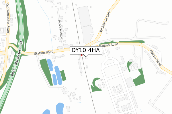
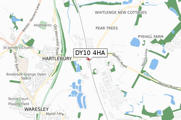
DY10 4HA is located in the Hartlebury electoral ward, within the local authority district of Wychavon and the English Parliamentary constituency of Mid Worcestershire. The Sub Integrated Care Board (ICB) Location is NHS Herefordshire and Worcestershire ICB - 18C and the police force is West Mercia. This postcode has been in use since April 2018.


GetTheData
Source: OS Open Zoomstack (Ordnance Survey)
Licence: Open Government Licence (requires attribution)
Attribution: Contains OS data © Crown copyright and database right 2024
Source: Open Postcode Geo
Licence: Open Government Licence (requires attribution)
Attribution: Contains OS data © Crown copyright and database right 2024; Contains Royal Mail data © Royal Mail copyright and database right 2024; Source: Office for National Statistics licensed under the Open Government Licence v.3.0
| Easting | 385057 |
| Northing | 270714 |
| Latitude | 52.334319 |
| Longitude | -2.220717 |
GetTheData
Source: Open Postcode Geo
Licence: Open Government Licence
| Country | England |
| Postcode District | DY10 |
| ➜ DY10 open data dashboard ➜ See where DY10 is on a map ➜ Where is Hartlebury? | |
GetTheData
Source: Land Registry Price Paid Data
Licence: Open Government Licence
| Ward | Hartlebury |
| Constituency | Mid Worcestershire |
GetTheData
Source: ONS Postcode Database
Licence: Open Government Licence
| May 2022 | Burglary | On or near Walton Road | 405m |
| April 2022 | Anti-social behaviour | On or near Moors Avenue | 219m |
| April 2022 | Violence and sexual offences | On or near Station Road | 237m |
| ➜ Get more crime data in our Crime section | |||
GetTheData
Source: data.police.uk
Licence: Open Government Licence
| Railway Station (Station Road) | Hartlebury | 48m |
| The Birches (Worcester Road) | Hartlebury | 471m |
| The Birches (Worcester Road) | Hartlebury | 472m |
| Ryland House (Worcester Road) | Hartlebury | 658m |
| Ryland House (Worcester Road) | Hartlebury | 673m |
| Hartlebury Station | 0km |
GetTheData
Source: NaPTAN
Licence: Open Government Licence
| Percentage of properties with Next Generation Access | 100.0% |
| Percentage of properties with Superfast Broadband | 100.0% |
| Percentage of properties with Ultrafast Broadband | 0.0% |
| Percentage of properties with Full Fibre Broadband | 0.0% |
Superfast Broadband is between 30Mbps and 300Mbps
Ultrafast Broadband is > 300Mbps
| Percentage of properties unable to receive 2Mbps | 0.0% |
| Percentage of properties unable to receive 5Mbps | 0.0% |
| Percentage of properties unable to receive 10Mbps | 0.0% |
| Percentage of properties unable to receive 30Mbps | 0.0% |
GetTheData
Source: Ofcom
Licence: Ofcom Terms of Use (requires attribution)
GetTheData
Source: ONS Postcode Database
Licence: Open Government Licence


➜ Get more ratings from the Food Standards Agency
GetTheData
Source: Food Standards Agency
Licence: FSA terms & conditions
| Last Collection | |||
|---|---|---|---|
| Location | Mon-Fri | Sat | Distance |
| Hartlebury Station | 18:30 | 09:00 | 51m |
| Hartlebury Trading Estate | 18:30 | 08:45 | 113m |
| Hartlebury Post Office | 18:30 | 09:00 | 471m |
GetTheData
Source: Dracos
Licence: Creative Commons Attribution-ShareAlike
| Facility | Distance |
|---|---|
| New Elizabethan School The Village, Hartlebury, Kidderminster Grass Pitches | 998m |
| Hartlebury C.e. Primary School The Village, Hartlebury, Kidderminster Grass Pitches | 1.1km |
| Hartlebury Village Green Waresley Court Road, Hartlebury, Kidderminster Outdoor Tennis Courts, Grass Pitches | 1.2km |
GetTheData
Source: Active Places
Licence: Open Government Licence
| School | Phase of Education | Distance |
|---|---|---|
| Cambian New Elizabethan School Quarry Bank, Hartlebury, DY11 7TE | Not applicable | 994m |
| Hartlebury CofE Primary School The Village, Hartlebury, Kidderminster, DY11 7TD | Primary | 1.1km |
| Wilden All Saints CofE Primary School Wilden Lane, Stourport-on-Severn, DY13 9LP | Primary | 3km |
GetTheData
Source: Edubase
Licence: Open Government Licence
The below table lists the International Territorial Level (ITL) codes (formerly Nomenclature of Territorial Units for Statistics (NUTS) codes) and Local Administrative Units (LAU) codes for DY10 4HA:
| ITL 1 Code | Name |
|---|---|
| TLG | West Midlands (England) |
| ITL 2 Code | Name |
| TLG1 | Herefordshire, Worcestershire and Warwickshire |
| ITL 3 Code | Name |
| TLG12 | Worcestershire CC |
| LAU 1 Code | Name |
| E07000238 | Wychavon |
GetTheData
Source: ONS Postcode Directory
Licence: Open Government Licence
The below table lists the Census Output Area (OA), Lower Layer Super Output Area (LSOA), and Middle Layer Super Output Area (MSOA) for DY10 4HA:
| Code | Name | |
|---|---|---|
| OA | E00165186 | |
| LSOA | E01032386 | Wychavon 001B |
| MSOA | E02006748 | Wychavon 001 |
GetTheData
Source: ONS Postcode Directory
Licence: Open Government Licence
| DY11 7YJ | Station Road | 133m |
| DY11 7YL | Moors Avenue | 224m |
| DY10 4JA | Walton Road | 364m |
| DY11 7XD | Worcester Road | 485m |
| DY11 7TP | Waterlaide Road | 577m |
| DY11 7XB | Council Houses | 580m |
| DY11 7TR | Woodlands Close | 582m |
| DY11 7TA | Inn Lane | 586m |
| DY11 7TW | Parkfield Close | 658m |
| DY11 7XQ | Old Worcester Road | 663m |
GetTheData
Source: Open Postcode Geo; Land Registry Price Paid Data
Licence: Open Government Licence