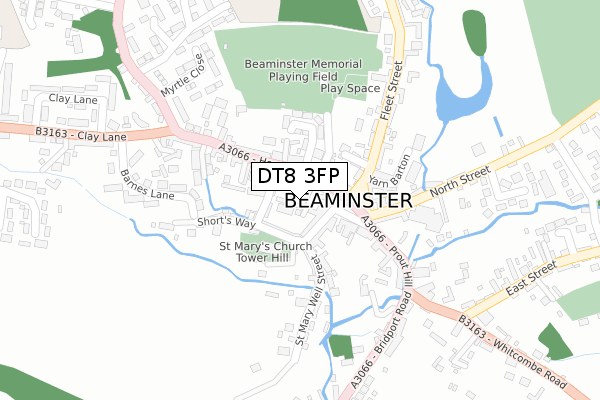
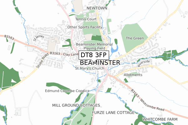
DT8 3FP is located in the Beaminster electoral ward, within the unitary authority of Dorset and the English Parliamentary constituency of West Dorset. The Sub Integrated Care Board (ICB) Location is NHS Dorset ICB - 11J and the police force is Dorset. This postcode has been in use since September 2019.


GetTheData
Source: OS Open Zoomstack (Ordnance Survey)
Licence: Open Government Licence (requires attribution)
Attribution: Contains OS data © Crown copyright and database right 2024
Source: Open Postcode Geo
Licence: Open Government Licence (requires attribution)
Attribution: Contains OS data © Crown copyright and database right 2024; Contains Royal Mail data © Royal Mail copyright and database right 2024; Source: Office for National Statistics licensed under the Open Government Licence v.3.0
| Easting | 347940 |
| Northing | 101316 |
| Latitude | 50.809035 |
| Longitude | -2.740238 |
GetTheData
Source: Open Postcode Geo
Licence: Open Government Licence
| Country | England |
| Postcode District | DT8 |
| ➜ DT8 open data dashboard ➜ See where DT8 is on a map ➜ Where is Beaminster? | |
GetTheData
Source: Land Registry Price Paid Data
Licence: Open Government Licence
| Ward | Beaminster |
| Constituency | West Dorset |
GetTheData
Source: ONS Postcode Database
Licence: Open Government Licence
2022 27 OCT £750,000 |
2020 22 MAY £575,000 |
9, FRANCIS MEWS, BEAMINSTER, DT8 3FP 2019 4 NOV £475,000 |
3 FRANCIS MEWS, HOGSHILL STREET, BEAMINSTER, DT8 3FP 2019 17 SEP £447,500 |
GetTheData
Source: HM Land Registry Price Paid Data
Licence: Contains HM Land Registry data © Crown copyright and database right 2024. This data is licensed under the Open Government Licence v3.0.
| October 2023 | Public order | On or near Parking Area | 91m |
| August 2023 | Anti-social behaviour | On or near Parking Area | 91m |
| June 2022 | Other theft | On or near Supermarket | 67m |
| ➜ Get more crime data in our Crime section | |||
GetTheData
Source: data.police.uk
Licence: Open Government Licence
| Red Lion | Beaminster | 108m |
| Red Lion (The Square) | Beaminster | 122m |
| The Fire Station (Clay Lane) | Beaminster | 330m |
| The Fire Station (Clay Lane) | Beaminster | 359m |
| North Street (Gerrards Green) | Beaminster | 527m |
GetTheData
Source: NaPTAN
Licence: Open Government Licence
GetTheData
Source: ONS Postcode Database
Licence: Open Government Licence


➜ Get more ratings from the Food Standards Agency
GetTheData
Source: Food Standards Agency
Licence: FSA terms & conditions
| Last Collection | |||
|---|---|---|---|
| Location | Mon-Fri | Sat | Distance |
| Fleet Street | 16:00 | 10:15 | 195m |
| Netherbury | 16:45 | 10:00 | 2,156m |
| Stoke Abbott | 16:00 | 08:00 | 2,787m |
GetTheData
Source: Dracos
Licence: Creative Commons Attribution-ShareAlike
| Facility | Distance |
|---|---|
| Beaminster Memorial Playing Fields Fleet Street, Beaminster Grass Pitches | 235m |
| Beaminster School Newtown, Beaminster Swimming Pool, Sports Hall, Grass Pitches, Health and Fitness Gym, Artificial Grass Pitch, Outdoor Tennis Courts | 623m |
| St Marys C Of E Academy Clay Lane, Beaminster Swimming Pool, Grass Pitches, Outdoor Tennis Courts | 630m |
GetTheData
Source: Active Places
Licence: Open Government Licence
| School | Phase of Education | Distance |
|---|---|---|
| Beaminster School Newtown, Beaminster, DT8 3EP | Secondary | 623m |
| Beaminster St Mary's Academy Clay Lane, Beaminster, DT8 3BY | Primary | 630m |
| Mountjoy School Tunnel Road, Beaminster, DT8 3HB | Not applicable | 1.3km |
GetTheData
Source: Edubase
Licence: Open Government Licence
The below table lists the International Territorial Level (ITL) codes (formerly Nomenclature of Territorial Units for Statistics (NUTS) codes) and Local Administrative Units (LAU) codes for DT8 3FP:
| ITL 1 Code | Name |
|---|---|
| TLK | South West (England) |
| ITL 2 Code | Name |
| TLK2 | Dorset and Somerset |
| ITL 3 Code | Name |
| TLK25 | Dorset |
| LAU 1 Code | Name |
| E06000059 | Dorset |
GetTheData
Source: ONS Postcode Directory
Licence: Open Government Licence
The below table lists the Census Output Area (OA), Lower Layer Super Output Area (LSOA), and Middle Layer Super Output Area (MSOA) for DT8 3FP:
| Code | Name | |
|---|---|---|
| OA | E00103897 | |
| LSOA | E01020495 | West Dorset 003B |
| MSOA | E02004271 | West Dorset 003 |
GetTheData
Source: ONS Postcode Directory
Licence: Open Government Licence
| DT8 3AZ | Church Street | 42m |
| DT8 3BE | Shadrack Street | 45m |
| DT8 3AE | Hogshill Street | 48m |
| DT8 3BA | Church Street | 50m |
| DT8 3AS | The Square | 52m |
| DT8 3AA | Hogshill Street | 97m |
| DT8 3AU | The Square | 97m |
| DT8 3AW | The Square | 99m |
| DT8 3BG | Shadrack Street | 104m |
| DT8 3AL | Champions Gardens | 122m |
GetTheData
Source: Open Postcode Geo; Land Registry Price Paid Data
Licence: Open Government Licence