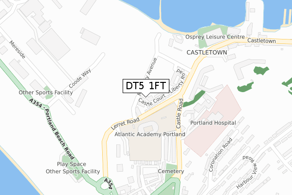
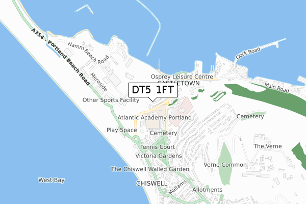
DT5 1FT is located in the Portland electoral ward, within the unitary authority of Dorset and the English Parliamentary constituency of South Dorset. The Sub Integrated Care Board (ICB) Location is NHS Dorset ICB - 11J and the police force is Dorset. This postcode has been in use since July 2018.


GetTheData
Source: OS Open Zoomstack (Ordnance Survey)
Licence: Open Government Licence (requires attribution)
Attribution: Contains OS data © Crown copyright and database right 2025
Source: Open Postcode Geo
Licence: Open Government Licence (requires attribution)
Attribution: Contains OS data © Crown copyright and database right 2025; Contains Royal Mail data © Royal Mail copyright and database right 2025; Source: Office for National Statistics licensed under the Open Government Licence v.3.0
| Easting | 368358 |
| Northing | 74167 |
| Latitude | 50.566377 |
| Longitude | -2.448128 |
GetTheData
Source: Open Postcode Geo
Licence: Open Government Licence
| Country | England |
| Postcode District | DT5 |
➜ See where DT5 is on a map ➜ Where is Fortuneswell? | |
GetTheData
Source: Land Registry Price Paid Data
Licence: Open Government Licence
| Ward | Portland |
| Constituency | South Dorset |
GetTheData
Source: ONS Postcode Database
Licence: Open Government Licence
2024 27 SEP £385,000 |
2023 2 MAR £335,000 |
12A, CASTLE COURT, MULBERRY AVENUE, PORTLAND, DT5 1FT 2021 31 MAR £298,000 |
18, CASTLE COURT, MULBERRY AVENUE, PORTLAND, DT5 1FT 2021 16 FEB £285,000 |
13, CASTLE COURT, MULBERRY AVENUE, PORTLAND, DT5 1FT 2020 21 DEC £315,000 |
19, CASTLE COURT, MULBERRY AVENUE, PORTLAND, DT5 1FT 2020 2 SEP £288,000 |
14, CASTLE COURT, MULBERRY AVENUE, PORTLAND, DT5 1FT 2019 26 SEP £228,500 |
2019 26 SEP £228,500 |
16, CASTLE COURT, MULBERRY AVENUE, PORTLAND, DT5 1FT 2019 26 SEP £228,500 |
17, CASTLE COURT, MULBERRY AVENUE, PORTLAND, DT5 1FT 2019 26 SEP £228,500 |
GetTheData
Source: HM Land Registry Price Paid Data
Licence: Contains HM Land Registry data © Crown copyright and database right 2025. This data is licensed under the Open Government Licence v3.0.
| Portland Castle (Liberty Road) | Castletown | 147m |
| Portland Castle (Mulberry Avenue) | Castletown | 158m |
| Portland Hospital (Castle Road) | Castletown | 191m |
| Portland Hospital (Castle Road) | Castletown | 197m |
| Lerrett Road | Castletown | 276m |
GetTheData
Source: NaPTAN
Licence: Open Government Licence
| Percentage of properties with Next Generation Access | 100.0% |
| Percentage of properties with Superfast Broadband | 100.0% |
| Percentage of properties with Ultrafast Broadband | 100.0% |
| Percentage of properties with Full Fibre Broadband | 100.0% |
Superfast Broadband is between 30Mbps and 300Mbps
Ultrafast Broadband is > 300Mbps
| Percentage of properties unable to receive 2Mbps | 0.0% |
| Percentage of properties unable to receive 5Mbps | 0.0% |
| Percentage of properties unable to receive 10Mbps | 0.0% |
| Percentage of properties unable to receive 30Mbps | 0.0% |
GetTheData
Source: Ofcom
Licence: Ofcom Terms of Use (requires attribution)
GetTheData
Source: ONS Postcode Database
Licence: Open Government Licence


➜ Get more ratings from the Food Standards Agency
GetTheData
Source: Food Standards Agency
Licence: FSA terms & conditions
| Last Collection | |||
|---|---|---|---|
| Location | Mon-Fri | Sat | Distance |
| Castletown P.o. | 16:00 | 12:00 | 299m |
| Verne Common | 16:15 | 11:15 | 361m |
| Little Ship | 17:30 | 12:00 | 457m |
GetTheData
Source: Dracos
Licence: Creative Commons Attribution-ShareAlike
| Risk of DT5 1FT flooding from rivers and sea | High |
| ➜ DT5 1FT flood map | |
GetTheData
Source: Open Flood Risk by Postcode
Licence: Open Government Licence
The below table lists the International Territorial Level (ITL) codes (formerly Nomenclature of Territorial Units for Statistics (NUTS) codes) and Local Administrative Units (LAU) codes for DT5 1FT:
| ITL 1 Code | Name |
|---|---|
| TLK | South West (England) |
| ITL 2 Code | Name |
| TLK2 | Dorset and Somerset |
| ITL 3 Code | Name |
| TLK25 | Dorset |
| LAU 1 Code | Name |
| E06000059 | Dorset |
GetTheData
Source: ONS Postcode Directory
Licence: Open Government Licence
The below table lists the Census Output Area (OA), Lower Layer Super Output Area (LSOA), and Middle Layer Super Output Area (MSOA) for DT5 1FT:
| Code | Name | |
|---|---|---|
| OA | E00104327 | |
| LSOA | E01033200 | Weymouth and Portland 008E |
| MSOA | E02004288 | Weymouth and Portland 008 |
GetTheData
Source: ONS Postcode Directory
Licence: Open Government Licence
| DT5 1FG | Sidon Mews | 183m |
| DT5 1BA | Foylebank Way | 197m |
| DT5 1FB | Ayton Drive | 200m |
| DT5 1DT | Ayton Drive | 211m |
| DT5 1EF | Ayton Drive | 211m |
| DT5 1FD | Mereside | 226m |
| DT5 1FH | Officers Field | 265m |
| DT5 1HA | Land Associated With | 289m |
| DT5 1EY | Coronation Road | 294m |
| DT5 1EZ | Coronation Road | 323m |
GetTheData
Source: Open Postcode Geo; Land Registry Price Paid Data
Licence: Open Government Licence