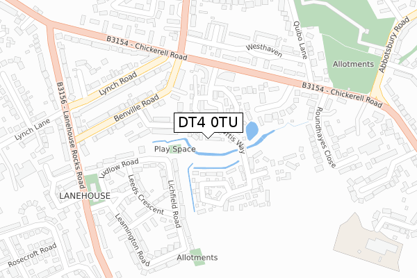
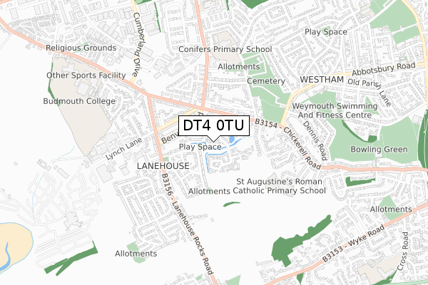
DT4 0TU is located in the Westham electoral ward, within the unitary authority of Dorset and the English Parliamentary constituency of South Dorset. The Sub Integrated Care Board (ICB) Location is NHS Dorset ICB - 11J and the police force is Dorset. This postcode has been in use since October 2018.


GetTheData
Source: OS Open Zoomstack (Ordnance Survey)
Licence: Open Government Licence (requires attribution)
Attribution: Contains OS data © Crown copyright and database right 2024
Source: Open Postcode Geo
Licence: Open Government Licence (requires attribution)
Attribution: Contains OS data © Crown copyright and database right 2024; Contains Royal Mail data © Royal Mail copyright and database right 2024; Source: Office for National Statistics licensed under the Open Government Licence v.3.0
| Easting | 366091 |
| Northing | 78769 |
| Latitude | 50.607634 |
| Longitude | -2.480558 |
GetTheData
Source: Open Postcode Geo
Licence: Open Government Licence
| Country | England |
| Postcode District | DT4 |
| ➜ DT4 open data dashboard ➜ See where DT4 is on a map ➜ Where is Weymouth? | |
GetTheData
Source: Land Registry Price Paid Data
Licence: Open Government Licence
| Ward | Westham |
| Constituency | South Dorset |
GetTheData
Source: ONS Postcode Database
Licence: Open Government Licence
8, MAY FARM WALK, WEYMOUTH, DT4 0TU 2019 22 MAR £275,000 |
GetTheData
Source: HM Land Registry Price Paid Data
Licence: Contains HM Land Registry data © Crown copyright and database right 2024. This data is licensed under the Open Government Licence v3.0.
| June 2022 | Violence and sexual offences | On or near Tollerdown Road | 130m |
| June 2022 | Criminal damage and arson | On or near Lichfield Road | 177m |
| June 2022 | Anti-social behaviour | On or near Lichfield Road | 177m |
| ➜ Get more crime data in our Crime section | |||
GetTheData
Source: data.police.uk
Licence: Open Government Licence
| Benville Road | Lanehouse | 150m |
| Fiveways | Lanehouse | 191m |
| Liverpool Road (Leeds Crescent) | Lanehouse | 206m |
| Ludlow Road | Lanehouse | 225m |
| Fiveways (Radipole Lane) | Lanehouse | 257m |
| Weymouth Station | 2km |
| Upwey Station | 4.6km |
GetTheData
Source: NaPTAN
Licence: Open Government Licence
➜ Broadband speed and availability dashboard for DT4 0TU
| Percentage of properties with Next Generation Access | 100.0% |
| Percentage of properties with Superfast Broadband | 100.0% |
| Percentage of properties with Ultrafast Broadband | 0.0% |
| Percentage of properties with Full Fibre Broadband | 0.0% |
Superfast Broadband is between 30Mbps and 300Mbps
Ultrafast Broadband is > 300Mbps
| Median download speed | 39.1Mbps |
| Average download speed | 33.3Mbps |
| Maximum download speed | 44.47Mbps |
| Median upload speed | 6.4Mbps |
| Average upload speed | 5.4Mbps |
| Maximum upload speed | 6.71Mbps |
| Percentage of properties unable to receive 2Mbps | 0.0% |
| Percentage of properties unable to receive 5Mbps | 0.0% |
| Percentage of properties unable to receive 10Mbps | 0.0% |
| Percentage of properties unable to receive 30Mbps | 0.0% |
➜ Broadband speed and availability dashboard for DT4 0TU
GetTheData
Source: Ofcom
Licence: Ofcom Terms of Use (requires attribution)
GetTheData
Source: ONS Postcode Database
Licence: Open Government Licence


➜ Get more ratings from the Food Standards Agency
GetTheData
Source: Food Standards Agency
Licence: FSA terms & conditions
| Last Collection | |||
|---|---|---|---|
| Location | Mon-Fri | Sat | Distance |
| Westham P.o. | 17:30 | 12:00 | 388m |
| Littlesea Estate | 17:30 | 12:00 | 481m |
| Dennis Road | 17:30 | 12:00 | 691m |
GetTheData
Source: Dracos
Licence: Creative Commons Attribution-ShareAlike
| Facility | Distance |
|---|---|
| St Augustines Catholic Primary School Hardy Avenue, Weymouth Grass Pitches | 489m |
| Conifers Primary School Radipole Lane, Weymouth Grass Pitches | 573m |
| Weymouth Swimming And Fitness Centre Knightsdale Road, Weymouth Swimming Pool, Health and Fitness Gym, Studio | 736m |
GetTheData
Source: Active Places
Licence: Open Government Licence
| School | Phase of Education | Distance |
|---|---|---|
| The Compass 307a Chickerell Road, Westham, Weymouth, DT4 0QU | Not applicable | 430m |
| St Augustine's Catholic Primary School, Weymouth Hardy Avenue, Weymouth, DT4 0RH | Primary | 489m |
| Conifers Primary School Radipole Lane, Weymouth, DT4 0QF | Primary | 543m |
GetTheData
Source: Edubase
Licence: Open Government Licence
The below table lists the International Territorial Level (ITL) codes (formerly Nomenclature of Territorial Units for Statistics (NUTS) codes) and Local Administrative Units (LAU) codes for DT4 0TU:
| ITL 1 Code | Name |
|---|---|
| TLK | South West (England) |
| ITL 2 Code | Name |
| TLK2 | Dorset and Somerset |
| ITL 3 Code | Name |
| TLK25 | Dorset |
| LAU 1 Code | Name |
| E06000059 | Dorset |
GetTheData
Source: ONS Postcode Directory
Licence: Open Government Licence
The below table lists the Census Output Area (OA), Lower Layer Super Output Area (LSOA), and Middle Layer Super Output Area (MSOA) for DT4 0TU:
| Code | Name | |
|---|---|---|
| OA | E00104386 | |
| LSOA | E01020577 | Weymouth and Portland 005C |
| MSOA | E02004285 | Weymouth and Portland 005 |
GetTheData
Source: ONS Postcode Directory
Licence: Open Government Licence
| DT4 0SQ | Tollerdown Road | 115m |
| DT4 0HE | Lichfield Road | 123m |
| DT4 0HD | Ludlow Road | 161m |
| DT4 0RW | Westdowne Close | 162m |
| DT4 0RA | Chickerell Road | 190m |
| DT4 0HG | Leeds Crescent | 199m |
| DT4 0RE | Chickerell Road | 202m |
| DT4 0SG | Benville Road | 208m |
| DT4 0HF | Lichfield Road | 223m |
| DT4 0SJ | Lynch Road | 232m |
GetTheData
Source: Open Postcode Geo; Land Registry Price Paid Data
Licence: Open Government Licence