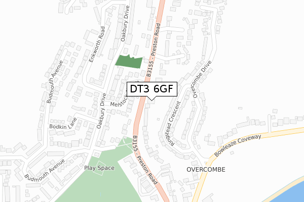
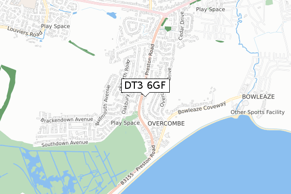
DT3 6GF is located in the Littlemoor & Preston electoral ward, within the unitary authority of Dorset and the English Parliamentary constituency of South Dorset. The Sub Integrated Care Board (ICB) Location is NHS Dorset ICB - 11J and the police force is Dorset. This postcode has been in use since July 2019.


GetTheData
Source: OS Open Zoomstack (Ordnance Survey)
Licence: Open Government Licence (requires attribution)
Attribution: Contains OS data © Crown copyright and database right 2024
Source: Open Postcode Geo
Licence: Open Government Licence (requires attribution)
Attribution: Contains OS data © Crown copyright and database right 2024; Contains Royal Mail data © Royal Mail copyright and database right 2024; Source: Office for National Statistics licensed under the Open Government Licence v.3.0
| Easting | 369520 |
| Northing | 82074 |
| Latitude | 50.637544 |
| Longitude | -2.432374 |
GetTheData
Source: Open Postcode Geo
Licence: Open Government Licence
| Country | England |
| Postcode District | DT3 |
| ➜ DT3 open data dashboard ➜ See where DT3 is on a map ➜ Where is Weymouth? | |
GetTheData
Source: Land Registry Price Paid Data
Licence: Open Government Licence
| Ward | Littlemoor & Preston |
| Constituency | South Dorset |
GetTheData
Source: ONS Postcode Database
Licence: Open Government Licence
| November 2023 | Violence and sexual offences | On or near Parking Area | 461m |
| October 2023 | Anti-social behaviour | On or near Parking Area | 461m |
| August 2023 | Violence and sexual offences | On or near Preston Road | 329m |
| ➜ Get more crime data in our Crime section | |||
GetTheData
Source: data.police.uk
Licence: Open Government Licence
| Melstock Avenue | Overcombe | 114m |
| Melstock Avenue (Oakbury Drive) | Overcombe | 124m |
| Melstock Avenue (Preston Road) | Overcombe | 124m |
| Melstock Avenue (Preston Road) | Overcombe | 129m |
| Eadon Close (Oakbury Drive) | Overcombe | 180m |
| Upwey Station | 2.7km |
| Weymouth Station | 2.9km |
GetTheData
Source: NaPTAN
Licence: Open Government Licence
GetTheData
Source: ONS Postcode Database
Licence: Open Government Licence


➜ Get more ratings from the Food Standards Agency
GetTheData
Source: Food Standards Agency
Licence: FSA terms & conditions
| Last Collection | |||
|---|---|---|---|
| Location | Mon-Fri | Sat | Distance |
| Oakbury Drive | 17:15 | 12:00 | 157m |
| Overcombe P.o. | 16:30 | 12:00 | 440m |
| Buddleia Close | 17:00 | 09:00 | 1,115m |
GetTheData
Source: Dracos
Licence: Creative Commons Attribution-ShareAlike
| Facility | Distance |
|---|---|
| Riviera Hotel Weymouth Bowleaze Coveway, Weymouth Health and Fitness Gym, Swimming Pool | 1km |
| Westfield Arts College Littlemoor Road, Weymouth Sports Hall, Health and Fitness Gym, Grass Pitches | 1km |
| Bincombe Valley Primary School Culliford Way, Littlemoor, Weymouth Grass Pitches | 1.4km |
GetTheData
Source: Active Places
Licence: Open Government Licence
| School | Phase of Education | Distance |
|---|---|---|
| St Andrew's Church of England Primary School Littlemoor Road, Preston, Weymouth, DT3 6AA | Primary | 843m |
| Westfield Arts College Littlemoor Road, Preston, Weymouth, DT3 6AA | Not applicable | 1km |
| Bincombe Valley Primary School Culliford Way, Littlemoor, Weymouth, DT3 6AW | Primary | 1.4km |
GetTheData
Source: Edubase
Licence: Open Government Licence
The below table lists the International Territorial Level (ITL) codes (formerly Nomenclature of Territorial Units for Statistics (NUTS) codes) and Local Administrative Units (LAU) codes for DT3 6GF:
| ITL 1 Code | Name |
|---|---|
| TLK | South West (England) |
| ITL 2 Code | Name |
| TLK2 | Dorset and Somerset |
| ITL 3 Code | Name |
| TLK25 | Dorset |
| LAU 1 Code | Name |
| E06000059 | Dorset |
GetTheData
Source: ONS Postcode Directory
Licence: Open Government Licence
The below table lists the Census Output Area (OA), Lower Layer Super Output Area (LSOA), and Middle Layer Super Output Area (MSOA) for DT3 6GF:
| Code | Name | |
|---|---|---|
| OA | E00104267 | |
| LSOA | E01020557 | Weymouth and Portland 002A |
| MSOA | E02004282 | Weymouth and Portland 002 |
GetTheData
Source: ONS Postcode Directory
Licence: Open Government Licence
| DT3 6PT | Ringstead Crescent | 105m |
| DT3 6JX | Melstock Avenue | 107m |
| DT3 6FU | Preston Road | 108m |
| DT3 6QE | Overcombe Drive | 140m |
| DT3 6JE | Oakbury Drive | 144m |
| DT3 6PZ | Preston Road | 170m |
| DT3 6JF | Oakbury Drive | 182m |
| DT3 6JU | Eadon Close | 184m |
| DT3 6JG | Oakbury Drive | 192m |
| DT3 6QB | Sunningdale Rise | 196m |
GetTheData
Source: Open Postcode Geo; Land Registry Price Paid Data
Licence: Open Government Licence