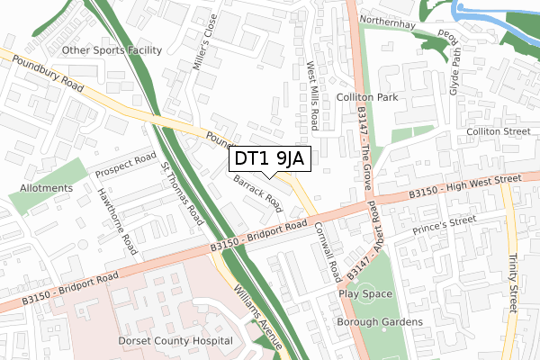
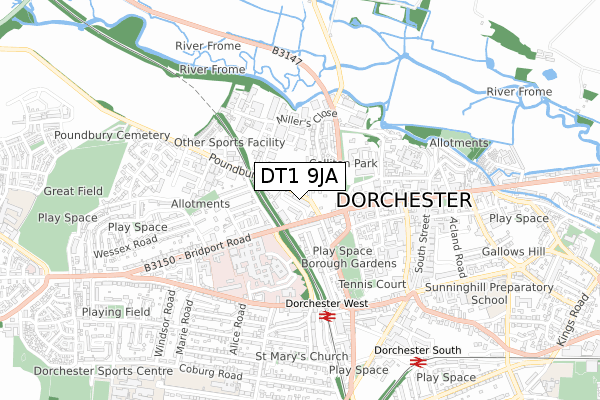
DT1 9JA is located in the Dorchester West electoral ward, within the unitary authority of Dorset and the English Parliamentary constituency of West Dorset. The Sub Integrated Care Board (ICB) Location is NHS Dorset ICB - 11J and the police force is Dorset. This postcode has been in use since September 2019.


GetTheData
Source: OS Open Zoomstack (Ordnance Survey)
Licence: Open Government Licence (requires attribution)
Attribution: Contains OS data © Crown copyright and database right 2024
Source: Open Postcode Geo
Licence: Open Government Licence (requires attribution)
Attribution: Contains OS data © Crown copyright and database right 2024; Contains Royal Mail data © Royal Mail copyright and database right 2024; Source: Office for National Statistics licensed under the Open Government Licence v.3.0
| Easting | 368730 |
| Northing | 90722 |
| Latitude | 50.715270 |
| Longitude | -2.444279 |
GetTheData
Source: Open Postcode Geo
Licence: Open Government Licence
| Country | England |
| Postcode District | DT1 |
| ➜ DT1 open data dashboard ➜ See where DT1 is on a map ➜ Where is Dorchester? | |
GetTheData
Source: Land Registry Price Paid Data
Licence: Open Government Licence
| Ward | Dorchester West |
| Constituency | West Dorset |
GetTheData
Source: ONS Postcode Database
Licence: Open Government Licence
| January 2024 | Public order | On or near Parking Area | 115m |
| November 2023 | Anti-social behaviour | On or near Parking Area | 115m |
| October 2023 | Criminal damage and arson | On or near Parking Area | 115m |
| ➜ Get more crime data in our Crime section | |||
GetTheData
Source: data.police.uk
Licence: Open Government Licence
| Dorset County Hospital | Dorchester | 212m |
| Top O Town (High West Street) | Dorchester | 236m |
| Top O Town (High West Street) | Dorchester | 251m |
| Williams Avenue | Dorchester | 287m |
| Dorset County Hospital (Bridport Road) | Dorchester | 306m |
| Dorchester West Station | 0.5km |
| Dorchester South Station | 0.8km |
GetTheData
Source: NaPTAN
Licence: Open Government Licence
GetTheData
Source: ONS Postcode Database
Licence: Open Government Licence


➜ Get more ratings from the Food Standards Agency
GetTheData
Source: Food Standards Agency
Licence: FSA terms & conditions
| Last Collection | |||
|---|---|---|---|
| Location | Mon-Fri | Sat | Distance |
| Celtic Crescent | 17:30 | 11:30 | 201m |
| Dorchester Delivery Office | 18:30 | 13:00 | 214m |
| High West Street | 17:30 | 11:30 | 262m |
GetTheData
Source: Dracos
Licence: Creative Commons Attribution-ShareAlike
| Facility | Distance |
|---|---|
| Physiques & Shapes Health Club The Grove, Dorchester Health and Fitness Gym, Studio | 194m |
| Dorchester Health Club (Closed) Somerleigh Road, Dorchester Health and Fitness Gym, Studio | 324m |
| Borough Gardens Cornwall Road, Dorchester Outdoor Tennis Courts | 416m |
GetTheData
Source: Active Places
Licence: Open Government Licence
| School | Phase of Education | Distance |
|---|---|---|
| Dorchester Middle School Queen's Avenue, Dorchester, DT1 2HS | Middle deemed secondary | 844m |
| Sunninghill Preparatory School South Court, South Walks, Dorchester, DT1 1EB | Not applicable | 891m |
| The Thomas Hardye School Queen's Avenue, Dorchester, DT1 2ET | Secondary | 1km |
GetTheData
Source: Edubase
Licence: Open Government Licence
The below table lists the International Territorial Level (ITL) codes (formerly Nomenclature of Territorial Units for Statistics (NUTS) codes) and Local Administrative Units (LAU) codes for DT1 9JA:
| ITL 1 Code | Name |
|---|---|
| TLK | South West (England) |
| ITL 2 Code | Name |
| TLK2 | Dorset and Somerset |
| ITL 3 Code | Name |
| TLK25 | Dorset |
| LAU 1 Code | Name |
| E06000059 | Dorset |
GetTheData
Source: ONS Postcode Directory
Licence: Open Government Licence
The below table lists the Census Output Area (OA), Lower Layer Super Output Area (LSOA), and Middle Layer Super Output Area (MSOA) for DT1 9JA:
| Code | Name | |
|---|---|---|
| OA | E00104064 | |
| LSOA | E01032643 | West Dorset 009G |
| MSOA | E02004277 | West Dorset 009 |
GetTheData
Source: ONS Postcode Directory
Licence: Open Government Licence
| DT1 1RS | Bridport Road | 110m |
| DT1 1AH | Little Keep Gate | 153m |
| DT1 1RR | Bridport Road | 157m |
| DT1 1RY | Cornwall Road | 163m |
| DT1 1XR | The Grove | 164m |
| DT1 2PA | St Thomas Road | 169m |
| DT1 1TD | The Grove | 173m |
| DT1 1SD | St Helens Road | 178m |
| DT1 1SP | West Mills Road | 186m |
| DT1 1SF | Albert Road | 212m |
GetTheData
Source: Open Postcode Geo; Land Registry Price Paid Data
Licence: Open Government Licence