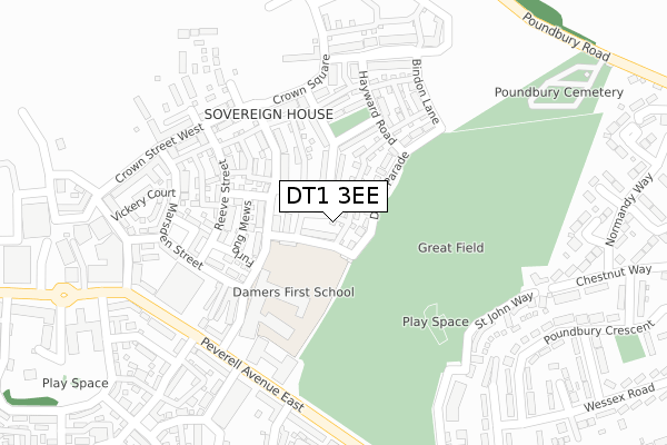
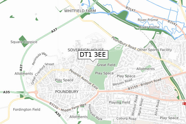
DT1 3EE is located in the Dorchester Poundbury electoral ward, within the unitary authority of Dorset and the English Parliamentary constituency of West Dorset. The Sub Integrated Care Board (ICB) Location is NHS Dorset ICB - 11J and the police force is Dorset. This postcode has been in use since February 2018.


GetTheData
Source: OS Open Zoomstack (Ordnance Survey)
Licence: Open Government Licence (requires attribution)
Attribution: Contains OS data © Crown copyright and database right 2024
Source: Open Postcode Geo
Licence: Open Government Licence (requires attribution)
Attribution: Contains OS data © Crown copyright and database right 2024; Contains Royal Mail data © Royal Mail copyright and database right 2024; Source: Office for National Statistics licensed under the Open Government Licence v.3.0
| Easting | 367608 |
| Northing | 90798 |
| Latitude | 50.715892 |
| Longitude | -2.460178 |
GetTheData
Source: Open Postcode Geo
Licence: Open Government Licence
| Country | England |
| Postcode District | DT1 |
| ➜ DT1 open data dashboard ➜ See where DT1 is on a map ➜ Where is Dorchester? | |
GetTheData
Source: Land Registry Price Paid Data
Licence: Open Government Licence
| Ward | Dorchester Poundbury |
| Constituency | West Dorset |
GetTheData
Source: ONS Postcode Database
Licence: Open Government Licence
1, SHUFFLING FURLONG, POUNDBURY, DORCHESTER, DT1 3EE 2017 20 OCT £399,950 |
GetTheData
Source: HM Land Registry Price Paid Data
Licence: Contains HM Land Registry data © Crown copyright and database right 2024. This data is licensed under the Open Government Licence v3.0.
| April 2023 | Violence and sexual offences | On or near Malta Close | 469m |
| February 2023 | Anti-social behaviour | On or near Malta Close | 469m |
| July 2022 | Other theft | On or near Monnington Lane | 334m |
| ➜ Get more crime data in our Crime section | |||
GetTheData
Source: data.police.uk
Licence: Open Government Licence
| Peverill Avenue East (Peverell Avenue East) | Poundbury | 247m |
| Peverill Avenue East (Peverell Avenue East) | Poundbury | 263m |
| Queen Mother Square (Peverill Avenue West) | Poundbury | 331m |
| Mansell Square | Poundbury | 404m |
| Mansell Square | Poundbury | 423m |
| Dorchester West Station | 1.4km |
| Dorchester South Station | 1.8km |
GetTheData
Source: NaPTAN
Licence: Open Government Licence
| Percentage of properties with Next Generation Access | 100.0% |
| Percentage of properties with Superfast Broadband | 100.0% |
| Percentage of properties with Ultrafast Broadband | 100.0% |
| Percentage of properties with Full Fibre Broadband | 100.0% |
Superfast Broadband is between 30Mbps and 300Mbps
Ultrafast Broadband is > 300Mbps
| Percentage of properties unable to receive 2Mbps | 0.0% |
| Percentage of properties unable to receive 5Mbps | 0.0% |
| Percentage of properties unable to receive 10Mbps | 0.0% |
| Percentage of properties unable to receive 30Mbps | 0.0% |
GetTheData
Source: Ofcom
Licence: Ofcom Terms of Use (requires attribution)
GetTheData
Source: ONS Postcode Database
Licence: Open Government Licence


➜ Get more ratings from the Food Standards Agency
GetTheData
Source: Food Standards Agency
Licence: FSA terms & conditions
| Last Collection | |||
|---|---|---|---|
| Location | Mon-Fri | Sat | Distance |
| Poundbury | 17:00 | 11:00 | 590m |
| Victoria Park | 17:15 | 11:30 | 1,157m |
| Celtic Crescent | 17:30 | 11:30 | 1,200m |
GetTheData
Source: Dracos
Licence: Creative Commons Attribution-ShareAlike
| Facility | Distance |
|---|---|
| Great Field (Closed) Peverell Avenue East, Poundbury, Dorchester Grass Pitches | 242m |
| 1610 Dorchester Sports Centre Coburg Road, Dorchester Swimming Pool, Health and Fitness Gym, Studio, Artificial Grass Pitch | 840m |
| Dorchester Rfc Coburg Road, Dorchester Grass Pitches | 881m |
GetTheData
Source: Active Places
Licence: Open Government Licence
| School | Phase of Education | Distance |
|---|---|---|
| Damers First School Liscombe Street, Poundbury, Dorchester, DT1 3DF | Primary | 109m |
| The Thomas Hardye School Queen's Avenue, Dorchester, DT1 2ET | Secondary | 952m |
| Dorchester Middle School Queen's Avenue, Dorchester, DT1 2HS | Middle deemed secondary | 1.2km |
GetTheData
Source: Edubase
Licence: Open Government Licence
The below table lists the International Territorial Level (ITL) codes (formerly Nomenclature of Territorial Units for Statistics (NUTS) codes) and Local Administrative Units (LAU) codes for DT1 3EE:
| ITL 1 Code | Name |
|---|---|
| TLK | South West (England) |
| ITL 2 Code | Name |
| TLK2 | Dorset and Somerset |
| ITL 3 Code | Name |
| TLK25 | Dorset |
| LAU 1 Code | Name |
| E06000059 | Dorset |
GetTheData
Source: ONS Postcode Directory
Licence: Open Government Licence
The below table lists the Census Output Area (OA), Lower Layer Super Output Area (LSOA), and Middle Layer Super Output Area (MSOA) for DT1 3EE:
| Code | Name | |
|---|---|---|
| OA | E00166096 | |
| LSOA | E01032641 | West Dorset 009F |
| MSOA | E02004277 | West Dorset 009 |
GetTheData
Source: ONS Postcode Directory
Licence: Open Government Licence
| DT1 3DF | Liscombe Street | 110m |
| DT1 3DR | Furlong Mews | 154m |
| DT1 3DB | Reeve Street | 176m |
| DT1 3DH | Marsden Street | 218m |
| DT1 3DN | Harptree Court | 221m |
| DT1 3WE | Peverell Avenue East | 253m |
| DT1 3RH | Peverell Avenue East | 280m |
| DT1 3WY | Peverell Avenue East | 287m |
| DT1 3DJ | Hamslade Court | 299m |
| DT1 3WW | Highdown Avenue | 307m |
GetTheData
Source: Open Postcode Geo; Land Registry Price Paid Data
Licence: Open Government Licence