Property/Postcode Data Search:
DN8 5FG maps, stats, and open data
DN8 5FG is located in the Hatfield electoral ward, within the metropolitan district of Doncaster and the English Parliamentary constituency of Don Valley. The Sub Integrated Care Board (ICB) Location is NHS South Yorkshire ICB - 02X and the police force is South Yorkshire. This postcode has been in use since September 2019.
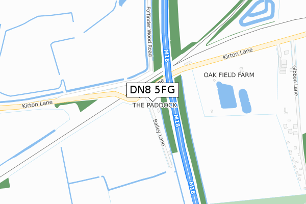
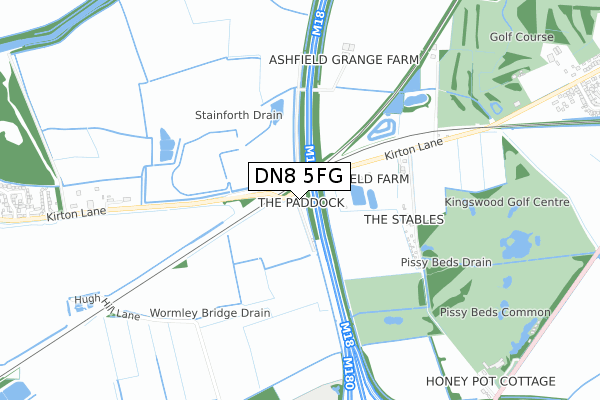
DN8 5FG maps


Source: OS Open Zoomstack (Ordnance Survey)
Licence: Open Government Licence (requires attribution)
Attribution: Contains OS data © Crown copyright and database right 2025
Source: Open Postcode Geo
Licence: Open Government Licence (requires attribution)
Attribution: Contains OS data © Crown copyright and database right 2025; Contains Royal Mail data © Royal Mail copyright and database right 2025; Source: Office for National Statistics licensed under the Open Government Licence v.3.0
Licence: Open Government Licence (requires attribution)
Attribution: Contains OS data © Crown copyright and database right 2025
Source: Open Postcode Geo
Licence: Open Government Licence (requires attribution)
Attribution: Contains OS data © Crown copyright and database right 2025; Contains Royal Mail data © Royal Mail copyright and database right 2025; Source: Office for National Statistics licensed under the Open Government Licence v.3.0
DN8 5FG geodata
| Easting | 466845 |
| Northing | 411936 |
| Latitude | 53.599758 |
| Longitude | -0.991394 |
Where is DN8 5FG?
| Country | England |
| Postcode District | DN8 |
Politics
| Ward | Hatfield |
|---|---|
| Constituency | Don Valley |
Transport
Nearest bus stops to DN8 5FG
| Ashfields (Kirton Lane) | Stainforth | 346m |
| Ashfields (Kirton Lane) | Stainforth | 350m |
| Gibbons Lane (Kirton Lane) | Thorne | 496m |
| Gibbon Lane (Kirton Lane) | Thorne | 498m |
| Gibbons Lane (Kirton Lane) | Thorne | 1,008m |
Nearest railway stations to DN8 5FG
| Thorne North Station | 2.2km |
| Thorne South Station | 2.4km |
| Hatfield & Stainforth Station | 2.4km |
Deprivation
81.3% of English postcodes are less deprived than DN8 5FG:Food Standards Agency
Three nearest food hygiene ratings to DN8 5FG (metres)
Kingswood Catering

Kingswood Golf Course
1,048m
Thorne Golf Club

Kirton Lane
1,420m
McDonalds Restaurants

Quora Retail Park
1,702m
➜ Get more ratings from the Food Standards Agency
Nearest post box to DN8 5FG
| Last Collection | |||
|---|---|---|---|
| Location | Mon-Fri | Sat | Distance |
| Old Village P.o. | 16:45 | 10:00 | 1,437m |
| Thorne Road | 16:00 | 07:30 | 1,491m |
| Kirton Lane | 17:00 | 09:45 | 1,735m |
Environment
| Risk of DN8 5FG flooding from rivers and sea | Medium |
DN8 5FG ITL and DN8 5FG LAU
The below table lists the International Territorial Level (ITL) codes (formerly Nomenclature of Territorial Units for Statistics (NUTS) codes) and Local Administrative Units (LAU) codes for DN8 5FG:
| ITL 1 Code | Name |
|---|---|
| TLE | Yorkshire and The Humber |
| ITL 2 Code | Name |
| TLE3 | South Yorkshire |
| ITL 3 Code | Name |
| TLE31 | Barnsley, Doncaster and Rotherham |
| LAU 1 Code | Name |
| E08000017 | Doncaster |
DN8 5FG census areas
The below table lists the Census Output Area (OA), Lower Layer Super Output Area (LSOA), and Middle Layer Super Output Area (MSOA) for DN8 5FG:
| Code | Name | |
|---|---|---|
| OA | E00038290 | |
| LSOA | E01007559 | Doncaster 008D |
| MSOA | E02001546 | Doncaster 008 |
Nearest postcodes to DN8 5FG
| DN8 5RQ | Kirton Lane | 452m |
| DN7 6EP | Thorne Road | 1039m |
| DN7 5BX | Mayfield Avenue | 1082m |
| DN7 5BH | Watsons Croft | 1141m |
| DN7 5TR | Moira Close | 1142m |
| DN7 5BT | Kirton Lane | 1180m |
| DN7 5BU | Main View | 1211m |
| DN8 5RG | Kirton Lane | 1215m |
| DN8 5YL | Grampian Way | 1259m |
| DN7 5BS | Ellesmere Grove | 1285m |