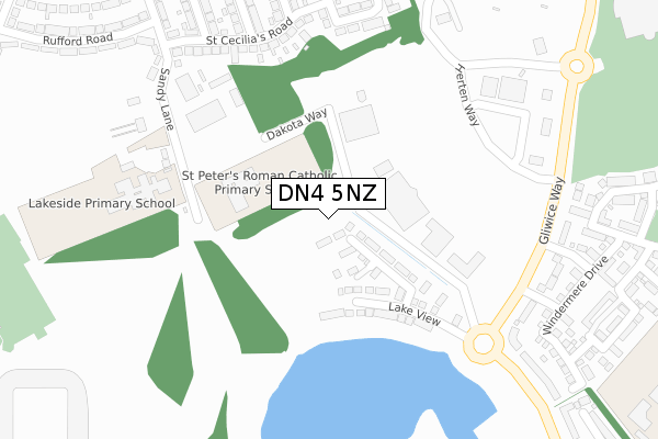
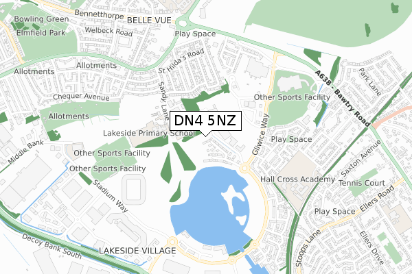
DN4 5NZ is located in the Town electoral ward, within the metropolitan district of Doncaster and the English Parliamentary constituency of Doncaster Central. The Sub Integrated Care Board (ICB) Location is NHS South Yorkshire ICB - 02X and the police force is South Yorkshire. This postcode has been in use since July 2019.


GetTheData
Source: OS Open Zoomstack (Ordnance Survey)
Licence: Open Government Licence (requires attribution)
Attribution: Contains OS data © Crown copyright and database right 2024
Source: Open Postcode Geo
Licence: Open Government Licence (requires attribution)
Attribution: Contains OS data © Crown copyright and database right 2024; Contains Royal Mail data © Royal Mail copyright and database right 2024; Source: Office for National Statistics licensed under the Open Government Licence v.3.0
| Easting | 459248 |
| Northing | 402116 |
| Latitude | 53.512416 |
| Longitude | -1.108030 |
GetTheData
Source: Open Postcode Geo
Licence: Open Government Licence
| Country | England |
| Postcode District | DN4 |
| ➜ DN4 open data dashboard ➜ See where DN4 is on a map ➜ Where is Doncaster? | |
GetTheData
Source: Land Registry Price Paid Data
Licence: Open Government Licence
| Ward | Town |
| Constituency | Doncaster Central |
GetTheData
Source: ONS Postcode Database
Licence: Open Government Licence
41, BLACKBERRY ROAD, DONCASTER, DN4 5NZ 2021 19 NOV £242,495 |
1, BLACKBERRY ROAD, DONCASTER, DN4 5NZ 2021 16 APR £239,495 |
GetTheData
Source: HM Land Registry Price Paid Data
Licence: Contains HM Land Registry data © Crown copyright and database right 2024. This data is licensed under the Open Government Licence v3.0.
| June 2022 | Burglary | On or near Sandy Lane | 150m |
| June 2022 | Violence and sexual offences | On or near Sandy Lane | 150m |
| June 2022 | Violence and sexual offences | On or near Sandy Lane | 150m |
| ➜ Get more crime data in our Crime section | |||
GetTheData
Source: data.police.uk
Licence: Open Government Licence
| St Peters School (Sandy Lane) | Hyde Park | 132m |
| Vue Cinema (Gliwice Way) | Belle Vue | 399m |
| Elter Drive (Gliwice Way) | Belle Vue | 423m |
| Langsett Court (Lakeside Boulevard) | Lakeside | 517m |
| Langsett Court (Lakeside Boulevard) | Lakeside | 542m |
| Doncaster Station | 2.4km |
| Bentley (S Yorks) Station | 4.5km |
GetTheData
Source: NaPTAN
Licence: Open Government Licence
GetTheData
Source: ONS Postcode Database
Licence: Open Government Licence


➜ Get more ratings from the Food Standards Agency
GetTheData
Source: Food Standards Agency
Licence: FSA terms & conditions
| Last Collection | |||
|---|---|---|---|
| Location | Mon-Fri | Sat | Distance |
| Belle Vue Post Office | 18:30 | 12:00 | 520m |
| Asda, Bawtry Road | 17:45 | 12:00 | 548m |
| Lakeside Boulevard | 18:45 | 12:15 | 577m |
GetTheData
Source: Dracos
Licence: Creative Commons Attribution-ShareAlike
| Facility | Distance |
|---|---|
| Lakeside Primary Academy Sandy Lane, Doncaster Grass Pitches, Sports Hall | 226m |
| Eco-power Stadium Stadium Way, Doncaster Artificial Grass Pitch, Athletics, Grass Pitches, Sports Hall | 415m |
| Fitness Village (Stadium) Stadium Way, Doncaster Health and Fitness Gym, Studio | 422m |
GetTheData
Source: Active Places
Licence: Open Government Licence
| School | Phase of Education | Distance |
|---|---|---|
| St Peter's Catholic Primary School Sandy Lane, St Peter's Catholic Primary School, Doncaster, DN4 5EP | Primary | 116m |
| Lakeside Primary Academy Sandy Lane, Doncaster, DN4 5ES | Primary | 226m |
| XP East Middle Bank, Doncaster, DN4 5NG | Secondary | 617m |
GetTheData
Source: Edubase
Licence: Open Government Licence
The below table lists the International Territorial Level (ITL) codes (formerly Nomenclature of Territorial Units for Statistics (NUTS) codes) and Local Administrative Units (LAU) codes for DN4 5NZ:
| ITL 1 Code | Name |
|---|---|
| TLE | Yorkshire and The Humber |
| ITL 2 Code | Name |
| TLE3 | South Yorkshire |
| ITL 3 Code | Name |
| TLE31 | Barnsley, Doncaster and Rotherham |
| LAU 1 Code | Name |
| E08000017 | Doncaster |
GetTheData
Source: ONS Postcode Directory
Licence: Open Government Licence
The below table lists the Census Output Area (OA), Lower Layer Super Output Area (LSOA), and Middle Layer Super Output Area (MSOA) for DN4 5NZ:
| Code | Name | |
|---|---|---|
| OA | E00038111 | |
| LSOA | E01007527 | Doncaster 027B |
| MSOA | E02001565 | Doncaster 027 |
GetTheData
Source: ONS Postcode Directory
Licence: Open Government Licence
| DN4 5EG | St Cecilias Road | 293m |
| DN4 5ES | Sandy Lane | 319m |
| DN4 5EN | St Cecilias Road | 327m |
| DN4 5EB | St Ursulas Road | 340m |
| DN4 5EW | St Cecilias Road | 346m |
| DN4 5EL | St Margarets Road | 390m |
| DN4 5EQ | St Helens Road | 393m |
| DN4 5QB | Gliwice Way | 414m |
| DN4 5EF | St Agnes Road | 416m |
| DN4 5ET | Sandy Lane | 417m |
GetTheData
Source: Open Postcode Geo; Land Registry Price Paid Data
Licence: Open Government Licence