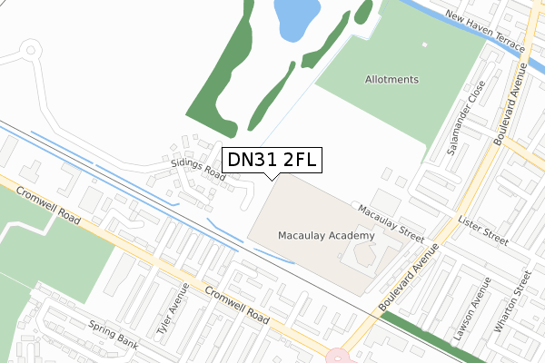
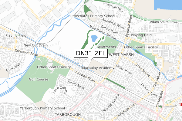
DN31 2FL is located in the West Marsh electoral ward, within the unitary authority of North East Lincolnshire and the English Parliamentary constituency of Great Grimsby. The Sub Integrated Care Board (ICB) Location is NHS Humber and North Yorkshire ICB - 03H and the police force is Humberside. This postcode has been in use since March 2019.


GetTheData
Source: OS Open Zoomstack (Ordnance Survey)
Licence: Open Government Licence (requires attribution)
Attribution: Contains OS data © Crown copyright and database right 2025
Source: Open Postcode Geo
Licence: Open Government Licence (requires attribution)
Attribution: Contains OS data © Crown copyright and database right 2025; Contains Royal Mail data © Royal Mail copyright and database right 2025; Source: Office for National Statistics licensed under the Open Government Licence v.3.0
| Easting | 525577 |
| Northing | 409735 |
| Latitude | 53.569224 |
| Longitude | -0.105198 |
GetTheData
Source: Open Postcode Geo
Licence: Open Government Licence
| Country | England |
| Postcode District | DN31 |
➜ See where DN31 is on a map ➜ Where is Grimsby? | |
GetTheData
Source: Land Registry Price Paid Data
Licence: Open Government Licence
| Ward | West Marsh |
| Constituency | Great Grimsby |
GetTheData
Source: ONS Postcode Database
Licence: Open Government Licence
27, ALEXANDRA CLOSE, GRIMSBY, DN31 2FL 2024 28 JUN £217,495 |
29, ALEXANDRA CLOSE, GRIMSBY, DN31 2FL 2024 28 JUN £192,495 |
25, ALEXANDRA CLOSE, GRIMSBY, DN31 2FL 2024 28 JUN £157,726 |
23, ALEXANDRA CLOSE, GRIMSBY, DN31 2FL 2024 28 JUN £165,358 |
33, ALEXANDRA CLOSE, GRIMSBY, DN31 2FL 2024 28 JUN £160,818 |
31, ALEXANDRA CLOSE, GRIMSBY, DN31 2FL 2024 28 JUN £156,797 |
35, ALEXANDRA CLOSE, GRIMSBY, DN31 2FL 2024 28 JUN £157,601 |
47, ALEXANDRA CLOSE, GRIMSBY, DN31 2FL 2024 28 MAR £157,726 |
45, ALEXANDRA CLOSE, GRIMSBY, DN31 2FL 2024 28 MAR £165,358 |
GetTheData
Source: HM Land Registry Price Paid Data
Licence: Contains HM Land Registry data © Crown copyright and database right 2025. This data is licensed under the Open Government Licence v3.0.
| Roseveare Avenue (Cromwell Road) | West Marsh | 230m |
| Roseveare Avenue (Cromwell Road) | West Marsh | 241m |
| Roseveare Avenue | West Marsh | 262m |
| Douglas Avenue (Cromwell Road) | West Marsh | 278m |
| Douglas Avenue (Cromwell Road) | West Marsh | 293m |
| Grimsby Town Station | 1.4km |
| Great Coates Station | 1.8km |
| Grimsby Docks Station | 2km |
GetTheData
Source: NaPTAN
Licence: Open Government Licence
GetTheData
Source: ONS Postcode Database
Licence: Open Government Licence


➜ Get more ratings from the Food Standards Agency
GetTheData
Source: Food Standards Agency
Licence: FSA terms & conditions
| Last Collection | |||
|---|---|---|---|
| Location | Mon-Fri | Sat | Distance |
| Yarborough Road P.o. | 16:00 | 12:00 | 401m |
| Lord Street | 16:00 | 11:00 | 424m |
| Gilby Road | 17:30 | 12:00 | 482m |
GetTheData
Source: Dracos
Licence: Creative Commons Attribution-ShareAlike
| Risk of DN31 2FL flooding from rivers and sea | Low |
| ➜ DN31 2FL flood map | |
GetTheData
Source: Open Flood Risk by Postcode
Licence: Open Government Licence
The below table lists the International Territorial Level (ITL) codes (formerly Nomenclature of Territorial Units for Statistics (NUTS) codes) and Local Administrative Units (LAU) codes for DN31 2FL:
| ITL 1 Code | Name |
|---|---|
| TLE | Yorkshire and The Humber |
| ITL 2 Code | Name |
| TLE1 | East Yorkshire and Northern Lincolnshire |
| ITL 3 Code | Name |
| TLE13 | North and North East Lincolnshire |
| LAU 1 Code | Name |
| E06000012 | North East Lincolnshire |
GetTheData
Source: ONS Postcode Directory
Licence: Open Government Licence
The below table lists the Census Output Area (OA), Lower Layer Super Output Area (LSOA), and Middle Layer Super Output Area (MSOA) for DN31 2FL:
| Code | Name | |
|---|---|---|
| OA | E00066696 | |
| LSOA | E01013219 | North East Lincolnshire 003B |
| MSOA | E02002728 | North East Lincolnshire 003 |
GetTheData
Source: ONS Postcode Directory
Licence: Open Government Licence
| DN31 2BS | St Albans Avenue | 179m |
| DN31 2BT | Roseveare Avenue | 179m |
| DN31 2BP | St Francis Avenue | 192m |
| DN31 2BU | Winceby Avenue | 192m |
| DN31 2BY | Naseby Drive | 226m |
| DN31 2BW | St Leonards Avenue | 227m |
| DN31 2BX | Cromwell Road | 248m |
| DN31 2BZ | Naseby Grove | 260m |
| DN31 2BE | Cromwell Road | 266m |
| DN31 2EP | Macaulay Street | 266m |
GetTheData
Source: Open Postcode Geo; Land Registry Price Paid Data
Licence: Open Government Licence