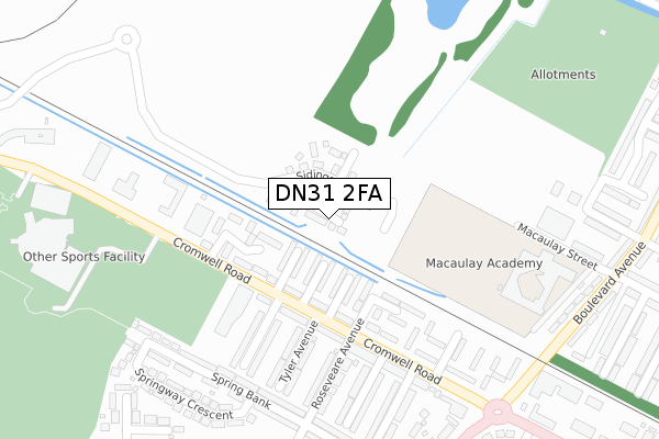
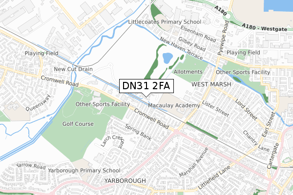
DN31 2FA is located in the West Marsh electoral ward, within the unitary authority of North East Lincolnshire and the English Parliamentary constituency of Great Grimsby. The Sub Integrated Care Board (ICB) Location is NHS Humber and North Yorkshire ICB - 03H and the police force is Humberside. This postcode has been in use since February 2019.


GetTheData
Source: OS Open Zoomstack (Ordnance Survey)
Licence: Open Government Licence (requires attribution)
Attribution: Contains OS data © Crown copyright and database right 2025
Source: Open Postcode Geo
Licence: Open Government Licence (requires attribution)
Attribution: Contains OS data © Crown copyright and database right 2025; Contains Royal Mail data © Royal Mail copyright and database right 2025; Source: Office for National Statistics licensed under the Open Government Licence v.3.0
| Easting | 525481 |
| Northing | 409729 |
| Latitude | 53.569193 |
| Longitude | -0.106649 |
GetTheData
Source: Open Postcode Geo
Licence: Open Government Licence
| Country | England |
| Postcode District | DN31 |
➜ See where DN31 is on a map ➜ Where is Grimsby? | |
GetTheData
Source: Land Registry Price Paid Data
Licence: Open Government Licence
| Ward | West Marsh |
| Constituency | Great Grimsby |
GetTheData
Source: ONS Postcode Database
Licence: Open Government Licence
86, SIDINGS ROAD, GRIMSBY, DN31 2FA 2024 28 MAR £189,995 |
2023 10 AUG £210,000 |
84, SIDINGS ROAD, GRIMSBY, DN31 2FA 2023 30 JUN £185,245 |
78, SIDINGS ROAD, GRIMSBY, DN31 2FA 2023 21 APR £189,995 |
76, SIDINGS ROAD, GRIMSBY, DN31 2FA 2022 23 DEC £180,995 |
74, SIDINGS ROAD, GRIMSBY, DN31 2FA 2022 22 DEC £207,995 |
62, SIDINGS ROAD, GRIMSBY, DN31 2FA 2022 30 JUN £194,995 |
64, SIDINGS ROAD, GRIMSBY, DN31 2FA 2022 30 JUN £174,995 |
56, SIDINGS ROAD, GRIMSBY, DN31 2FA 2022 28 MAR £174,995 |
52, SIDINGS ROAD, GRIMSBY, DN31 2FA 2022 21 MAR £205,995 |
GetTheData
Source: HM Land Registry Price Paid Data
Licence: Contains HM Land Registry data © Crown copyright and database right 2025. This data is licensed under the Open Government Licence v3.0.
| Douglas Avenue (Cromwell Road) | West Marsh | 194m |
| Douglas Avenue (Cromwell Road) | West Marsh | 208m |
| Roseveare Avenue (Cromwell Road) | West Marsh | 210m |
| Roseveare Avenue (Cromwell Road) | West Marsh | 214m |
| Roseveare Avenue | West Marsh | 230m |
| Grimsby Town Station | 1.5km |
| Great Coates Station | 1.7km |
| Grimsby Docks Station | 2.1km |
GetTheData
Source: NaPTAN
Licence: Open Government Licence
| Percentage of properties with Next Generation Access | 100.0% |
| Percentage of properties with Superfast Broadband | 100.0% |
| Percentage of properties with Ultrafast Broadband | 75.0% |
| Percentage of properties with Full Fibre Broadband | 75.0% |
Superfast Broadband is between 30Mbps and 300Mbps
Ultrafast Broadband is > 300Mbps
| Percentage of properties unable to receive 2Mbps | 0.0% |
| Percentage of properties unable to receive 5Mbps | 0.0% |
| Percentage of properties unable to receive 10Mbps | 0.0% |
| Percentage of properties unable to receive 30Mbps | 0.0% |
GetTheData
Source: Ofcom
Licence: Ofcom Terms of Use (requires attribution)
GetTheData
Source: ONS Postcode Database
Licence: Open Government Licence

➜ Get more ratings from the Food Standards Agency
GetTheData
Source: Food Standards Agency
Licence: FSA terms & conditions
| Last Collection | |||
|---|---|---|---|
| Location | Mon-Fri | Sat | Distance |
| Yarborough Road P.o. | 16:00 | 12:00 | 420m |
| Lord Street | 16:00 | 11:00 | 519m |
| Gilby Road | 17:30 | 12:00 | 530m |
GetTheData
Source: Dracos
Licence: Creative Commons Attribution-ShareAlike
| Risk of DN31 2FA flooding from rivers and sea | Low |
| ➜ DN31 2FA flood map | |
GetTheData
Source: Open Flood Risk by Postcode
Licence: Open Government Licence
The below table lists the International Territorial Level (ITL) codes (formerly Nomenclature of Territorial Units for Statistics (NUTS) codes) and Local Administrative Units (LAU) codes for DN31 2FA:
| ITL 1 Code | Name |
|---|---|
| TLE | Yorkshire and The Humber |
| ITL 2 Code | Name |
| TLE1 | East Yorkshire and Northern Lincolnshire |
| ITL 3 Code | Name |
| TLE13 | North and North East Lincolnshire |
| LAU 1 Code | Name |
| E06000012 | North East Lincolnshire |
GetTheData
Source: ONS Postcode Directory
Licence: Open Government Licence
The below table lists the Census Output Area (OA), Lower Layer Super Output Area (LSOA), and Middle Layer Super Output Area (MSOA) for DN31 2FA:
| Code | Name | |
|---|---|---|
| OA | E00066696 | |
| LSOA | E01013219 | North East Lincolnshire 003B |
| MSOA | E02002728 | North East Lincolnshire 003 |
GetTheData
Source: ONS Postcode Directory
Licence: Open Government Licence
| DN31 2BS | St Albans Avenue | 125m |
| DN31 2BP | St Francis Avenue | 128m |
| DN31 2BW | St Leonards Avenue | 141m |
| DN31 2BT | Roseveare Avenue | 147m |
| DN31 2FE | Finchley Court | 173m |
| DN31 2BU | Winceby Avenue | 193m |
| DN31 2BH | Cromwell Road | 207m |
| DN31 2BN | Cromwell Road | 208m |
| DN31 2BY | Naseby Drive | 251m |
| DN31 2BE | Cromwell Road | 261m |
GetTheData
Source: Open Postcode Geo; Land Registry Price Paid Data
Licence: Open Government Licence