DN22 7ZS maps, stats, and open data
DN22 7ZS is located in the East Retford North electoral ward, within the local authority district of Bassetlaw and the English Parliamentary constituency of Bassetlaw. The Sub Integrated Care Board (ICB) Location is NHS Nottingham and Nottinghamshire ICB - 02Q and the police force is Nottinghamshire. This postcode has been in use since December 2018.
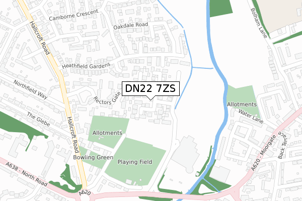
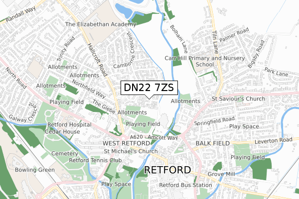
DN22 7ZS maps


Licence: Open Government Licence (requires attribution)
Attribution: Contains OS data © Crown copyright and database right 2025
Source: Open Postcode Geo
Licence: Open Government Licence (requires attribution)
Attribution: Contains OS data © Crown copyright and database right 2025; Contains Royal Mail data © Royal Mail copyright and database right 2025; Source: Office for National Statistics licensed under the Open Government Licence v.3.0
DN22 7ZS geodata
| Easting | 470393 |
| Northing | 381758 |
| Latitude | 53.328088 |
| Longitude | -0.944533 |
Where is DN22 7ZS?
| Country | England |
| Postcode District | DN22 |
Politics
| Ward | East Retford North |
|---|---|
| Constituency | Bassetlaw |
House Prices
Sales of detached houses in DN22 7ZS
2025 30 MAY £525,000 |
2023 15 SEP £515,000 |
4, HAWFINCH MEADOWS, RETFORD, DN22 7ZS 2021 24 FEB £472,500 |
17, HAWFINCH MEADOWS, RETFORD, DN22 7ZS 2021 19 FEB £457,500 |
41, HAWFINCH MEADOWS, RETFORD, DN22 7ZS 2020 12 OCT £370,000 |
2020 9 OCT £480,000 |
8, HAWFINCH MEADOWS, RETFORD, DN22 7ZS 2020 10 SEP £365,000 |
21, HAWFINCH MEADOWS, RETFORD, DN22 7ZS 2020 21 AUG £480,000 |
10, HAWFINCH MEADOWS, RETFORD, DN22 7ZS 2020 22 JUN £350,000 |
19, HAWFINCH MEADOWS, RETFORD, DN22 7ZS 2020 15 JUN £480,000 |
Licence: Contains HM Land Registry data © Crown copyright and database right 2025. This data is licensed under the Open Government Licence v3.0.
Transport
Nearest bus stops to DN22 7ZS
| Heathfield Gardens (Woodbeck Rise) | Hallcroft | 177m |
| Willand Court (Camborne Crescent) | Hallcroft | 402m |
| Bridgegate | Retford | 434m |
| Hallcroft Avenue (Hallcroft Road) | Hallcroft | 442m |
| Bridgegate | Retford | 445m |
Nearest railway stations to DN22 7ZS
| Retford Station | 1.5km |
| Retford Low Level Station | 1.6km |
Broadband
Broadband access in DN22 7ZS (2020 data)
| Percentage of properties with Next Generation Access | 94.1% |
| Percentage of properties with Superfast Broadband | 94.1% |
| Percentage of properties with Ultrafast Broadband | 94.1% |
| Percentage of properties with Full Fibre Broadband | 94.1% |
Superfast Broadband is between 30Mbps and 300Mbps
Ultrafast Broadband is > 300Mbps
Broadband limitations in DN22 7ZS (2020 data)
| Percentage of properties unable to receive 2Mbps | 0.0% |
| Percentage of properties unable to receive 5Mbps | 0.0% |
| Percentage of properties unable to receive 10Mbps | 0.0% |
| Percentage of properties unable to receive 30Mbps | 0.0% |
Deprivation
39.9% of English postcodes are less deprived than DN22 7ZS:Food Standards Agency
Three nearest food hygiene ratings to DN22 7ZS (metres)


➜ Get more ratings from the Food Standards Agency
Nearest post box to DN22 7ZS
| Last Collection | |||
|---|---|---|---|
| Location | Mon-Fri | Sat | Distance |
| Morrisons | 18:15 | 11:30 | 270m |
| Hallcroft Road | 17:15 | 12:00 | 403m |
| Mills Newsagent | 17:30 | 12:15 | 472m |
Environment
| Risk of DN22 7ZS flooding from rivers and sea | Low |
DN22 7ZS ITL and DN22 7ZS LAU
The below table lists the International Territorial Level (ITL) codes (formerly Nomenclature of Territorial Units for Statistics (NUTS) codes) and Local Administrative Units (LAU) codes for DN22 7ZS:
| ITL 1 Code | Name |
|---|---|
| TLF | East Midlands (England) |
| ITL 2 Code | Name |
| TLF1 | Derbyshire and Nottinghamshire |
| ITL 3 Code | Name |
| TLF15 | North Nottinghamshire |
| LAU 1 Code | Name |
| E07000171 | Bassetlaw |
DN22 7ZS census areas
The below table lists the Census Output Area (OA), Lower Layer Super Output Area (LSOA), and Middle Layer Super Output Area (MSOA) for DN22 7ZS:
| Code | Name | |
|---|---|---|
| OA | E00142732 | |
| LSOA | E01028013 | Bassetlaw 005A |
| MSOA | E02005839 | Bassetlaw 005 |
Nearest postcodes to DN22 7ZS
| DN22 7ZD | Birchcroft Road | 129m |
| DN22 7TX | Rectors Gate | 134m |
| DN22 7LG | Heathfield Gardens | 218m |
| DN22 7JX | Woodbeck Rise | 240m |
| DN22 7GX | Oakdale Road | 249m |
| DN22 7TG | Crofters View | 278m |
| DN22 7LB | Hallcroft Road | 279m |
| DN22 7LA | Cricket Field Lane | 313m |
| DN22 6RE | Waterfields | 313m |
| DN22 7JW | Camborne Close | 322m |