Property/Postcode Data Search:
DN22 7XB maps, stats, and open data
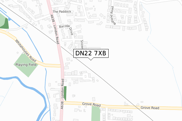
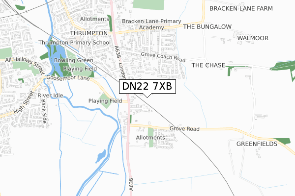
DN22 7XB is located in the East Retford East electoral ward, within the local authority district of Bassetlaw and the English Parliamentary constituency of Bassetlaw. The Sub Integrated Care Board (ICB) Location is NHS Nottingham and Nottinghamshire ICB - 02Q and the police force is Nottinghamshire. This postcode has been in use since June 2019.
DN22 7XB maps


Source: OS Open Zoomstack (Ordnance Survey)
Licence: Open Government Licence (requires attribution)
Attribution: Contains OS data © Crown copyright and database right 2025
Source: Open Postcode Geo
Licence: Open Government Licence (requires attribution)
Attribution: Contains OS data © Crown copyright and database right 2025; Contains Royal Mail data © Royal Mail copyright and database right 2025; Source: Office for National Statistics licensed under the Open Government Licence v.3.0
Licence: Open Government Licence (requires attribution)
Attribution: Contains OS data © Crown copyright and database right 2025
Source: Open Postcode Geo
Licence: Open Government Licence (requires attribution)
Attribution: Contains OS data © Crown copyright and database right 2025; Contains Royal Mail data © Royal Mail copyright and database right 2025; Source: Office for National Statistics licensed under the Open Government Licence v.3.0
DN22 7XB geodata
| Easting | 471461 |
| Northing | 379446 |
| Latitude | 53.307167 |
| Longitude | -0.929020 |
Where is DN22 7XB?
| Country | England |
| Postcode District | DN22 |
Politics
| Ward | East Retford East |
|---|---|
| Constituency | Bassetlaw |
House Prices
Sales of detached houses in DN22 7XB
2024 27 JUN £315,000 |
2023 23 OCT £400,000 |
6, MONSELLA GROVE, RETFORD, DN22 7XB 2021 7 MAY £288,995 |
2, MONSELLA GROVE, RETFORD, DN22 7XB 2021 30 APR £329,995 |
2021 31 MAR £278,995 |
11, MONSELLA GROVE, RETFORD, DN22 7XB 2021 26 FEB £271,995 |
2021 26 FEB £356,995 |
7, MONSELLA GROVE, RETFORD, DN22 7XB 2021 12 FEB £354,995 |
5, MONSELLA GROVE, RETFORD, DN22 7XB 2021 29 JAN £363,995 |
3, MONSELLA GROVE, RETFORD, DN22 7XB 2020 18 DEC £354,995 |
Source: HM Land Registry Price Paid Data
Licence: Contains HM Land Registry data © Crown copyright and database right 2025. This data is licensed under the Open Government Licence v3.0.
Licence: Contains HM Land Registry data © Crown copyright and database right 2025. This data is licensed under the Open Government Licence v3.0.
Transport
Nearest bus stops to DN22 7XB
| Goosemoor Lane | White Houses | 229m |
| Goosemoor Lane | White Houses | 247m |
| Allison Avenue (Grove Road) | White Houses | 252m |
| Allison Avenue (Grove Road) | White Houses | 284m |
| Grove Road (London Road) | White Houses | 335m |
Nearest railway stations to DN22 7XB
| Retford Low Level Station | 1.3km |
| Retford Station | 1.5km |
Deprivation
19.6% of English postcodes are less deprived than DN22 7XB:Food Standards Agency
Three nearest food hygiene ratings to DN22 7XB (metres)
Whitehouses @ Retford
Whitehouse Inn
175m
Whitehouses Service Station

London Road
248m
Bracken Lane Primary - Diverse Academies Trust (Kitchen)

Bracken Lane Primary School
564m
➜ Get more ratings from the Food Standards Agency
Nearest post box to DN22 7XB
| Last Collection | |||
|---|---|---|---|
| Location | Mon-Fri | Sat | Distance |
| Whitehouses | 17:30 | 11:00 | 225m |
| Allison Avenue | 17:30 | 11:30 | 324m |
| Grove Coach Road | 17:30 | 11:30 | 493m |
DN22 7XB ITL and DN22 7XB LAU
The below table lists the International Territorial Level (ITL) codes (formerly Nomenclature of Territorial Units for Statistics (NUTS) codes) and Local Administrative Units (LAU) codes for DN22 7XB:
| ITL 1 Code | Name |
|---|---|
| TLF | East Midlands (England) |
| ITL 2 Code | Name |
| TLF1 | Derbyshire and Nottinghamshire |
| ITL 3 Code | Name |
| TLF15 | North Nottinghamshire |
| LAU 1 Code | Name |
| E07000171 | Bassetlaw |
DN22 7XB census areas
The below table lists the Census Output Area (OA), Lower Layer Super Output Area (LSOA), and Middle Layer Super Output Area (MSOA) for DN22 7XB:
| Code | Name | |
|---|---|---|
| OA | E00142712 | |
| LSOA | E01028010 | Bassetlaw 008C |
| MSOA | E02005842 | Bassetlaw 008 |
Nearest postcodes to DN22 7XB
| DN22 7JF | London Road | 169m |
| DN22 7JL | Grove Road | 222m |
| DN22 7HP | Grosvenor Close | 239m |
| DN22 7HW | Harcourt Place | 243m |
| DN22 7HF | Rutland Road | 247m |
| DN22 7HQ | Five Fields Lane | 283m |
| DN22 7JD | The Paddock | 288m |
| DN22 7JG | London Road | 291m |
| DN22 7JE | London Road | 300m |
| DN22 7HE | Haddon Road | 302m |