DN22 7PT maps, stats, and open data
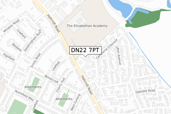
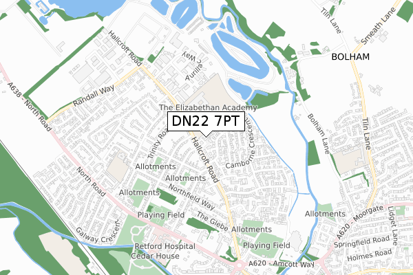
DN22 7PT lies on Hallcroft Road in Retford. DN22 7PT is located in the East Retford North electoral ward, within the local authority district of Bassetlaw and the English Parliamentary constituency of Bassetlaw. The Sub Integrated Care Board (ICB) Location is NHS Nottingham and Nottinghamshire ICB - 02Q and the police force is Nottinghamshire. This postcode has been in use since June 2019.
DN22 7PT maps


Licence: Open Government Licence (requires attribution)
Attribution: Contains OS data © Crown copyright and database right 2025
Source: Open Postcode Geo
Licence: Open Government Licence (requires attribution)
Attribution: Contains OS data © Crown copyright and database right 2025; Contains Royal Mail data © Royal Mail copyright and database right 2025; Source: Office for National Statistics licensed under the Open Government Licence v.3.0
DN22 7PT geodata
| Easting | 469989 |
| Northing | 382177 |
| Latitude | 53.331907 |
| Longitude | -0.950505 |
Where is DN22 7PT?
| Street | Hallcroft Road |
| Town/City | Retford |
| Country | England |
| Postcode District | DN22 |
Politics
| Ward | East Retford North |
|---|---|
| Constituency | Bassetlaw |
House Prices
Sales of detached houses in DN22 7PT
2021 18 JUN £365,000 |
4, MERCHANTS FOLD, RETFORD, DN22 7PT 2020 28 FEB £304,500 |
2019 14 NOV £378,000 |
2019 25 OCT £324,500 |
5, MERCHANTS FOLD, RETFORD, DN22 7PT 2019 22 JUL £350,000 |
1, MERCHANTS FOLD, RETFORD, DN22 7PT 2019 22 MAY £350,000 |
DIGITRON TRANSLIFT LTD, HALLCROFT ROAD, RETFORD, DN22 7PT 2009 21 MAY £400,000 |
Licence: Contains HM Land Registry data © Crown copyright and database right 2025. This data is licensed under the Open Government Licence v3.0.
Transport
Nearest bus stops to DN22 7PT
| Elizabethan School (Bus Park) | Hallcroft | 136m |
| Hallcroft Avenue (Hallcroft Road) | Hallcroft | 193m |
| Hallcroft Avenue (Hallcroft Road) | Hallcroft | 197m |
| Cherry Holt (Milnercroft) | Hallcroft | 202m |
| Cherry Holt (Milnercroft) | Hallcroft | 214m |
Nearest railway stations to DN22 7PT
| Retford Station | 1.9km |
| Retford Low Level Station | 2km |
Broadband
Broadband access in DN22 7PT (2020 data)
| Percentage of properties with Next Generation Access | 100.0% |
| Percentage of properties with Superfast Broadband | 100.0% |
| Percentage of properties with Ultrafast Broadband | 0.0% |
| Percentage of properties with Full Fibre Broadband | 0.0% |
Superfast Broadband is between 30Mbps and 300Mbps
Ultrafast Broadband is > 300Mbps
Broadband limitations in DN22 7PT (2020 data)
| Percentage of properties unable to receive 2Mbps | 0.0% |
| Percentage of properties unable to receive 5Mbps | 0.0% |
| Percentage of properties unable to receive 10Mbps | 0.0% |
| Percentage of properties unable to receive 30Mbps | 0.0% |
Deprivation
37.7% of English postcodes are less deprived than DN22 7PT:Food Standards Agency
Three nearest food hygiene ratings to DN22 7PT (metres)


➜ Get more ratings from the Food Standards Agency
Nearest post box to DN22 7PT
| Last Collection | |||
|---|---|---|---|
| Location | Mon-Fri | Sat | Distance |
| Hallcroft Road | 17:15 | 12:00 | 239m |
| Northfield Way | 17:15 | 12:00 | 370m |
| Shrewsbury View | 17:30 | 11:45 | 677m |
DN22 7PT ITL and DN22 7PT LAU
The below table lists the International Territorial Level (ITL) codes (formerly Nomenclature of Territorial Units for Statistics (NUTS) codes) and Local Administrative Units (LAU) codes for DN22 7PT:
| ITL 1 Code | Name |
|---|---|
| TLF | East Midlands (England) |
| ITL 2 Code | Name |
| TLF1 | Derbyshire and Nottinghamshire |
| ITL 3 Code | Name |
| TLF15 | North Nottinghamshire |
| LAU 1 Code | Name |
| E07000171 | Bassetlaw |
DN22 7PT census areas
The below table lists the Census Output Area (OA), Lower Layer Super Output Area (LSOA), and Middle Layer Super Output Area (MSOA) for DN22 7PT:
| Code | Name | |
|---|---|---|
| OA | E00142728 | |
| LSOA | E01028015 | Bassetlaw 005C |
| MSOA | E02005839 | Bassetlaw 005 |
Nearest postcodes to DN22 7PT
| DN22 7RE | Selsey Court | 52m |
| DN22 7AL | Camborne Mews | 67m |
| DN22 7PY | Hallcroft Road | 97m |
| DN22 7RB | Hallcroft Road | 99m |
| DN22 7RG | Merton Avenue | 130m |
| DN22 7RD | Camborne Crescent | 151m |
| DN22 7LZ | Cherry Holt | 156m |
| DN22 7QA | Hallcroft Road | 159m |
| DN22 7NZ | Darcy Court | 161m |
| DN22 7RQ | Sennen Court | 173m |