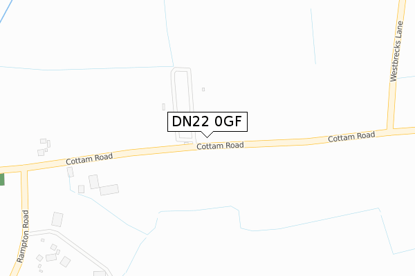
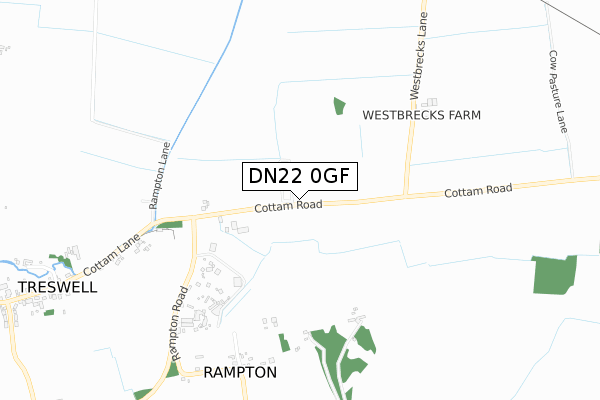
DN22 0GF is located in the Rampton electoral ward, within the local authority district of Bassetlaw and the English Parliamentary constituency of Newark. The Sub Integrated Care Board (ICB) Location is NHS Nottingham and Nottinghamshire ICB - 02Q and the police force is Nottinghamshire. This postcode has been in use since October 2018.


GetTheData
Source: OS Open Zoomstack (Ordnance Survey)
Licence: Open Government Licence (requires attribution)
Attribution: Contains OS data © Crown copyright and database right 2025
Source: Open Postcode Geo
Licence: Open Government Licence (requires attribution)
Attribution: Contains OS data © Crown copyright and database right 2025; Contains Royal Mail data © Royal Mail copyright and database right 2025; Source: Office for National Statistics licensed under the Open Government Licence v.3.0
| Easting | 479544 |
| Northing | 379730 |
| Latitude | 53.308569 |
| Longitude | -0.807673 |
GetTheData
Source: Open Postcode Geo
Licence: Open Government Licence
| Country | England |
| Postcode District | DN22 |
➜ See where DN22 is on a map | |
GetTheData
Source: Land Registry Price Paid Data
Licence: Open Government Licence
| Ward | Rampton |
| Constituency | Newark |
GetTheData
Source: ONS Postcode Database
Licence: Open Government Licence
| Green Lane | Treswell | 655m |
| Green Lane | Treswell | 665m |
| The Green (Treswell Road) | Rampton | 1,186m |
| Demand Responsive Area (Treswell Road) | Rampton | 1,197m |
| The Green (Treswell Road) | Rampton | 1,202m |
GetTheData
Source: NaPTAN
Licence: Open Government Licence
GetTheData
Source: ONS Postcode Database
Licence: Open Government Licence


➜ Get more ratings from the Food Standards Agency
GetTheData
Source: Food Standards Agency
Licence: FSA terms & conditions
| Last Collection | |||
|---|---|---|---|
| Location | Mon-Fri | Sat | Distance |
| Rampton P.o. | 16:30 | 11:00 | 1,250m |
| Treswell | 17:00 | 10:45 | 1,297m |
| South Leverton P.o. | 17:00 | 10:45 | 1,710m |
GetTheData
Source: Dracos
Licence: Creative Commons Attribution-ShareAlike
| Risk of DN22 0GF flooding from rivers and sea | Low |
| ➜ DN22 0GF flood map | |
GetTheData
Source: Open Flood Risk by Postcode
Licence: Open Government Licence
The below table lists the International Territorial Level (ITL) codes (formerly Nomenclature of Territorial Units for Statistics (NUTS) codes) and Local Administrative Units (LAU) codes for DN22 0GF:
| ITL 1 Code | Name |
|---|---|
| TLF | East Midlands (England) |
| ITL 2 Code | Name |
| TLF1 | Derbyshire and Nottinghamshire |
| ITL 3 Code | Name |
| TLF15 | North Nottinghamshire |
| LAU 1 Code | Name |
| E07000171 | Bassetlaw |
GetTheData
Source: ONS Postcode Directory
Licence: Open Government Licence
The below table lists the Census Output Area (OA), Lower Layer Super Output Area (LSOA), and Middle Layer Super Output Area (MSOA) for DN22 0GF:
| Code | Name | |
|---|---|---|
| OA | E00142832 | |
| LSOA | E01028033 | Bassetlaw 015C |
| MSOA | E02005849 | Bassetlaw 015 |
GetTheData
Source: ONS Postcode Directory
Licence: Open Government Licence
| DN22 0EP | Cottam Road | 611m |
| DN22 0HX | Treswell Road | 781m |
| DN22 0DP | West Croft Close | 1050m |
| DN22 0EW | 1091m | |
| DN22 0EN | Town Street | 1095m |
| DN22 0HU | Treswell Road | 1133m |
| DN22 0TB | Birch Close | 1198m |
| DN22 0EL | Orchard Rise | 1217m |
| DN22 0JN | Greenside Avenue | 1219m |
| DN22 0EJ | Town Street | 1242m |
GetTheData
Source: Open Postcode Geo; Land Registry Price Paid Data
Licence: Open Government Licence