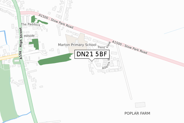
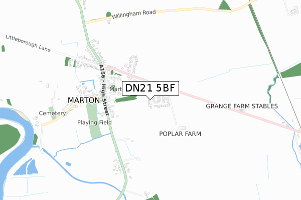
DN21 5BF is located in the Torksey electoral ward, within the local authority district of West Lindsey and the English Parliamentary constituency of Gainsborough. The Sub Integrated Care Board (ICB) Location is NHS Lincolnshire ICB - 71E and the police force is Lincolnshire. This postcode has been in use since February 2020.


GetTheData
Source: OS Open Zoomstack (Ordnance Survey)
Licence: Open Government Licence (requires attribution)
Attribution: Contains OS data © Crown copyright and database right 2024
Source: Open Postcode Geo
Licence: Open Government Licence (requires attribution)
Attribution: Contains OS data © Crown copyright and database right 2024; Contains Royal Mail data © Royal Mail copyright and database right 2024; Source: Office for National Statistics licensed under the Open Government Licence v.3.0
| Easting | 484404 |
| Northing | 381778 |
| Latitude | 53.326222 |
| Longitude | -0.734209 |
GetTheData
Source: Open Postcode Geo
Licence: Open Government Licence
| Country | England |
| Postcode District | DN21 |
| ➜ DN21 open data dashboard ➜ See where DN21 is on a map ➜ Where is Marton? | |
GetTheData
Source: Land Registry Price Paid Data
Licence: Open Government Licence
| Ward | Torksey |
| Constituency | Gainsborough |
GetTheData
Source: ONS Postcode Database
Licence: Open Government Licence
1, SARAHS MEWS, MARTON, GAINSBOROUGH, DN21 5BF 2021 17 SEP £399,950 |
3, SARAHS MEWS, MARTON, GAINSBOROUGH, DN21 5BF 2021 19 MAR £366,000 |
1, SARAHS MEWS, MARTON, GAINSBOROUGH, DN21 5BF 2020 19 MAR £380,000 |
2, SARAHS MEWS, MARTON, GAINSBOROUGH, DN21 5BF 2020 28 FEB £380,000 |
4, SARAHS MEWS, MARTON, GAINSBOROUGH, DN21 5BF 2020 21 JAN £380,000 |
GetTheData
Source: HM Land Registry Price Paid Data
Licence: Contains HM Land Registry data © Crown copyright and database right 2024. This data is licensed under the Open Government Licence v3.0.
| May 2022 | Violence and sexual offences | On or near High Street | 405m |
| May 2022 | Violence and sexual offences | On or near High Street | 405m |
| April 2022 | Burglary | On or near Trent View | 58m |
| ➜ Get more crime data in our Crime section | |||
GetTheData
Source: data.police.uk
Licence: Open Government Licence
| Primary School (Stow Park Road) | Marton | 193m |
| Primary School (Stow Park Road) | Marton | 219m |
| Demand Responsive Area | Marton | 353m |
| St Margaret's Church (High Street) | Marton | 401m |
| St Margaret's Church (High Street) | Marton | 416m |
GetTheData
Source: NaPTAN
Licence: Open Government Licence
GetTheData
Source: ONS Postcode Database
Licence: Open Government Licence


➜ Get more ratings from the Food Standards Agency
GetTheData
Source: Food Standards Agency
Licence: FSA terms & conditions
| Last Collection | |||
|---|---|---|---|
| Location | Mon-Fri | Sat | Distance |
| Marton Post Office | 16:15 | 09:15 | 325m |
| Stow Park Station | 16:00 | 11:00 | 1,281m |
| Little Borough | 16:00 | 09:00 | 2,215m |
GetTheData
Source: Dracos
Licence: Creative Commons Attribution-ShareAlike
| Facility | Distance |
|---|---|
| Lincoln Golf Club Main Street, Brampton, Lincoln Golf | 2.5km |
| Willingham Playing Field Marton Road, Willingham By Stow, Gainsborough Grass Pitches | 3.8km |
| Torksey Lock (Polish Scouting Association) Newark Road, Torksey Lock, Lincoln Grass Pitches | 4.4km |
GetTheData
Source: Active Places
Licence: Open Government Licence
| School | Phase of Education | Distance |
|---|---|---|
| The Marton Academy Stow Park Road, Marton, Gainsborough, DN21 5AG | Primary | 135m |
| Sturton by Stow Primary School School Lane, Sturton-by-Stow, Lincoln, LN1 2BY | Primary | 4.6km |
| Frances Olive Anderson Church of England (Aided) Primary School The Grove, Lea, Gainsborough, DN21 5EP | Primary | 4.9km |
GetTheData
Source: Edubase
Licence: Open Government Licence
The below table lists the International Territorial Level (ITL) codes (formerly Nomenclature of Territorial Units for Statistics (NUTS) codes) and Local Administrative Units (LAU) codes for DN21 5BF:
| ITL 1 Code | Name |
|---|---|
| TLF | East Midlands (England) |
| ITL 2 Code | Name |
| TLF3 | Lincolnshire |
| ITL 3 Code | Name |
| TLF30 | Lincolnshire CC |
| LAU 1 Code | Name |
| E07000142 | West Lindsey |
GetTheData
Source: ONS Postcode Directory
Licence: Open Government Licence
The below table lists the Census Output Area (OA), Lower Layer Super Output Area (LSOA), and Middle Layer Super Output Area (MSOA) for DN21 5BF:
| Code | Name | |
|---|---|---|
| OA | E00134177 | |
| LSOA | E01026410 | West Lindsey 007D |
| MSOA | E02005498 | West Lindsey 007 |
GetTheData
Source: ONS Postcode Directory
Licence: Open Government Licence
| DN21 5AU | Trent View | 45m |
| DN21 5AQ | Adams Way | 62m |
| DN21 5AS | Spafford Close | 129m |
| DN21 5AG | Stow Park Road | 161m |
| DN21 5AJ | Wapping Lane | 299m |
| DN21 5AE | Mount Pleasant Close | 303m |
| DN21 5XZ | The Paddock | 347m |
| DN21 5AD | Stow Park Road | 347m |
| DN21 5AF | Stow Park Road | 365m |
| DN21 5AT | Cornfield Drive | 373m |
GetTheData
Source: Open Postcode Geo; Land Registry Price Paid Data
Licence: Open Government Licence