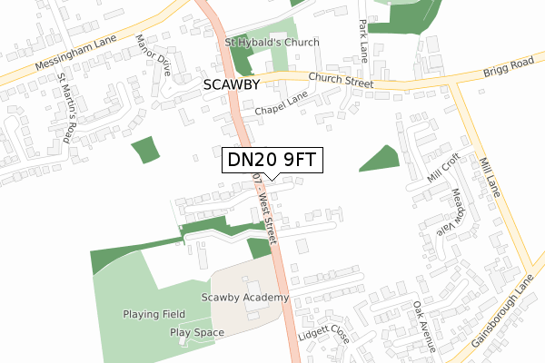
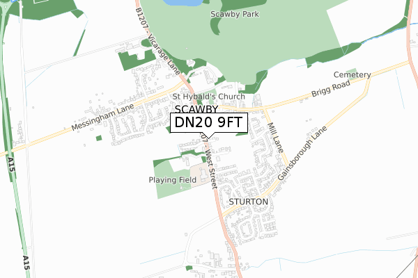
DN20 9FT is located in the Broughton & Scawby electoral ward, within the unitary authority of North Lincolnshire and the English Parliamentary constituency of Scunthorpe. The Sub Integrated Care Board (ICB) Location is NHS Humber and North Yorkshire ICB - 03K and the police force is Humberside. This postcode has been in use since October 2018.


GetTheData
Source: OS Open Zoomstack (Ordnance Survey)
Licence: Open Government Licence (requires attribution)
Attribution: Contains OS data © Crown copyright and database right 2024
Source: Open Postcode Geo
Licence: Open Government Licence (requires attribution)
Attribution: Contains OS data © Crown copyright and database right 2024; Contains Royal Mail data © Royal Mail copyright and database right 2024; Source: Office for National Statistics licensed under the Open Government Licence v.3.0
| Easting | 496937 |
| Northing | 405365 |
| Latitude | 53.536022 |
| Longitude | -0.538851 |
GetTheData
Source: Open Postcode Geo
Licence: Open Government Licence
| Country | England |
| Postcode District | DN20 |
| ➜ DN20 open data dashboard ➜ See where DN20 is on a map ➜ Where is Scawby? | |
GetTheData
Source: Land Registry Price Paid Data
Licence: Open Government Licence
| Ward | Broughton & Scawby |
| Constituency | Scunthorpe |
GetTheData
Source: ONS Postcode Database
Licence: Open Government Licence
23, FRANCIS GARDENS, SCAWBY, BRIGG, DN20 9FT 2021 6 DEC £396,640 |
11, FRANCIS GARDENS, SCAWBY, BRIGG, DN20 9FT 2021 30 APR £390,000 |
8, FRANCIS GARDENS, SCAWBY, BRIGG, DN20 9FT 2021 31 MAR £335,000 |
6, FRANCIS GARDENS, SCAWBY, BRIGG, DN20 9FT 2021 26 FEB £330,000 |
4, FRANCIS GARDENS, SCAWBY, BRIGG, DN20 9FT 2020 18 DEC £335,000 |
2, FRANCIS GARDENS, SCAWBY, BRIGG, DN20 9FT 2020 11 DEC £330,000 |
GetTheData
Source: HM Land Registry Price Paid Data
Licence: Contains HM Land Registry data © Crown copyright and database right 2024. This data is licensed under the Open Government Licence v3.0.
| June 2022 | Anti-social behaviour | On or near West Street | 113m |
| June 2022 | Shoplifting | On or near West Street | 113m |
| June 2022 | Burglary | On or near Mill Lane | 338m |
| ➜ Get more crime data in our Crime section | |||
GetTheData
Source: data.police.uk
Licence: Open Government Licence
| Sutton Arms (West Street) | Scawby | 133m |
| Sutton Arms (West Street) | Scawby | 172m |
| Demand Responsive Area | Scawby | 224m |
| Church (West Street) | Scawby | 264m |
| Church (West Street) | Scawby | 286m |
| Brigg Station | 3.8km |
GetTheData
Source: NaPTAN
Licence: Open Government Licence
| Percentage of properties with Next Generation Access | 100.0% |
| Percentage of properties with Superfast Broadband | 100.0% |
| Percentage of properties with Ultrafast Broadband | 0.0% |
| Percentage of properties with Full Fibre Broadband | 0.0% |
Superfast Broadband is between 30Mbps and 300Mbps
Ultrafast Broadband is > 300Mbps
| Percentage of properties unable to receive 2Mbps | 0.0% |
| Percentage of properties unable to receive 5Mbps | 0.0% |
| Percentage of properties unable to receive 10Mbps | 0.0% |
| Percentage of properties unable to receive 30Mbps | 0.0% |
GetTheData
Source: Ofcom
Licence: Ofcom Terms of Use (requires attribution)
GetTheData
Source: ONS Postcode Database
Licence: Open Government Licence


➜ Get more ratings from the Food Standards Agency
GetTheData
Source: Food Standards Agency
Licence: FSA terms & conditions
| Last Collection | |||
|---|---|---|---|
| Location | Mon-Fri | Sat | Distance |
| Scawby P.o. | 16:15 | 11:15 | 185m |
| Gainsborough Lane | 16:15 | 10:15 | 473m |
| Messingham Lane | 16:15 | 10:15 | 498m |
GetTheData
Source: Dracos
Licence: Creative Commons Attribution-ShareAlike
| Facility | Distance |
|---|---|
| Scawby Academy West Street, Scawby, Brigg Grass Pitches | 237m |
| Scawby Playing Field West Street , Scawby, Brigg Grass Pitches, Outdoor Tennis Courts | 369m |
| Forest Pines Hotel And Golf Resort Ermine Street, Broughton, Brigg Swimming Pool, Health and Fitness Gym, Golf, Studio | 2.1km |
GetTheData
Source: Active Places
Licence: Open Government Licence
| School | Phase of Education | Distance |
|---|---|---|
| Scawby Academy West Street, Scawby, Brigg, DN20 9AN | Primary | 173m |
| Hibaldstow Academy Hopfield, Hibaldstow, Brigg, DN20 9PN | Primary | 3.1km |
| Broughton Primary Academy Brigg Road, Broughton, Brigg, DN20 0JW | Primary | 3.3km |
GetTheData
Source: Edubase
Licence: Open Government Licence
The below table lists the International Territorial Level (ITL) codes (formerly Nomenclature of Territorial Units for Statistics (NUTS) codes) and Local Administrative Units (LAU) codes for DN20 9FT:
| ITL 1 Code | Name |
|---|---|
| TLE | Yorkshire and The Humber |
| ITL 2 Code | Name |
| TLE1 | East Yorkshire and Northern Lincolnshire |
| ITL 3 Code | Name |
| TLE13 | North and North East Lincolnshire |
| LAU 1 Code | Name |
| E06000013 | North Lincolnshire |
GetTheData
Source: ONS Postcode Directory
Licence: Open Government Licence
The below table lists the Census Output Area (OA), Lower Layer Super Output Area (LSOA), and Middle Layer Super Output Area (MSOA) for DN20 9FT:
| Code | Name | |
|---|---|---|
| OA | E00067269 | |
| LSOA | E01013326 | North Lincolnshire 021B |
| MSOA | E02002769 | North Lincolnshire 021 |
GetTheData
Source: ONS Postcode Directory
Licence: Open Government Licence
| DN20 9BS | Ingram Gardens | 62m |
| DN20 9AS | West Street | 65m |
| DN20 9AT | West Street | 129m |
| DN20 9AQ | Chapel Lane | 158m |
| DN20 9BJ | Coach House Gardens | 172m |
| DN20 9AN | West Street | 174m |
| DN20 9AR | Beechwood Drive | 177m |
| DN20 9BN | Orchard Lane | 180m |
| DN20 9EN | The Rookery | 225m |
| DN20 9AE | Church Street | 228m |
GetTheData
Source: Open Postcode Geo; Land Registry Price Paid Data
Licence: Open Government Licence