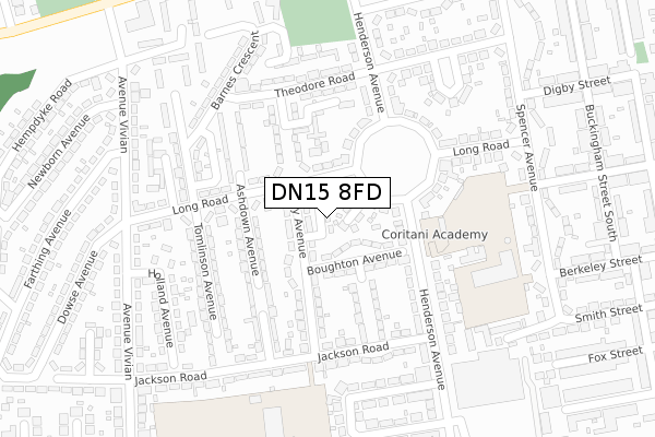
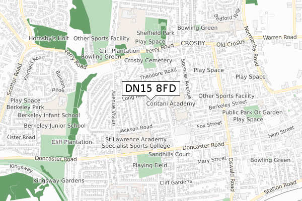
DN15 8FD is located in the Crosby & Park electoral ward, within the unitary authority of North Lincolnshire and the English Parliamentary constituency of Scunthorpe. The Sub Integrated Care Board (ICB) Location is NHS Humber and North Yorkshire ICB - 03K and the police force is Humberside. This postcode has been in use since September 2018.


GetTheData
Source: OS Open Zoomstack (Ordnance Survey)
Licence: Open Government Licence (requires attribution)
Attribution: Contains OS data © Crown copyright and database right 2024
Source: Open Postcode Geo
Licence: Open Government Licence (requires attribution)
Attribution: Contains OS data © Crown copyright and database right 2024; Contains Royal Mail data © Royal Mail copyright and database right 2024; Source: Office for National Statistics licensed under the Open Government Licence v.3.0
| Easting | 488530 |
| Northing | 411679 |
| Latitude | 53.594241 |
| Longitude | -0.663874 |
GetTheData
Source: Open Postcode Geo
Licence: Open Government Licence
| Country | England |
| Postcode District | DN15 |
| ➜ DN15 open data dashboard ➜ See where DN15 is on a map ➜ Where is Scunthorpe? | |
GetTheData
Source: Land Registry Price Paid Data
Licence: Open Government Licence
| Ward | Crosby & Park |
| Constituency | Scunthorpe |
GetTheData
Source: ONS Postcode Database
Licence: Open Government Licence
| January 2024 | Criminal damage and arson | On or near Petrol Station | 478m |
| January 2024 | Other crime | On or near Petrol Station | 478m |
| January 2024 | Other theft | On or near Petrol Station | 478m |
| ➜ Get more crime data in our Crime section | |||
GetTheData
Source: data.police.uk
Licence: Open Government Licence
| Theodore Road (Henderson Avenue) | Crosby | 203m |
| Ashdown Avenue (Jackson Road) | Crosby | 252m |
| Farthing Avenue (Avenue Vivian) | Crosby | 327m |
| Holland Avenue (Avenue Vivian) | Crosby | 328m |
| Holland Avenue (Avenue Vivian) | Crosby | 328m |
| Scunthorpe Station | 1.2km |
| Althorpe Station | 4.7km |
GetTheData
Source: NaPTAN
Licence: Open Government Licence
| Percentage of properties with Next Generation Access | 100.0% |
| Percentage of properties with Superfast Broadband | 100.0% |
| Percentage of properties with Ultrafast Broadband | 0.0% |
| Percentage of properties with Full Fibre Broadband | 0.0% |
Superfast Broadband is between 30Mbps and 300Mbps
Ultrafast Broadband is > 300Mbps
| Percentage of properties unable to receive 2Mbps | 0.0% |
| Percentage of properties unable to receive 5Mbps | 0.0% |
| Percentage of properties unable to receive 10Mbps | 0.0% |
| Percentage of properties unable to receive 30Mbps | 0.0% |
GetTheData
Source: Ofcom
Licence: Ofcom Terms of Use (requires attribution)
GetTheData
Source: ONS Postcode Database
Licence: Open Government Licence


➜ Get more ratings from the Food Standards Agency
GetTheData
Source: Food Standards Agency
Licence: FSA terms & conditions
| Last Collection | |||
|---|---|---|---|
| Location | Mon-Fri | Sat | Distance |
| Long Road | 17:15 | 12:15 | 88m |
| Henderson Avenue P.o. | 17:30 | 11:45 | 126m |
| Doncaster Road | 17:30 | 12:30 | 451m |
GetTheData
Source: Dracos
Licence: Creative Commons Attribution-ShareAlike
| Facility | Distance |
|---|---|
| Oasis Academy Henderson Avenue Henderson Avenue, Scunthorpe Grass Pitches, Sports Hall | 276m |
| The St Lawrence Academy Doncaster Road, Scunthorpe Sports Hall, Health and Fitness Gym, Artificial Grass Pitch, Grass Pitches, Studio, Outdoor Tennis Courts | 390m |
| Sheffield Park Sheffield Park Avenue, Scunthorpe Grass Pitches | 590m |
GetTheData
Source: Active Places
Licence: Open Government Licence
| School | Phase of Education | Distance |
|---|---|---|
| Oasis Academy Henderson Avenue Henderson Avenue, Scunthorpe, DN15 7RW | Primary | 176m |
| The St Lawrence Academy Doncaster Road, Scunthorpe, DN15 7DF | Secondary | 406m |
| Outwood Academy Foxhills 2 Foxhills Road, Scunthorpe, DN15 8LJ | Secondary | 716m |
GetTheData
Source: Edubase
Licence: Open Government Licence
The below table lists the International Territorial Level (ITL) codes (formerly Nomenclature of Territorial Units for Statistics (NUTS) codes) and Local Administrative Units (LAU) codes for DN15 8FD:
| ITL 1 Code | Name |
|---|---|
| TLE | Yorkshire and The Humber |
| ITL 2 Code | Name |
| TLE1 | East Yorkshire and Northern Lincolnshire |
| ITL 3 Code | Name |
| TLE13 | North and North East Lincolnshire |
| LAU 1 Code | Name |
| E06000013 | North Lincolnshire |
GetTheData
Source: ONS Postcode Directory
Licence: Open Government Licence
The below table lists the Census Output Area (OA), Lower Layer Super Output Area (LSOA), and Middle Layer Super Output Area (MSOA) for DN15 8FD:
| Code | Name | |
|---|---|---|
| OA | E00067108 | |
| LSOA | E01013298 | North Lincolnshire 008B |
| MSOA | E02002756 | North Lincolnshire 008 |
GetTheData
Source: ONS Postcode Directory
Licence: Open Government Licence
| DN15 7RR | Henderson Crescent | 31m |
| DN15 8EZ | Davy Avenue | 60m |
| DN15 7RP | Henderson Avenue | 70m |
| DN15 8HE | Long Road | 82m |
| DN15 8EY | Boughton Avenue | 97m |
| DN15 8HF | Long Road | 117m |
| DN15 7RW | Henderson Avenue | 119m |
| DN15 8HQ | Ashdown Avenue | 133m |
| DN15 8HA | Davy Avenue | 146m |
| DN15 8EX | Davy Avenue | 150m |
GetTheData
Source: Open Postcode Geo; Land Registry Price Paid Data
Licence: Open Government Licence