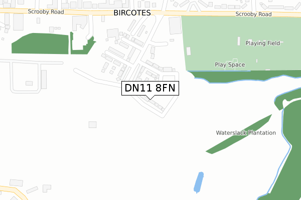
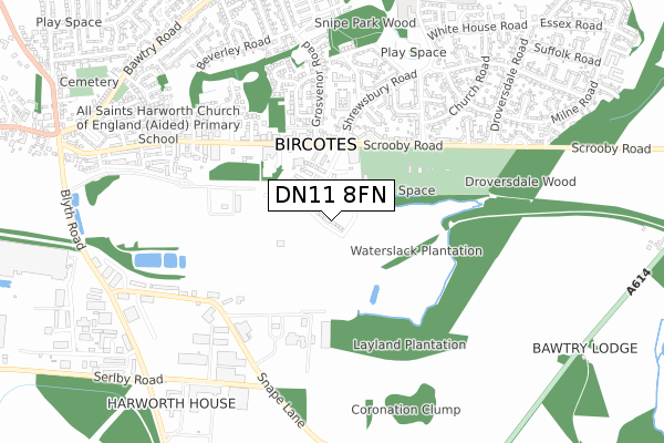
DN11 8FN is located in the Harworth electoral ward, within the local authority district of Bassetlaw and the English Parliamentary constituency of Bassetlaw. The Sub Integrated Care Board (ICB) Location is NHS Nottingham and Nottinghamshire ICB - 02Q and the police force is Nottinghamshire. This postcode has been in use since September 2019.


GetTheData
Source: OS Open Zoomstack (Ordnance Survey)
Licence: Open Government Licence (requires attribution)
Attribution: Contains OS data © Crown copyright and database right 2024
Source: Open Postcode Geo
Licence: Open Government Licence (requires attribution)
Attribution: Contains OS data © Crown copyright and database right 2024; Contains Royal Mail data © Royal Mail copyright and database right 2024; Source: Office for National Statistics licensed under the Open Government Licence v.3.0
| Easting | 462605 |
| Northing | 391252 |
| Latitude | 53.414390 |
| Longitude | -1.059573 |
GetTheData
Source: Open Postcode Geo
Licence: Open Government Licence
| Country | England |
| Postcode District | DN11 |
| ➜ DN11 open data dashboard ➜ See where DN11 is on a map ➜ Where is Bircotes? | |
GetTheData
Source: Land Registry Price Paid Data
Licence: Open Government Licence
| Ward | Harworth |
| Constituency | Bassetlaw |
GetTheData
Source: ONS Postcode Database
Licence: Open Government Licence
1, BRINSLEY WAY, BIRCOTES, DONCASTER, DN11 8FN 2022 25 MAR £297,995 |
1A, BRINSLEY WAY, BIRCOTES, DONCASTER, DN11 8FN 2022 25 FEB £294,995 |
1B, BRINSLEY WAY, BIRCOTES, DONCASTER, DN11 8FN 2022 22 FEB £286,995 |
3, BRINSLEY WAY, BIRCOTES, DONCASTER, DN11 8FN 2021 25 JUN £315,995 |
7, BRINSLEY WAY, BIRCOTES, DONCASTER, DN11 8FN 2021 13 APR £280,995 |
21, BRINSLEY WAY, BIRCOTES, DONCASTER, DN11 8FN 2020 18 DEC £282,995 |
53, BRINSLEY WAY, BIRCOTES, DONCASTER, DN11 8FN 2020 27 MAR £249,995 |
33, BRINSLEY WAY, BIRCOTES, DONCASTER, DN11 8FN 2019 20 DEC £249,950 |
GetTheData
Source: HM Land Registry Price Paid Data
Licence: Contains HM Land Registry data © Crown copyright and database right 2024. This data is licensed under the Open Government Licence v3.0.
| June 2022 | Shoplifting | On or near Colliery Road | 231m |
| June 2022 | Other theft | On or near Parking Area | 245m |
| June 2022 | Vehicle crime | On or near Parking Area | 245m |
| ➜ Get more crime data in our Crime section | |||
GetTheData
Source: data.police.uk
Licence: Open Government Licence
| Colliery (Scrooby Road) | Bircotes | 257m |
| Primary Care Centre (Car Park) | Harworth | 270m |
| Colliery (Scrooby Road) | Bircotes | 272m |
| Grosvenor Road | Harworth | 293m |
| Cricket Ground (Scrooby Road) | Bircotes | 331m |
GetTheData
Source: NaPTAN
Licence: Open Government Licence
GetTheData
Source: ONS Postcode Database
Licence: Open Government Licence


➜ Get more ratings from the Food Standards Agency
GetTheData
Source: Food Standards Agency
Licence: FSA terms & conditions
| Last Collection | |||
|---|---|---|---|
| Location | Mon-Fri | Sat | Distance |
| Bircotes Post Office | 17:15 | 11:15 | 278m |
| Scrooby Road | 17:00 | 10:45 | 409m |
| Dorchester Road | 17:15 | 10:45 | 651m |
GetTheData
Source: Dracos
Licence: Creative Commons Attribution-ShareAlike
| Facility | Distance |
|---|---|
| Bircotes And Harworth Sports And Social Club Scrooby Road, Bircotes, Doncaster Grass Pitches, Artificial Grass Pitch | 421m |
| Harworth Bmx Track (Closed) Scrooby Road, Harworth, Doncaster Cycling | 576m |
| Harworth Church Of England Academy Scrooby Road, Harworth, Doncaster Grass Pitches | 691m |
GetTheData
Source: Active Places
Licence: Open Government Licence
| School | Phase of Education | Distance |
|---|---|---|
| Harworth CofE Academy Scrooby Road, Harworth, Doncaster, DN11 8JT | Primary | 700m |
| St Patrick's Catholic Primary School Whitehouse Road, Bircotes, Doncaster, DN11 8EF | Primary | 830m |
| Serlby Park Academy Whitehouse Road, Bircotes, Doncaster, DN11 8EF | All-through | 999m |
GetTheData
Source: Edubase
Licence: Open Government Licence
The below table lists the International Territorial Level (ITL) codes (formerly Nomenclature of Territorial Units for Statistics (NUTS) codes) and Local Administrative Units (LAU) codes for DN11 8FN:
| ITL 1 Code | Name |
|---|---|
| TLF | East Midlands (England) |
| ITL 2 Code | Name |
| TLF1 | Derbyshire and Nottinghamshire |
| ITL 3 Code | Name |
| TLF15 | North Nottinghamshire |
| LAU 1 Code | Name |
| E07000171 | Bassetlaw |
GetTheData
Source: ONS Postcode Directory
Licence: Open Government Licence
The below table lists the Census Output Area (OA), Lower Layer Super Output Area (LSOA), and Middle Layer Super Output Area (MSOA) for DN11 8FN:
| Code | Name | |
|---|---|---|
| OA | E00142791 | |
| LSOA | E01028027 | Bassetlaw 001E |
| MSOA | E02005835 | Bassetlaw 001 |
GetTheData
Source: ONS Postcode Directory
Licence: Open Government Licence
| DN11 8AA | Colliery Road | 215m |
| DN11 8JN | Scrooby Road | 308m |
| DN11 8DE | Shrewsbury Road | 395m |
| DN11 8AD | Scrooby Road | 395m |
| DN11 8DF | Talbot Road | 407m |
| DN11 8JJ | Scrooby Close | 429m |
| DN11 8EZ | Alexandra Road | 433m |
| DN11 8EX | Grosvenor Road | 447m |
| DN11 8EY | Grosvenor Road | 459m |
| DN11 8JW | Scrooby Road | 483m |
GetTheData
Source: Open Postcode Geo; Land Registry Price Paid Data
Licence: Open Government Licence